


Three maps with labels for students to attach.
Map 1 - World map with continents and ocean labels to link.
Atlantic, Arctic Pacific, Indian, Southern
Antarctic, North America, South America, Africa, Australasia, Europe, Asia
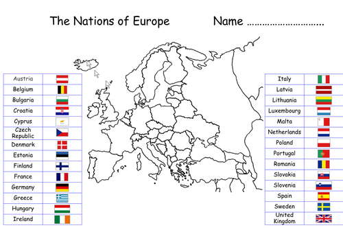
Map 2 - European map with all EU countries and their flags to link.
Austria, Belgium, Bulgaria, Croatia, Republic of Cyprus, Czech Republic, Denmark, Estonia, Finland, France, Germany, Greece, Hungary, Ireland, Italy, Latvia, Lithuania, Luxembourg, Malta, Netherlands, Poland, Portugal, Romania, Slovakia, Slovenia, Spain, Sweden and the UK.
Map 3 - United Kingdom map with four nations, flags and names to link.
Scotland, England, Wales and Northern Ireland.
Map 1 - World map with continents and ocean labels to link.
Atlantic, Arctic Pacific, Indian, Southern
Antarctic, North America, South America, Africa, Australasia, Europe, Asia
Map 2 - European map with all EU countries and their flags to link.
Austria, Belgium, Bulgaria, Croatia, Republic of Cyprus, Czech Republic, Denmark, Estonia, Finland, France, Germany, Greece, Hungary, Ireland, Italy, Latvia, Lithuania, Luxembourg, Malta, Netherlands, Poland, Portugal, Romania, Slovakia, Slovenia, Spain, Sweden and the UK.
Map 3 - United Kingdom map with four nations, flags and names to link.
Scotland, England, Wales and Northern Ireland.
Something went wrong, please try again later.
This resource hasn't been reviewed yet
To ensure quality for our reviews, only customers who have purchased this resource can review it
Report this resourceto let us know if it violates our terms and conditions.
Our customer service team will review your report and will be in touch.
$6.00