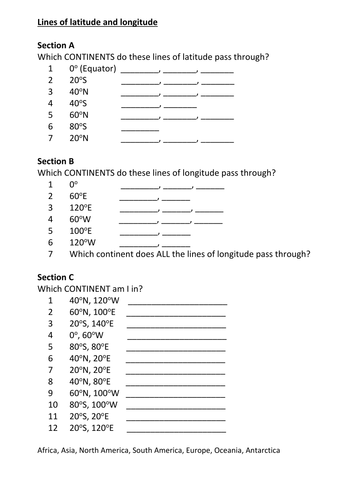

Simple worksheet for reading global map using lines of longitude and latitude. starts with Follow the lines and list countries it passes through up to identifying continent from point at which given lines cross.
Something went wrong, please try again later.
Lovely little resource will use for my first ever attempt at L&L many thanks
Great Resource
Really well structured, first takes you through the lines individually, then combines. Also a great opportunity to revise atlas usage and knowledge of conitnents. Thank you!
Report this resourceto let us know if it violates our terms and conditions.
Our customer service team will review your report and will be in touch.
£0.00