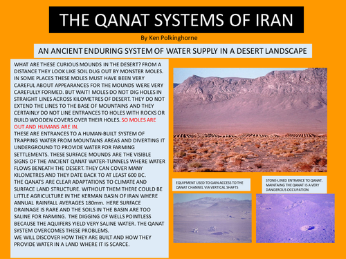

The recognition of mound lines on the surface of the Kerman Basin which indicate the underground qanat lines. The analysis by description, photographs and diagrams/map of the form and function of a system that provides water in a region of scarcity in West Asia. There are questions to resolve and issues to answer which makes this unit a learning inquiry.
Something went wrong, please try again later.
This resource hasn't been reviewed yet
To ensure quality for our reviews, only customers who have downloaded this resource can review it
Report this resourceto let us know if it violates our terms and conditions.
Our customer service team will review your report and will be in touch.
£0.00