
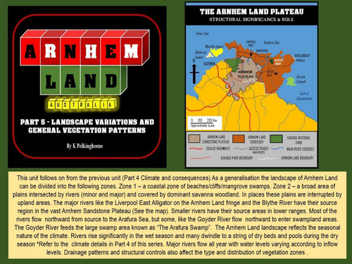
This unit takes students through a range of landscape and vegetation zones in Arnhem Land. It can stand alone but is also a follow on from Part 4 (Climate and consequences). Changes in type of vegetation are shown from coastal to river floodplains, swamplands and within the broad area usually generalised as "woodlands" in general classifications in atlases. Through photographs and diagrams students will be able to recognise variations. The unit is set up so that reasons for the changes can be a cause for debate. This unit could go more deeply into analysis of landscape structure, environmental difference, fresh/salt water plant associations, aspect, soil moisture budgets, human impacts, feral animals as reasons for different vegetation patterns. It could be covered at a more basic level as a "what is there?" and "why is it so?" list of possibilities. Investigate the possibilities and enjoy the visual journey.
Something went wrong, please try again later.
This resource hasn't been reviewed yet
To ensure quality for our reviews, only customers who have downloaded this resource can review it
Report this resourceto let us know if it violates our terms and conditions.
Our customer service team will review your report and will be in touch.
£0.00