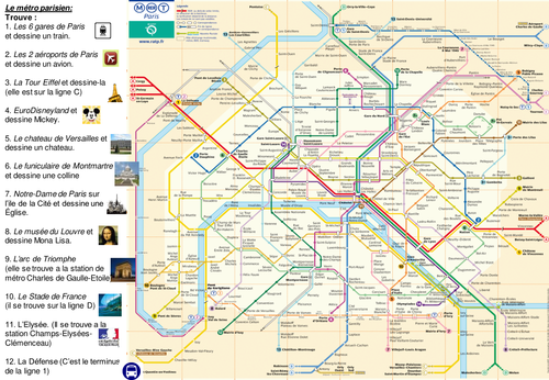


Pupils are given a genuine map of the subway lines of Paris. Then, they have to find different places on it (train stations, airports, Eiffel tower, Arc de Triomphe, Stade de France, Le Louvre, Versailles…). They have clues and have to learn how to read the map. The map can then be used if they go to Paris someday and should be printed on A3 sheets. The PowerPoint presentation features the answers, the clues and some descriptions in French of the places. If some pupils have been there, they can share their experience. The whole activity is 50-minutes long and it worked well with my Y9 bottom set and Y10 pupils. It could be useful for all pupils.
Something went wrong, please try again later.
Thank you so much!
Great resource! Merci beaucoup!
Report this resourceto let us know if it violates our terms and conditions.
Our customer service team will review your report and will be in touch.
£0.00