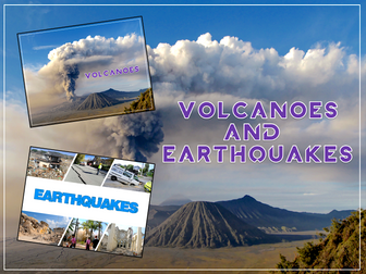
Volcanoes & Earthquakes is an exciting extended Geography unit designed for students in KS2.
The planning overview, topic title page and vocabulary page can be downloaded for free here. Lessons include:
L1 – Understanding the structure of the Earth
L2 – Investigating the structure of a volcano (FREE)
L3 – Locating the world’s famous volcanoes
L4 – Investigating the five deadly features of a volcanic eruption
L5 – Understanding tectonic plates
L6 – Exploring the effects of volcanic eruptions on Montserrat
L7 – Why do people live near volcanoes?
L8 – Understanding the causes of earthquakes
L9 – Investigating the five deadly features of an earthquake
L10 – Researching earthquakes using Wikipedia
L11 – Locating the world’s biggest earthquakes using latitude & longitude
L12 – Writing a fact file about a famous earthquake
Each lesson includes a presentation and differentiated activities/worksheets.
A FREE newspaper report template is also included in this unit.
If you like this resource, we would appreciate a review! We will happily send you a free resource in return for a review or useful suggestions/feedback. Contact us at ed@teachitforward.co.uk.
Investigating Rivers is a Geography unit suitable for KS2 (Y4-6).
The planning overview and topic title page can be downloaded for free here. Lessons include:
L1 - Understanding the water cycle
L2 - Identifying features of a river system
L3 - Identifying characteristics of the three stages of a river
L4 - Investigating features of the River Thames
L5 - Thinking about the different ways we use water
L6 - Understanding the impacts of floods and droughts
Each lesson includes a presentation and differentiated activities/worksheets.
If you like this resource, we would appreciate a review! We will happily send you a free resource in return for a review or useful suggestions/feedback. Contact us at ed@teachitforward.co.uk.
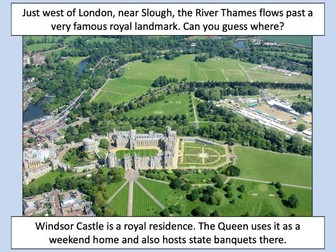
This lesson is part of Investigating Rivers, a unit designed for upper KS2 (Y4-6).
The presentation takes students on a journey from the source to the mouth of the River Thames. Starting at Thames Head, the source of the River Thames, students investigate maps and satellite photos and try to identify river features along the way. Other locations include Windsor Castle, the Isle of Dogs in London and the mouth of the river at Southend-on-Sea.
The writing-based activity challenges students to first label each map/satellite photo and then write a paragraph describing the location and river features they can see. It is differentiated two ways:
Easier – Students have maps/satellite photos and cloze procedure paragraphs to complete.
Harder – Students have maps/satellite photos, a wordbank and write their own paragraphs.
If you like this resource, we would appreciate a review! We will happily send you a free resource in return for a review or useful suggestions/feedback. Contact us at ed@teachitforward.co.uk.
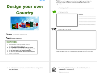
This is a new resource for KS3 that can be adapted, expanded or used as it. It is a 6 page resource that can take 2-3 lessons or even as a homework task.
It includes questions about the governance, laws, location, flag, national holidays etc. It is a great way to engage students to think about how they perceive geography and politics.
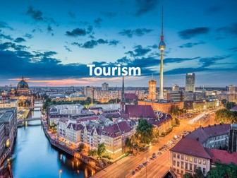
Full unit of work for tourism. All lesson are suitable for 50 minutes to 1 hour of teaching time. Includes supporting worksheets for lessons - no additional resources are required. Homework’s integrated into lessons where appropriate.
Most suitable for KS3 geography.
All lessons have a starter and lesson objectives. All PowerPoints in the same style.
Lesson sequence:
1 - What is tourism?
2 - The growth of tourism
3 - What attracts tourists to different destination?
4 - British tourism
5 - What are the impacts of tourism in National Parks?
6 - Declining tourism in Britain
7 - History and tourism
8 - The impact of tourism
9 - Jobs in the tourist industry
10 - Ski resorts
11 - Tourism in Kenya
12 - Sustainable tourism
13 - Sustainable tourism in Peru
14 - Does tourism cause conflict?
For more resources visit This is Geography. Full SoW for all new GCSE specifications - AQA, Edexcel, OCR, CIE IGCSE, Edexcel IGCSE and Eduqas. As well as over 200 lessons for KS3 and KS2. Want something bespoke designing? Email us for further details info@thisisgeography.co.uk
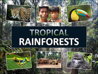
Tropical Rainforests is a Geography unit designed for students in KS2 (Y3-6).
The planning overview, topic title page and a knowledge organiser can be downloaded for free here. Lessons include:
L1 – Locating tropical rainforests on a world map
L2 – Identifying tropical rainforest animals
L3 – Investigating the layers of a tropical rainforest
L4 – Exploring the Amazon rainforest
L5 – Understanding the impact of deforestation on the Amazon
L6 – Investigating how deforestation affects an Amazon tribe
L7 - Thinking of ways to help save tropical rainforests
Each lesson includes a presentation and differentiated activities/worksheets. A knowledge organiser is also included. All resources are compatible with both Microsoft Office and Google Workspace.
If you like this resource, we would appreciate a review! We will happily send you a free resource in return for a review or useful suggestions/feedback. Contact us at ed@teachitforward.co.uk.
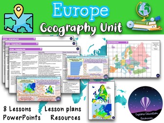
This Europe Geography Unit is a comprehensive and engaging teaching resource designed for Key Stage 2 children to explore various aspects of Europe, including famous landmarks, cultural similarities and differences, and the impact of human activity on the environment. The unit consists of eight lessons, each targeting specific learning objectives and accompanied by a range of interactive activities and discussions.
Lesson 1: Introduction to Europe
In this lesson, students are introduced to the continent of Europe and its diverse countries. They learn about the significance of Europe, its geographical features, and the countries that make up the continent.
Lesson 2: Exploring European Landmarks
Students delve into the fascinating world of famous landmarks in Europe, such as the Eiffel Tower, Colosseum, Big Ben, and more. They learn about the historical and cultural importance of these landmarks, their locations on a map of Europe, and engage in activities like landmark descriptions and map marking.
Lesson 3: Cultural Similarities and Differences
This lesson focuses on the cultural aspects of different European countries and compares them to the students’ local area. Students learn about traditions, customs, and languages, and engage in activities like creating travel brochure collages and group discussions about dream European holidays.
Lesson 4: Trade and Travel Connections
Students explore the trade and travel connections between Europe and their local area. They analyze import and export of goods, tourism, and transportation networks, and evaluate the impact of geographical factors on these connections.
Lesson 5: Planning a European Travel Adventure
In this lesson, students plan an imaginary travel adventure to visit multiple European landmarks. They research the landmarks, their locations, and plan an itinerary, considering factors like transportation, accommodations, local cuisine, and cultural experiences.
Lesson 6: Expressing Personal Views about European Locations
Students learn to express their opinions and preferences about specific European locations, providing clear reasons for their views. They engage in discussions and debates, considering factors like climate, landmarks, culture, or personal interests.
Lesson 7: Geographical Similarities and Differences
This lesson focuses on understanding geographical similarities and differences between Spain and the students’ local area. Students explore traditions, customs, languages, and analyze trade and travel connections, considering the impact of geographical factors.
Lesson 8: Graphing and Comparing Geographical Data
Students gather and analyze data related to temperature and rainfall in specific European locations. They create graphs to represent the data accurately and compare and interpret the data to draw conclusions about environmental conditions.
This resource provides a comprehensive and well-structured unit for teaching outstanding geography lessons about Europe to Key Stage 2 children. It incorporates a variety of interactive activities, discussions, and opportunities for reflection, promoting critical thinking and global awareness among students. The lessons are designed to engage and inspire students while fostering their understanding of landmarks and cultures. Also suitable for Key Stage 3.
KS2 LKS2 UKS2 KS3
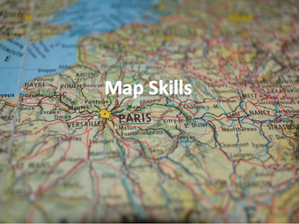
Full unit of work for map skills. All lesson are suitable for 50 minutes to 1 hour of teaching time. Includes supporting worksheets for lessons - no additional resources are required. Develops core skills for geography students in KS3 or high ability KS2.
All lessons have a starter and lesson objectives. All PowerPoints in the same signature style.
Lesson sequence:
1 - Introduction to maps
2 - Where is the UK?
3 - Compass points
4 - Map symbols
5 - 4 and 6 figure grid references
6 - Scale and distance
7 - Atlas skills
8 - Height and relief
9 - Longitude and latitude
10 - Design your own treasure map
11 - Mapzone GIS
Also includes Types of Geography lesson (can be used as an introduction lesson for Y7), Geography Literacy mat and Geography Numeracy/Map Skills mat.
Homeworks - 3 x countries and capitals test sheets to develop global place knowledge
For more resources visit This is Geography. Full SoW for all new GCSE specifications - AQA, Edexcel, OCR, CIE IGCSE, Edexcel IGCSE and Eduqas. As well as over 200 lessons for KS3 and KS2. Want something bespoke designing? Email us for further details info@thisisgeography.co.uk
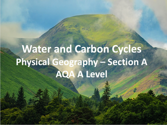
9 part lesson series for section A (physical geography) of the AQA A Level, Water and Carbon Cycles. This unit covers the Amazon and Eden Basin case studies, natural systems, drainage basins, variations in the cycles and the human impact on the cycles.
All lessons are designed in the same signature style and come with worksheets and exam questions to match the specification. No other resources are needed.
Lesson sequence:
1- Natural Systems
2 - The Water Cycle
3 - Drainage Basins
4 - Variations in run off and the water cycle
5 - The Carbon Cycle (1)
6 - The Carbon Cycle (2)
7 - Water, Carbon and Climate
8 - The Amazon Rainforest - Case Study
9 - The Eden Basin - Case Study
For more resources visit This is Geography. Full SoW for all new GCSE specifications - AQA, Edexcel, OCR, CIE IGCSE, Edexcel IGCSE and Eduqas. As well as over 200 lessons for KS3 and KS2. Want something bespoke designing? Email us for further details info@thisisgeography.co.uk
A baseline that will test the knowledge and skills of year 7 students as soon as they enter secondary school. It provides a great benchmark for students and is a good start to help the measure of progress across Key Stage 3. Marks out of 50, to link into the new 1-9 system.
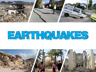
Earthquakes is an exciting Geography unit designed for students in KS2.
The planning overview, topic title page and vocabulary page can be downloaded for free here. Lessons include:
L1 – Understanding the structure of the Earth
L2 – Understanding tectonic plates
L3 – Understanding the causes of earthquakes
L4 – Investigating the five deadly features of an earthquake
L5 – Researching earthquakes using Wikipedia
L6 – Locating the world’s biggest earthquakes using latitude & longitude
L7 – Writing a fact file about a famous earthquake
Each lesson includes a presentation and differentiated activities/worksheets.
If you like this resource, we would appreciate a review! We will happily send you a free resource in return for a review or useful suggestions/feedback. Contact us at ed@teachitforward.co.uk.
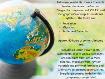
Fully-resourced & comprehensive unit of works for Cambridge International (CIE) AS Level Geography (KS5), on the Human Geography components of the course. The topics covered are:
Population
Migration
Settlement Dynamics
Approximately 90 hours of delivery across the lessons in this bundle, fully addressing all requirements of the Human Geography Units. Includes Powerpoints, with supporting worksheets/resources for lessons, as well as a range of other useful resources to support delivery e.g. Geofiles, ‘Be the Examiner’ Tasks, exam question practice/analysis etc.
I also have a bundles available which cover the entire CIE A-Level syllabus (A2 & AS), the entire A2 and AS programmes individually, just the Physical Geography component of AS-Level, as well as separate resources which cover each of the 4 A2 topics & 6 AS topics individually. Similar resources for delivery of CIE IGCSE Geography are available also - everything you need to successfully deliver CIE Geography Programmes at your school:) All can be found on my shop by accessing this link - https://www.tes.com/teaching-resources/shop/AidanGeoTeacher.
Building expertise in the topic(s), active and independent learning, and preparation for AS Level Examinations through answering past exam questions and self/peer assessing using mark schemes are the cornerstones of these lessons.
In addition to the class activities and content required to teach the lessons (PPTs, worksheets etc.), also included within the bundle are:
• Exam questions and mark schemes contained in almost every lesson, some with analysis and model answers.
• Links to webpages, extra readings, extension activities, Youtube videos.
• All case studies, with multiple alternatives in some cases, required for the course are included in the bundle, along with several case study card ‘templates’ and model answers for some of the case study 15 mark questions.
• Revision booklets/guides and other useful revision material for the topic.
• Extension/consolidation/review activities.
No additional resources are required. All aspects of the Cambridge Syllabus Guide for Human Geography are fully addressed. These are the lessons which I currently use to teach my students in a high-achieving High Performance Learning School, and are, therefore, of a very high quality and fully up-to-date.
Please click on the 3 resources in the ‘resources included’ box at the top of the page to see the resource for each individual topic. The ‘preview’ images in the individual resources are sample screenshots of PowerPoint slides, worksheets, activities etc. taken from some of the lessons in the bundle. One of the preview images lists the titles of the sub-topics within each unit, which match with the CIE Syllabus (within each of these sub-topics folders, is the individual lesson folders). If you want more information, or wish to see more before you purchase the bundle, please contact me on aidanannagh@hotmail.com and, if needed, we can arrange a video call where I can share some more :)
Exploring Brazil is a Geography unit designed for students in KS2 (Y4-6).
The planning overview, topic title page and vocabulary page can be downloaded for free here. Lessons include:
L1 – Identifying the countries and capitals of South America
L2 – Writing a Brazil fact file
L3 – Using 4 and 6-figure grid references to locate Brazilian cities
L4 – Identifying the human and physical features of Brazil
L5 – Exploring Brazil’s ecosystems
L6 – Investigating Brazil’s weather and climate
Each lesson includes a presentation and differentiated activities/worksheets.
If you like this resource, we would appreciate a review! We will happily send you a free resource in return for a review or useful suggestions/feedback. Contact us at ed@teachitforward.co.uk.
Exploring the UK is a Geography unit suitable for KS1 and lower KS2 (Y2-4).
The planning overview, topic title page and vocabulary page can be downloaded for free here. Lessons include:
L1 – Identifying the countries and capitals of the UK & Ireland (FREE)
L2 – Locating UK cities using compass directions
L3 – Identifying human & physical features of the UK
L4 – Investigating satellite photos of the UK
L5 – Comparing the city and the countryside
L6– Identifying famous features and characteristics of countries of the UK
L7 – Identifying flags of the United Kingdom
L8 – Identifying the four seasons of weather in the UK
Optional lesson – Identifying the countries and capital cities of Europe
Each lesson includes a presentation and differentiated activities/worksheets.
If you like this resource, we would appreciate a review! We will happily send you a free resource in return for a review or useful suggestions/feedback. Contact us at ed@teachitforward.co.uk.
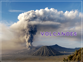
Volcanoes is an exciting Geography unit designed for students in KS2.
The planning overview, topic title page and vocabulary page can be downloaded for free here. Lessons include:
L1 – Understanding the structure of the Earth
L2 – Investigating the structure of a volcano (FREE)
L3 – Locating the world’s famous volcanoes
L4 – Investigating the five deadly features of a volcanic eruption
L5 – Understanding tectonic plates
L6 – Exploring the effects of volcanic eruptions on Montserrat
L7 – Why do people live near volcanoes?
Each lesson includes a presentation and differentiated activities/worksheets.
A FREE newspaper report template is also included in this unit.
If you like this resource, we would appreciate a review! We will happily send you a free resource in return for a review or useful suggestions/feedback. Contact us at ed@teachitforward.co.uk.
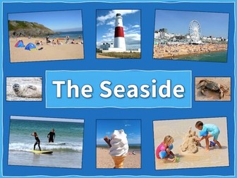
The Seaside is a Geography unit designed for students in upper KS1 and lower KS2 (Y2-Y3).
The planning overview, topic title page and vocabulary page can be downloaded for free here. Lessons include:
L1 – Identifying features of the seaside
L2 – Identifying human and physical features of the seaside
L3 – Locating seaside towns and cities of the UK
L4 – Investigating a seaside town - Lyme Regis
L5 – Identifying islands of the United Kingdom
L6 – Investigating what life is like on a small island
L7 - Packing for a seaside holiday
Each lesson includes a presentation and differentiated activities/worksheets.
If you like this resource, we would appreciate a review! We will happily send you a free resource in return for a review or useful suggestions/feedback. Contact us at ed@teachitforward.co.uk.
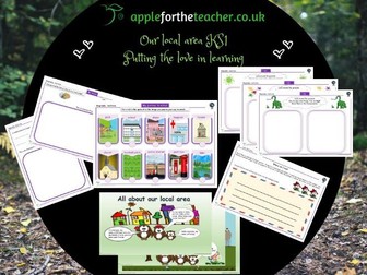
This is a great activity pack to cover the Geography topic of ‘Our Local Area’ in KS1. There is an animated, interactive powerpoint created in a very child friendly format, to engage and inspire learning. Also included are I spy sheets, to encourage young children to look carefully around their local area to see what they can find. A checklist and some drawing activities and address writing. A lovely bundle of teaching resources to put the love back in learning.
Worksheets based on Wayland's Popcorn series Where I Live - 4 books that introduce how children live in different places in the UK. A photocopiable worksheet focuses on each place. Covers topics such as How does where you live change what you can do?, What is the local area like in a city, a village, by the seaside on in an island home? The books can be used for literacy, as they feature many examples of report text. Order copies of these books now at www.waylandbooks.co.uk and get 10% discount! Please enter promotional code DOWNLOAD10 at checkout to receive your discount.
A fab diary to record the changing weather.
Temperature, rainfall, wind speed, cloudiness.
Get kids outdoors exploring and bring the outdoors into your classroom with this fresh activity from the Woodland Trust's nature detectives website.
What is a shop? These worksheets look at different types of shopping experiences from malls to high street and local convenience store. Children consider their family’s own shopping habits.
Worksheets included: Spot the difference; A high street survey; Convenience store goods; My family’s
shopping habits; Shop signs
These worksheets may accompany a series of books called Your Local Area, published by Wayland Publishers. Order copies of these books now at www.waylandbooks.co.uk and get 10% discount! Please enter promotional code DOWNLOAD10 at checkout to receive your discount.
 Quick View