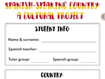
A cultural project on a Spanish-speaking country (list included). Students will have to look up information on food, sports, music, wildlife, travel or fashion. By the end, they will have a small booklet with lots of information on the country.
Students will have to complete some files on the different cultural aspects. They look like questionnaires that they have to fill in.
Fact file: basic information on the country (capital, population, size, currency, etc.)
Food file - information on a recipe (utensils, ingredients, method) and some culture facts related (when do you eat it, variations of the dish, etc.)
Sport file - information on the national sport, notable athletes and the Olympics
Travel file - scavenger hunt around a city of your choice
Wildlife file - information on the country’s basic geography, animals and plants
Music file - information on a song & artist
Fashion file - information on the native clothing and some culture facts related (when do you wear it, variations of the outfit, etc.)
Mini-dictionary: section with important phrases related to the topic. Things they would need if they went to the country and had to talk/ask about the topic.
A cultural project on a French-speaking country (list included). Students will have to look up information on food, sports, music, wildlife, travel or fashion. By the end, they will have a small booklet with lots of information on the country.
Students will have to complete some files on the different cultural aspects. They look like questionnaires that they have to fill in.
Fact file: basic information on the country (capital, population, size, currency, etc.)
Food file - information on a recipe (utensils, ingredients, method) and some culture facts related (when do you eat it, variations of the dish, etc.)
Sport file - information on the national sport, notable athletes and the Olympics
Travel file - scavenger hunt around a city of your choice
Wildlife file - information on the country’s basic geography, animals and plants
Music file - information on a song & artist
Fashion file - information on the native clothing and some culture facts related (when do you wear it, variations of the outfit, etc.)
Mini-dictionary: section with important phrases related to the topic. Things they would need if they went to the country and had to talk/ask about the topic.
Spanish version available here: https://www.tes.com/teaching-resource/spanish-speaking-country-a-culture-project-12329242
Spanish Cultural Quiz
Suitable for KS3 & KS4 Spanish students.
This interactive PPT quiz (65 slides) is a fun way for students to learn and revise different aspects of the Spanish culture.
It includes many opportunities for learners to talk, share opinions, and even sing and dance.
Easy to adapt as you like.
There are 7 rounds:
Festivales en España: scavenger hunt (2 options), match up vocabulary, videos and worksheets
Música: guess the song/artist
Comida española: food matching game
Países hispánicos: guess the country and flag
Famosos hispánicos: guess the celebrity
La Ruleta: spin the wheel and answer the question
Cine y Televisión: work out the English name of different films/TV shows
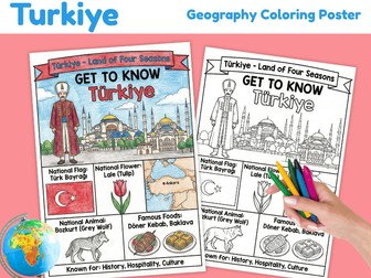
Printable Türkiye Geography Coloring Poster featuring country facts, national symbols, famous foods and cultural information in both full-color and black-and-white versions.
Explore Türkiye with this engaging geography poster designed to introduce students to important country facts through visual learning and coloring activities.
Students can learn about Türkiye’s flag, capital city, cultural symbols, traditional foods, geography and important features while coloring and displaying their completed poster.
What’s included:
Full-color Türkiye geography poster
Black-and-white coloring poster
Türkiye national flag
Capital city and country map
Traditional and cultural symbols
Famous foods
Cultural facts and country information
Kid-friendly illustrations
Ready-to-print classroom display
Geography coloring activity
This resource is ideal for world geography lessons, country studies, Türkiye studies, Europe and Asia geography, cultural studies, classroom displays, homeschool learning, geography centers, coloring activities, social studies lessons, world cultures projects and early-finisher activities.
Use this printable poster to introduce Türkiye, encourage visual learning, support geography lessons and help students discover important features of this unique country connecting Europe and Asia.
Perfect for learning about Türkiye, Ankara, the Turkish flag, tulips, Turkish culture, traditional foods, döner kebab, baklava, Turkish history, geography, world cultures and country facts.
File type: Printable PDF
Preparation: Print and use
This is a quiz that contains around 37 slides of the best language quiz for world culture day to play with students where they will need to guess the language - it also comes with a hint.
All in all it contains around 14 different languages from around the world that then offers a little bit of information about the country to help promote the countries location and culture!
Enjoy!
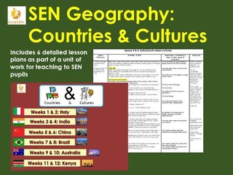
A multi-sensory approach for teaching Geography to pupils with multiple learning difficulties.
This resource is for 6 individual lesson plans (taught over 12 weeks) for 6 distinct countries and cultures.
Pupils will look at distinct cultures and identify some of the different tastes, smells, noises and items associated with that particular culture. Pupils will learn about the following cultures/countries:
Italian (European)
Indian (South Asian)
Chinese (East Asian)
Brazil (South American)
Australia (Australasian)
Kenyan (East African)
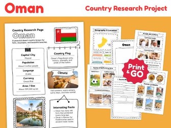
Printable Oman country research project with 14 pages covering geography, culture, landmarks, food, sports and student research activities.
Explore Oman with this ready-to-print country study resource designed to help students learn about the geography, culture and important features of this Middle Eastern country.
What’s included:
14 printable pages
Oman country information and facts
Capital city, population, language and currency
Country flag and climate
Geography and location
Country map and nearby countries
People and culture
Traditional clothing
Traditional music
Traditional food
Sports and performing arts
Famous landmarks and natural features
Reference images
Country research questions
Writing and reflection activities
This resource is ideal for geography lessons, country studies, Middle East units, Asia studies, Arabian Peninsula studies, independent research, classroom projects, homeschool learning and early-finisher activities.
Students can use the information and reference pages to learn about Oman before completing the research questions and writing tasks.
Perfect for learning about Oman, the Middle East, the Arabian Peninsula, Omani geography, Omani culture, Muscat, Nizwa Fort, Wadi Shab, the Hajar Mountains, frankincense, Asian countries, world cultures and country studies.
File type: Printable PDF
Pages: 14
Preparation: Print and go
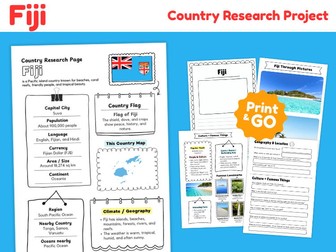
Printable Fiji Country Research Project featuring engaging geography worksheets, country facts, cultural information and student research activities.
Explore Fiji with this ready-to-print country study resource designed to help students learn about the geography, culture and important features of this beautiful Pacific island nation.
Students will discover Fiji’s capital city, national flag, location, population, famous landmarks, climate and geographical features while developing their research, observation and writing skills.
What’s included:
Fiji Country Research Page
Capital city and population
Official languages and currency
Country flag and its meaning
Country map and geographical location
Area and size
Continent and geographical region
Main islands and nearby Pacific countries
Climate and geography information
Fiji Through Pictures
People and culture
Traditional clothing and cultural activities
Traditional music and dancing
Popular foods and local culture
Sports, games and interesting activities
Famous landmarks and natural attractions
Interesting facts about Fiji
Student research and writing activities
Printable worksheets for independent learning
This resource is ideal for world geography lessons, country studies, Oceania geography units, Melanesian countries studies, Pacific Islands geography lessons, islands and landforms projects, coral reefs and marine ecosystems, tropical rainforest studies, oceans and coastal geography, traditional cultures, world cultures projects, classroom displays, homeschool learning, geography centers, independent research, social studies activities and early-finisher tasks.
Use these printable pages to introduce Fiji, explore country facts, develop geographical knowledge, practise research skills and encourage students to discover the unique characteristics of different Pacific island countries and cultures around the world.
Students can complete the research worksheets, identify Fiji on a map, explore its location in the South Pacific Ocean, discover important cultural features and record their findings through guided activities.
Perfect for learning about Fiji, Suva, Oceania, Melanesia, South Pacific Ocean, Viti Levu, Vanua Levu, Taveuni, Mamanuca Islands, Yasawa Islands, Garden of the Sleeping Giant, Bouma Waterfalls, Great Astrolabe Reef, Coral Coast, Sigatoka Sand Dunes, Levuka Historical Port Town, tropical rainforests, coral reefs, lagoons, beaches, marine ecosystems, traditional Fijian culture, meke dancing, kokoda, lovo, cultural heritage, famous landmarks, world geography and independent research activities.
File type: Printable PDF
Preparation: Print and use
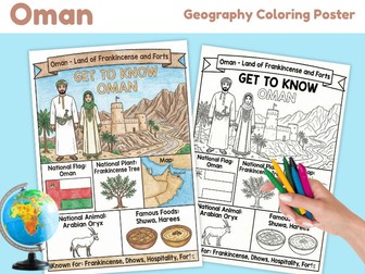
Printable Oman Geography Coloring Poster featuring key country facts, cultural symbols, traditional food, landmarks and a student-friendly coloring activity.
Help students get to know Oman with this engaging country study resource combining geography, culture and creativity. This printable poster introduces important features of Oman through simple illustrations, visual facts and a black-and-white coloring version.
Students can explore Oman’s national flag, frankincense tree, map, Arabian oryx, traditional foods and famous cultural features while coloring and learning at the same time.
What’s included:
Full-color Oman geography poster
Black-and-white coloring poster
Oman country title and theme
National flag
National plant – Frankincense Tree
Country map
National animal – Arabian Oryx
Traditional foods – Shuwa and Harees
Traditional clothing
Mountains and desert landscape
Traditional fort architecture
Cultural symbols and country facts
Print-and-go geography activity
This resource is ideal for world geography lessons, Oman country studies, Middle East geography, Asia geography, country research activities, world cultures, geography centers, classroom displays, homeschool learning, coloring activities, early-finisher tasks and cultural studies.
Students can color the black-and-white version while learning about the geography, traditions and important symbols of Oman. The completed poster can also be used as a classroom display, geography notebook page or visual reference during a country study.
Perfect for learning about Oman, Muscat, the Arabian Peninsula, Middle East geography, Omani culture, frankincense, Arabian oryx, traditional dhows, forts, mountains, Shuwa, Harees, traditional clothing and world geography.
File type: Printable PDF
Preparation: Print and use
Project based learning booklet on Latin America and Spanish speaking countries. This would be a great introductory module for students to ease into TY, or for a wellbeing week class with other year groups.
The project can be completed through English or Spanish but the headings are in Spanish. Students can complete the project either individually or in pairs/groups.
Students will research information on the following headings:
Basic information, tourism, food, sports, music, festivals.
A powerpoint to help develop an understanding of other cultures and countries.
Links in nicely with Handa's Surprise.
Can be used to discuss where they live, clothes they wear, where they play, animals, transport. Discuss similarities and differences between our own home/community.
Lesson aimed mainly at KS3 for a school “culture day”. Looks a links between traditional and modern medicines.
Includes links to 2 short videos with matching questions, and reading comprehension activity.
Particular focus on Asia and Africa.
Included in purchase: powerpoint presentation and word document (worksheet).
Bring culture into your Spanish classroom!
I created this resource for my classroom and my students had such a great time!
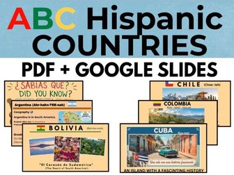
This Spanish cultural slides resource introduces students to Hispanic countries through engaging, ready-to-project presentations. Use them for Cultural Friday, Cultural Day, Hispanic Heritage Month, or as a starting point for a student research project.
Countries in this presentation: Argentina, Bolivia, Chile, Colombia y Cuba. (ABC)
What is included in this resource?
Country geography & quick facts
Government & landmarks
Traditional foods
Music & dance
Slang & expressions
Famous people
Fun & interesting facts
Speaker notes with additional information and teaching suggestions
Format: Google Slides and P.D.F
Please note: The existing slide elements are fixed as background images and are not individually editable. You can still customize the presentation by adding your own slides, text, images, videos, and other content.
Copyright & Image Notice
This resource is for personal/classroom use only. Please do not redistribute, resell, share, or upload the files or editable links. Images and other third-party content remain the property of their respective copyright holders and are used for educational purposes. No ownership of third-party images is claimed.
Florida Standards Alignment
This resource supports the following Florida USA B.E.S.T. World Languages Standards:
Resources created by Mayra Ramos
Some basic information about Asians
List of Asian people
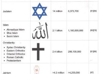
List of faiths, with numbers of followers, in Asian culture
Percentage of Christians and showing dominant faith, in Asian countries
List of Festivals and Celebrations
Brief information on Cuisine
Are you looking for lots of different examples of countries and cultures from around the world? Perhaps some of your class could focus on each of the different countries shown in this list? A great way of starting a conversation and getting everyone interested in learning more!
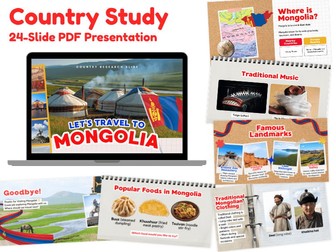
Take your students on a virtual journey to Mongolia with this colorful and engaging 24-slide Country Study Presentation!
This ready-to-use geography resource introduces students to Mongolia through age-appropriate facts, photographs, maps, cultural traditions, famous landmarks, food, clothing, music, geography, and everyday life.
Designed as a visual country study, this presentation makes it easy to introduce Mongolia during world geography, social studies, cultural studies, or country research units.
What’s included:
24-slide Mongolia Country Study Presentation
Introduction to Mongolia
Country location and map
Capital city and important places
National flag and country facts
Geography and landscapes
Climate and natural features
People and daily life
Traditional Mongolian homes
Traditional clothing
Traditional music
Popular foods
Famous landmarks
Cultural traditions
Interesting facts
Visual photographs and student-friendly explanations
Closing / review slide
Students will explore Mongolia’s unique landscapes, nomadic traditions, traditional ger homes, clothing, foods, music, landmarks, and cultural heritage while building their knowledge of world geography.
Perfect for world geography lessons, country studies, Asia geography, social studies, homeschool learning, cultural studies, classroom presentations, research projects, morning work, enrichment activities, and introductory lessons about Mongolia.
This resource can be displayed on a classroom screen, used during whole-class instruction, or assigned as a visual reference for independent country research.
Topics featured include Mongolia, Ulaanbaatar, Central Asia, East Asia, Gobi Desert, Mongolian steppe, traditional ger homes, Mongolian clothing, deel, traditional music, morin khuur, yurt culture, Mongolian food, famous landmarks, nomadic culture, geography, and cultural traditions.
File type: PDF Presentation
Number of slides: 24
Preparation: Open and present
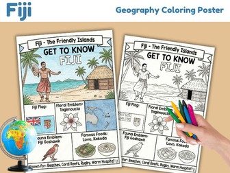
Explore Fiji with this fun and educational Geography Coloring Poster!
This printable country study activity introduces students to important facts, symbols, culture and geography of Fiji through an engaging color-and-learn format.
Students can use the completed color poster as a visual reference, then color their own black-and-white version while learning about Fiji’s flag, floral emblem, map, wildlife, traditional foods and cultural identity.
What’s included:
Full-color Fiji geography poster
Black-and-white coloring version
Fiji national flag
Fiji map and capital city
Floral emblem: Tagimoucia
Fiji wildlife
Traditional Fijian foods
Famous cultural and geographical features
Simple country facts for young learners
Ready-to-print geography activity
Students will learn about:
Fiji’s location in the South Pacific
Suva, the capital city
The national flag of Fiji
Tagimoucia, Fiji’s famous endemic flower
Traditional foods such as lovo and kokoda
Tropical islands, beaches and coral reefs
Rugby and Fijian culture
Important symbols and characteristics of Fiji
Perfect for world geography lessons, Oceania studies, Fiji country studies, Pacific Islands units, social studies, homeschool geography, classroom displays, early finishers, coloring activities, cultural studies and geography centers.
The color version can be used as a classroom poster or reference sheet, while the black-and-white version gives students a hands-on way to review what they have learned.
A simple print-and-go activity for introducing Fiji in a memorable and creative way.
File type: Printable PDF
Preparation: Print and use
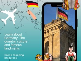
Our teaching resource offers a comprehensive approach to learn about Germany, focusing on its people, culture, and famous landmarks. The lesson presentation included covers a wide range of topics, providing an in-depth understanding of this vibrant European country. Students will have the opportunity to explore the rich history, traditions, and modern-day life in Germany through engaging visuals and informative content.
In addition to the lesson presentation, the resource includes a student research task worksheet designed to encourage independent learning and critical thinking skills. This worksheet will guide students through conducting research on various aspects of Germany, prompting them to delve deeper into specific areas of interest. By completing this task, students will not only expand their knowledge of the country but also develop their research and analytical abilities.
The resource is available for download in PDF format to ensure easy access and compatibility across devices. The non-editable nature of the PDF guarantees that the content remains intact and secure, allowing for a seamless learning experience. Teachers can confidently incorporate this resource into their lessons, knowing that it provides reliable and accurate information on Germany.
Overall, our teaching resource on Germany is a valuable tool for educators looking to enhance their geography or cultural studies curriculum. With its combination of engaging lesson presentations and interactive research tasks, students will gain a comprehensive insight into the diverse aspects of German society. Download the resource today and ignite curiosity about one of Europe’s most fascinating countries.
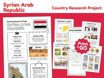
Printable Syria country research project with 14 pages covering geography, culture, landmarks, food, sports and student research activities.
Explore Syria, officially the Syrian Arab Republic, with this ready-to-print country study resource designed to help students learn about the geography, culture and important features of this Middle Eastern country.
What’s included:
14 printable pages
Syria country information and facts
Capital city, population, language and currency
Country flag and climate
Geography and location
Country map and nearby countries
People and culture
Traditional clothing
Traditional music
Traditional food
Sports and performing arts
Famous landmarks and cultural sites
Reference images
Country research questions
Writing and reflection activities
This resource is ideal for geography lessons, country studies, Middle East units, Asia studies, ancient civilizations topics, independent research, classroom projects, homeschool learning and early-finisher activities.
Students can use the information and reference pages to learn about Syria before completing the research questions and writing tasks.
Perfect for learning about Syria, the Syrian Arab Republic, the Middle East, Syrian geography, Syrian culture, Damascus, Aleppo, Palmyra, ancient civilizations, Asian countries, world cultures and country studies.
File type: Printable PDF
Pages: 14
Preparation: Print and go
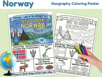
Printable Norway Geography Coloring Poster featuring country facts, national symbols, culture, food and important geographical features.
Help students explore Norway with this engaging geography coloring activity designed to combine visual learning, country facts and creativity.
This printable resource includes a completed color reference poster and a black-and-white version for students to color while learning about Norway.
Students will learn about:
Norway and its location in Europe
National flag
Capital city: Oslo
Famous Norwegian landscapes
Fjords and mountains
Northern Lights
Midnight Sun
Norwegian culture and traditions
Traditional clothing
Popular Norwegian foods
Native wildlife
Important national and cultural symbols
What’s included:
Completed Norway geography poster
Black-and-white Norway coloring poster
Country facts and visual references
Geography and culture learning activity
Print-and-go classroom resource
This resource is perfect for world geography lessons, Norway country studies, European geography, countries of Europe units, geography centers, homeschool learning, cultural studies, social studies, coloring activities, early-finisher work, classroom displays and independent learning.
Students can color the poster while exploring Norway’s geography, culture and famous features. The completed reference page can also be used as a visual aid, classroom poster or study guide.
Perfect for learning about Norway, Oslo, Norwegian flag, fjords, mountains, Northern Lights, Midnight Sun, Norwegian culture, traditional clothing, Scandinavian countries, Nordic countries, European geography and country facts.
File type: Printable PDF
Preparation: Print and use
Worksheets based on Wayland’s Popcorn series Countries - 4 books that introduce children to other countries, looking both at the geography and at how people live there. Covers curriculum topics such as: Where is Barnaby Bear? A photocopiable worksheet is available for each country and book.The books can also be used for literacy work, as they feature many examples of report text.


 Quick View