AQA GCSE Geography lesson for the new specification Unit 1C: In this lesson we look at landforms of the River Tees in North-East England.
We start with a retrieval practice grid based on the content learned so far in the unit. The lesson is based on an A3 worksheet and the students complete tasks on the worksheet starting with the upper section features and landforms and working our way down to the mouth in the lower section. There are supporting slides and videos for each of the ten tasks on the worksheet.
We finish with a 4-mark GCSE-style question where the students can use the information gained during the lesson within the context of an exam question.
Hope this saves you some valuable planning time.
https://www.tes.com/teaching-resources/shop/markthegeographer
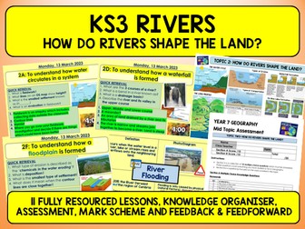
A full series of 11 lessons and resources
Lessons coded:
2A. Water Cycle
2B. River Processes
2C. River Long and Cross Profile
2D. Formation of Waterfalls and Gorges
2E. Formation of Meanders and Ox Bow Lakes
2F. Formation of Floodplains and Levees
2G. Rivers on OS Maps
2H. Causes of Flooding
2I. UK Flood Event~ Cumbria 2015
2J. Flood Management
2K. Assessment, Close the Gap and Feed Forward Activity
Rivers Knowledge Organiser
Rivers Revision Tasks
Rivers Quiz
A double sided A3 revision sheet to capture knowledge of the Rivers unit as part of Section C (Physical Landscapes) in the GCSE AQA (8035) Geography course.
Side 1 - processes, upper, middle, lower course landforms and formation
Side 2 - causes of flooding, impacts of flooding, flood management and hydrographs.
Can easily be used as a standalone resource or from using resources such as textbooks, revision guides and exercise book notes.
Investigating Rivers is a Geography unit suitable for KS2 (Y4-6).
The planning overview and topic title page can be downloaded for free here. Lessons include:
L1 - Understanding the water cycle
L2 - Identifying features of a river system
L3 - Identifying characteristics of the three stages of a river
L4 - Investigating features of the River Thames
L5 - Thinking about the different ways we use water
L6 - Understanding the impacts of floods and droughts
Each lesson includes a presentation and differentiated activities/worksheets.
If you like this resource, we would appreciate a review! We will happily send you a free resource in return for a review or useful suggestions/feedback. Contact us at ed@teachitforward.co.uk.
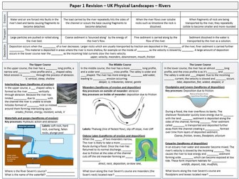
Complete sequence of lessons for the AQA GCSE Geography Unit 1, section C. The case study example of a river is the River Tees in North-East England and the example for flood management is Banbury.
Included are the lessons in this suggested sequence.
Drainage Basins
Long and Cross Profiles of a River
Erosion and Transportation
V-Shaped Valleys and Interlocking Spurs
Waterfalls and Gorges
Meanders and Oxbow Lakes
Depositional Landforms
Factors Increasing Flood Risk
Hard Engineering
Soft Engineering
Managing Floods at Banbury
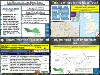
Landforms of the River Tees
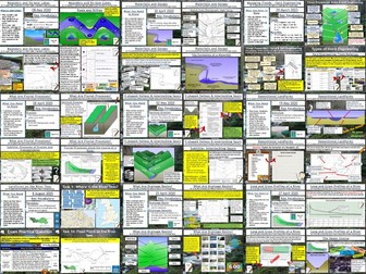
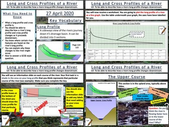
AQA GCSE Geography lesson for the new specification Unit 1C: In this lesson we look at long and cross profiles of a river and how river valleys change shape downstream.
We start with “perfect paragraph”. The pupils read a paragraph describing a drainage basin and they should try to find the errors in the paragraph and what should be added in. We then introduce long profiles, and the pupils will be plotting a long profile of a river on their worksheet. We then look at the upper, middle and lower courses of the river. The pupils shade in these sections on their graph. We complete the worksheet by looking at cross profiles and how river valley shapes change downstream. The pupils create annotated cross sections of the upper, middle and lower courses using the info slides. We finish with a 4 mark GCSE-style question “describe how the shape of a river valley changes downstream”. As always the pupils have some guidance on the question if they need it.
In a nutshell lesson includes:
Perfect paragraph starter.
Long profile plotting exercise.
Cross profile diagram activity.
4-mark GCSE-style question.
Hope this saves you some valuable planning time.
https://www.tes.com/teaching-resources/shop/markthegeographer
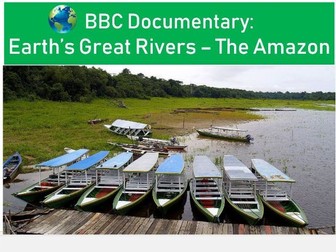
Easy to use question and answer worksheet to accompany the BBC documentary Earth’s Greatest Rivers, Episode 1, The Amazon River. Questions span the full 50 minute length of the documentary. An answer sheet for teachers is provided. There is an optional challenge sheet (exam questions and mapping task) to round up ideas from this documentary. Used with a year 8 group studying rivers, but equally could be used for students as part of a place based study in Brazil for example.
Topics include:
Factfile on the Amazon River
Upper, middle and lower course characteristics
Indigenous views of the river
Manaus
Human activity along the river
Flooding in the lower course
Download will include all worksheets both in Word and PDF formats.
Find other documentary worksheets and the rest of this series at my shop
The lesson
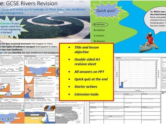
A very thorough & detailed revision lesson that recaps all of the key content from GCSE Rivers topics (works for AQA, Edexcel, Cambridge, OCR and international specs) as well as practicing photo analysis skills and question writing. Extremely easy to teach, straightforward and concise yet still very engaging. The lesson could even be set as homework/extra revision.
**PLEASE SEE MY DISCOUNTED GCSE REVISION BUNDLE BEFORE YOU BUY @ just £5.99! Includes content on deserts, rainforests, coasts, tectonics and more!
GCSE Coasts revision + map skills rated 5 for just £3.19!*
https://www.tes.com/teaching-resource/gcse-geography-coasts-map-skills-lesson-suitable-for-all-exam-boards-aqa-ocr-edexcel-and-more-12659857
GCSE Rivers revision + map skills rated 5 for just £3.17!*
https://www.tes.com/teaching-resource/geography-gcse-rivers-skills-lesson-suitable-for-all-exam-boards-aqa-ocr-edexcel-and-more-12638099
Includes:
Double sided A3 worksheet
PPT with title, LO and all answers
Starter tasks and extension tasks
Quick quiz with answers
The lesson includes a very detailed worksheet with sections on river processes, landforms, river engineering and more. There is also a Power point that includes a starter activity, revision sheet (including all answers) and quiz to finish. There is enough material for 1-2 lessons depending on ability. I would recommend using textbooks and/or exercise books along with the revision sheets if students are struggling.
This would serve as a great recap/revision lesson for any GCSE class and will save you a lot of time!
Please check out all of my FREE school resources and Geography lessons on my shop where you´ll also find full schemes of work for just £3 and lots of other useful resources… Or purchase all of my resources for just £13.99!
https://www.tes.com/teaching-resources/shop/ukjoshkelly94
I would really appreciate it if you could leave me a review, thanks!
https://www.tes.com/teaching-resources/shop/ukjoshkelly94
Questions or issues: ukjoshkelly@yahoo.co.uk
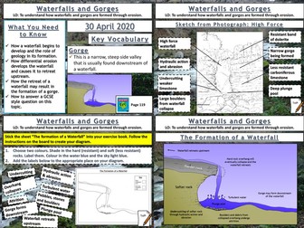
AQA GCSE Geography lesson for the new specification Unit 1C: In this lesson we look at waterfalls and gorges and how they are formed through the processes of erosion.
The starter is a retrieval practice grid filled in for the rivers work so far, but it’s editable.
We then look at how underlying geology plays and important part in the formation of waterfalls, the pupils have some questions to answer and I sometimes get a pupil to teach this bit. We then look at how waterfalls develop, after some teacher exposition the pupils will have an outline diagram of a waterfall with some tasks to complete on the diagram. We then look at the formation of gorges and how they relate to waterfalls. This time the pupils use the diagram on the board to create one themselves. We finish with a sketch from photograph of High Force. After we have introduced the waterfall and given some detail on its formation the pupils will create a field sketch either in a blank box, or using a feint outline, which they can draw over the top of. They then label features etc. We finish with a 6-mark question similar to the 2019 May exam on physical processes and waterfalls/gorges. There is advice and guidance should the pupils need it.
In a nutshell lesson includes:
Retrieval practice grid starter.
Question answer session on how a waterfall starts to form.
Blank outline actvity on the development of waterfalls over time.
Diagram activity on the formation of a gorge.
Worksheet activty on sketching High Force from a photograph.
6-mark GCSE question with guidance.
Hope this saves you some valuable planning time.
https://www.tes.com/teaching-resources/shop/markthegeographer
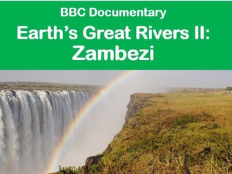
Documentary topic: Water, Rivers, Africa
24 question and answer sheet to accompany the BBC documentary Earth’s Greatest Rivers 2, episode 1, Zambezi River. Documentary follows the river’s course from source to mouth and looks at how animal and human life depends on the river.
The worksheet has 24 questions that cover the full 50 minute documentary and comes with a detailed answer sheet for teachers. There is a differentiated follow on worksheet for students to complete to think further around this topic. Designed for study alongside rivers unit, but equally could be used for students as part of a place based study in Southern Africa.
Topics include:
Fact file on the Zambezi
upper, middle and lower course characteristics
Human activity along the river
Flooding
Conservation and management
Downloaded materials include all sheets in both Word and PDF formats.
Find other documentary worksheets and the rest of this series at my shop
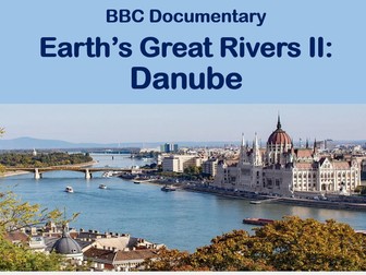
Topics: Water, Rivers, Danube River
22 question and answer sheet to accompany the BBC documentary Earth’s Greatest Rivers 2, episode 2, Danube River. The documentary follows the river’s course from source to mouth and looks at how animal and human life depends on the River Danube.
The worksheet has 22 questions that cover the full 50 minute documentary and comes with a detailed answer sheet for teachers. There is a follow on worksheet with exam questions and mapping exercise for students to complete to think further around this topic. Designed for study alongside rivers unit, but equally could be used for students as part of a place based study in Europe.
Topics include:
Fact file on the the Danube
Upper, middle and lower course characteristics
Human activity along the river
Flooding
Conservation and management
Downloaded bundle includes all sheets in both Word and PDF formats.
Find other documentary worksheets and the rest of this series at my shop
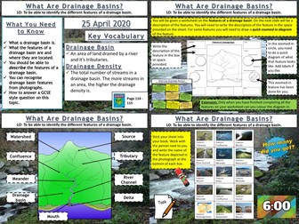
AQA GCSE Geography lesson for the new specification Unit 1C: In this lesson we look at drainage basins and what types of features you find within them.
We start with a photo mystery starter, the pupils only see fragments of a map of the drainage basins of the UK and Ireland. The pupils try to guess what the complete picture might be. This leads onto a discussion about drainage basins and the Amazon Basin in particular. Next we look at the features within a drainage basin. The pupils will work from a worksheet and are given a description of a feature. They must find the feature on the diagram, write the description, and then for some features they draw their own zoomed-in picture of the feature. Following this the pupils get a grid of photographs of the various features and they need to work out what the feature is. The board is editable so they can play bingo as well if you want to create bingo cards.
We finish with a simple post-it plenary based on a GCSE-style question.
In a nutshell lesson includes:
Geographical gallery of contemporary art starter
Worksheet activities on the features of a drainage basin
Photo grid of the features of a drainage basin.
Post-it plenary.
Hope this saves you some valuable planning time.
https://www.tes.com/teaching-resources/shop/markthegeographer
Resource showing and explaining the journey of a river from source to mouth and the physical features of rivers along the way.
I created this to use with my year 5 class but it would be suitable for year 6 as well.
There are hyperlinks to videos on BBC learning zone and to a BBC bitesize activity - some of the questions in the activity are more complex as it is aimed at KS3 but I do not think this would be an issue as it is reinforcing what is learnt through the PowerPoint and extending the children further.
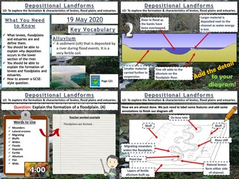
AQA GCSE Geography lesson for the new specification Unit 1C: In this lesson we look at depositional features found in the lower course of a river.
The starter is a a countdown retrieval practice quiz with dramatic countdown music!
We start by looking at natural levees and how they are formed. The pupils create a sequence of diagrams to show their formation based on information on the board. They are provided with outline drawings to start with to save time. We then look at the formation of floodplains. The pupils create a diagram based on the instructions on the board without actually seeing the diagram, but there is an example if they are struggling and they are given an outline floodplain to start with. We then look at the formation of estuaries. The pupils annotate a photograph to show the different features of the estuary formed by deposition. We finish on a 4 mark question on the formation of floodplains that was in an exam in 2017. I usually model the answer after the pupils have had a go.
In a nutshell lesson includes:
Retrieval practice grid starter.
Formation of levees sequential diagram.
Formation and features of a floodplain diagram activity with outline.
Photo annotation for estuaries.
4-mark GCSE question with guidance.
Hope this saves you some valuable planning time.
https://www.tes.com/teaching-resources/shop/markthegeographer
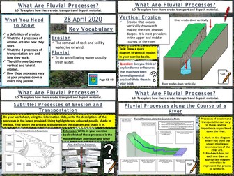
AQA GCSE Geography lesson for the new specification Unit 1C: In this lesson we look at erosion, transportation and deposition.
The starter is “which row is the odd one out”. The pupils need to work out which row has an incorrect term in. Just gets them thinking.
We then look at erosion and when rivers are eroding more effectively. The pupils learn about vertical and lateral erosion and will be making some diagrams in there exercise books. They then receive a worksheet where the processes of erosion and transportation are illustrated, the pupils use an information slide (or sheet if you prefer) and label the processes on and colour code the area of the diagram where that process is displayed. We then look at how these processes vary as you progress down the long profile of a river. The pupils get another worksheet where they read the labels and draw an appropriate diagram in each box to create an illustrated log profile. We finish with a summarising pyramid plenary.
In a nutshell lesson includes:
Odd one out starter.
Vertical and lateral erosion diagram activity
Worksheet on processes of erosion
Worksheet activity on processes of erosion along the course of a river
Summarising pyramid
Hope this saves you some valuable planning time.
https://www.tes.com/teaching-resources/shop/markthegeographer
30 mark (35 minute) test on rivers, flooding and the water cycle for Year 7. This was based on the content from the Geog.1 text books; however, it is suitable for any topic on rivers at KS3. Students have to label a diagram of the water cycle, define key terms, draw diagrams and produce longer responses on flood defences. This assessment should be accessible for lower ability students whilst the longer responses will stretch G&T pupils.
There is no mark scheme with this assessment; however, it is relatively straight forward to put one together based on the content that has been covered in your class. I am aware that some content may have been missed out due to time restrictions, so this test is easily modified.
This lesson is part of Investigating Rivers, a unit designed for upper KS2 (Y4-6).
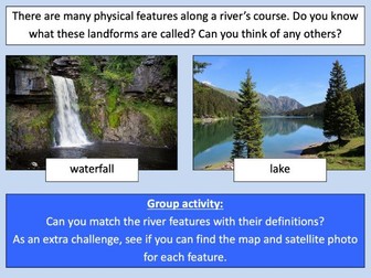
It introduces many key river concepts and a wide range of related vocabulary. First the presentation recaps the main processes of the water cycle. It then introduces some of the well known features of river systems (e.g. waterfalls and lakes). There are two activities:
Group Activity:
Students are challenged to match eight features of river systems to photos, satellite images and maps. This activity can easily be differentiated by giving groups different numbers of cards.
Individual Activity:
In the worksheet activity students identify the same features on a simplified drawing of a river system. It is differentiated two ways:
Easier – Students identify river features and complete cloze procedure definitions.
Harder – Students identify river features and write their own definitions of four river features.
If you like this resource, we would appreciate a review! We will happily send you a free resource in return for a review or useful suggestions/feedback. Contact us at ed@teachitforward.co.uk.
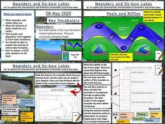
AQA GCSE Geography lesson for the new specification Unit 1C: In this lesson we look at how both meanders and ox-bow lakes are formed by both erosion and deposition.
The starter is a retrieval practice grid filled in for the rivers work so far, but it’s editable.
We then look at a diagram of the Mississippi flood plain and the pupils answer some questions about the archaic meanders that can be seen plotted on the diagram and how they might be formed. We then watch a short video clip on how river meanders get started. We then look at the cross section of a meander and its various features. The pupils get an outline drawing of a meander for them to colour in by numbers to start with, then label the various features on the cross section. The pupils seem to love this colourful neat diagram. The next thing we consider is riffles and pools, after discussing how they are formed the pupils create a diagram in their books for this one. We then watch a video clip on meander formation and there are some colourful diagrams to help teacher explanation. The pupils have a strip to stick in their books, there is a feint outline of the original meander to help them in their drawings. They then explain the process. We finish with a 6-mark question on the formation of ox-bow lakes with some guidance.
In a nutshell lesson includes:
Retrieval practice grid starter.
Question answer session on old Mississippi meanders diagram.
Colour by numbers cross sectional diagram activity.
Diagram activity on the formation of riffles and pools.
Sequential diagram task on ox-bow lake formation.
6-mark GCSE question with guidance.
Hope this saves you some valuable planning time.
https://www.tes.com/teaching-resources/shop/markthegeographer
This is a workbook designed to meet part of the criteria for the AQA Entry Level Geography Rivers Unit - I think it includes everything but Flooding and Flood management and the case study.
Some of the activities have been adapted from other worksheets
I have created this worksheet to accompany the PowerPoint I created of the same name.
Created to be used with my year 5 class, though suitable for other KS2 classes.
Children have to label the physical features of a river from source to mouth.
 Quick View