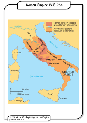

Children look at how the Roman Empire expanded over a period of 400 years and then began to diminish in extent. They relate this to the systems of government identified in Session 2. They map the Roman Empire on today’s world map, identifying countries.
Suitable for years 3 and 4.
Suitable for years 3 and 4.
Something went wrong, please try again later.
Great maps to identify countries in the Roman Empire.
Report this resourceto let us know if it violates our terms and conditions.
Our customer service team will review your report and will be in touch.
£0.00