
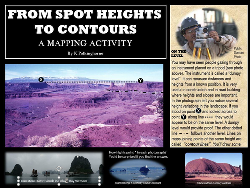
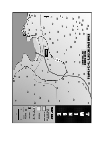
Geography students need to know about maps. They need to know how to present maps so that the information is easy to read. Most maps are two dimensional. Landscapes however are three dimensional. This is an introductory approach to developing a contour pattern on a map by using the guidance of spot heights. By completing this activity students will gain an understanding of contour lines and how they indicate different levels of elevation above sea level. The contour lines are then used as a background guide to add some land use areas. The aim of this activity is to produce maps that provide information that is easy to read. The black and white attachment is provided if hard copies of the map completion activity is needed. The extension activity on the last 3 pages leads from the map into aspects of land formations (cliff/erosion; beach deposition) This is more advanced but there may be some students looking for more difficult concepts. Teachers will know the capabilities of their students and select activities to match them.
Something went wrong, please try again later.
Report this resourceto let us know if it violates our terms and conditions.
Our customer service team will review your report and will be in touch.
£0.00