
An engaging lesson that uses photographs and diagrams to show and explain how glacial landforms of erosion are formed.
Lesson includes:
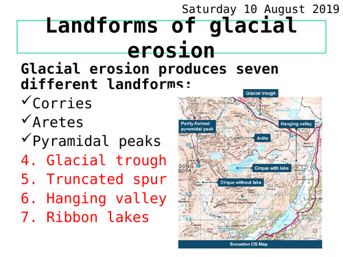
A clear note-taking frame with photos/diagrams of each landform
Definition and photo of a U-shaped valley (glacial trough)
Diagrams and photographs to show how truncated spurs and hanging valleys are formed
Photos and a diagram with word fill activity to explain how ribbon lakes are formed
Summary quiz to check on learning
All activities and worksheets are included within the powerpoint.
Something went wrong, please try again later.
really great lesson
Great resource, I adapted it to make a market place activity. Thank you
Good resource with lots of pictures and good explanations. Thanks very much
Report this resourceto let us know if it violates our terms and conditions.
Our customer service team will review your report and will be in touch.
£0.00