
A skills based activity centred around Swanage, Dorset. This lesson is perfect for the end of a GCSE Coasts topic or for fieldwork preparation in the area.
Student activities:
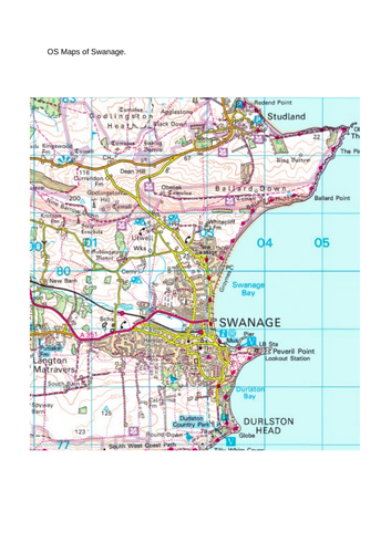
a) Stick the OS map of Swanage in the centre of an A3 page.
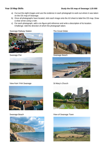
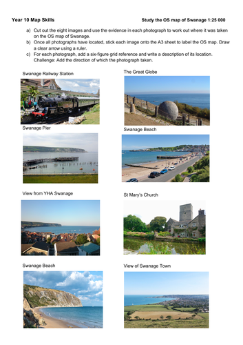
a) Cut out the eight images and use the evidence in each photograph to work out where it was taken on the OS map of Swanage.
b) Once all photographs have located, stick each image onto the A3 sheet to label the OS map. Draw a clear arrow using a ruler.
c) For each photograph, add a six-figure grid reference and write a description of its location. Challenge: Add the direction of which the photograph taken.
Please note that the OS map I used for my lesson was from an OCR skills textbook. I have therefore included an alternative map but this will need re-sizing if you wish to use the 1:25000 scale (i.e. 4cm = 1km).
Something went wrong, please try again later.
Spot on!
A fabulous exercise. Thanks very much.
Report this resourceto let us know if it violates our terms and conditions.
Our customer service team will review your report and will be in touch.
£0.00