Edexcel A Level Geography P1 2024 Prediction Paper and Mark SchemeQuick View
katicskatics

Edexcel A Level Geography P1 2024 Prediction Paper and Mark Scheme

(1)
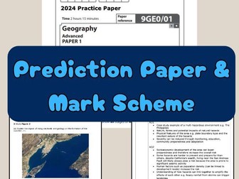
I created a practice paper with **all new questions ** for students to practice during the countdown to the exam. I used the specification and all past papers to work out what hasn’t come up yet. It includes areas of the most difficult parts of the specification. I also produced a mark scheme with ideas for answers. Hazards, coasts and carbon and water cycle. Optional theme of coasts is included. No glaciers section. Edexcel A Level Geography prediction paper, Paper 1, mark scheme included. Practice questions.
AQA A Level Geography 2024 Prediction Paper - Water, Carbon, Coasts and HazardsQuick View
katicskatics

AQA A Level Geography 2024 Prediction Paper - Water, Carbon, Coasts and Hazards

(1)
AQA A Level Geography 2024 Prediction Paper Please note this only contains questions on: Water, Carbon, Coasts and Hazards topics. I create these papers through taking the specification and colour coding what has come up before. I then look for patterns, what hasn’t come up, and tricky parts of the spec that they might sneak in. I teach AQA presently, have previously taught Eduqas, and I tutor Edexcel. This wide ranging knowledge of different exam boards gives me the ability to have a good grasp on the range and style of Geography A Level questions. It’s just a prediction, so see what you think! At present there is no mark scheme as I wanted to get this up and out before the exam.
AQA GCSE Geography Paper 1 - Revision QuizQuick View
CharlotteBrimerCharlotteBrimer

AQA GCSE Geography Paper 1 - Revision Quiz

(1)
A thorough revision quiz for Paper 1 of the new AQA GCSE Geography specification (9-1) 4 rounds: a) The challenge of natural hazards b) The living world c) Physical landscapes in the UK d) Case studies and examples 51 marks available. ANSWERS INCLUDED AFTER EACH ROUND.
Paper 1 AQA GCSE Geography Revision BundleQuick View
teachgeogblogteachgeogblog

Paper 1 AQA GCSE Geography Revision Bundle

(0)
Full series of revision lessons and Resources Session 1: Natural Hazards Revision Revision Clock Blockbuster Session 2: Living World Revision Revision Clock Blockbuster Session 3: Coasts and Rivers Revision Revision Clock Blockbuster
GCSE Coasts: All LessonsQuick View
markthegeographermarkthegeographer

GCSE Coasts: All Lessons

13 Resources
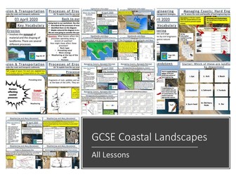
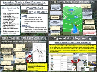
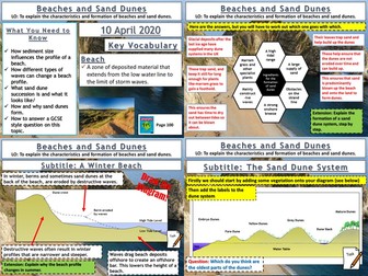
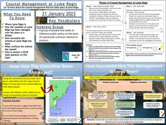
A bundle of all my coasts lessons prepared for the AQA specification, but still useful for other specifications. Lesson titles in order are: Types of Waves Weathering and Mass Movement Processes of Erosion and Transportation Headlands and Bays Wave Cut-Notches & Platforms, Stacks, Stumps and Arches Longshore Drift and Deposition Beaches and Sand Dunes Spits and Bars Coastal Landforms at Swanage Hard Engineering Soft Engineering Managed Retreat https://www.tes.com/teaching-resources/shop/markthegeographer
Geography Christmas QuizQuick View
mrshopehistorymrshopehistory

Geography Christmas Quiz

(1)
Celebrate Christmas this winter with your secondary Geography students with this 54 question xmas quiz for 2023 themed around the event complete with answers in both quick and question by question format. This resource is 54 question Xmas quiz spread across 5 different rounds. It is created on Microsoft Powerpoint and suitable for KS3 and KS4 secondary students. Whats included? Within this resource there are 54 questions spanning 5 rounds. A mixture of multiple choice, general knowledge and picture quiz questions. Topics range from Christmas traditions from around the world, flag picture round, capital city and country matchups, Christmas themed Geographical knowledge in addition to skyline picture round.Your learners will have so much fun engaging with this quiz. Delivery and timings The answers can then shared as a class by going through each question individually (ensure you are in present mode for the correct answer to colour yellow and the transitions to work) for students to peer or self mark. Additionally, answers to each individual question can be found on the notes section of each individual PowerPoint slide. If you choose to deliver this in a single session - it could take upto (but not in excess of) an hour to complete depending on how much thinking time you decide to give your students. However, the rounds have been sectioned off within the Powerpoint so that you could potentially delivered a round or two at a time with your classes or tutor groups over the period of a week or two. I really hope you enjoy this quiz activity. If you get the time, please leave a review - for a limited time I am offering a FREE copy of my Christmas Dingbats resource for every review left. So please leave your email address in the review so I can be sure to get this across to you! Looking for more Christmas resources? Check out this Christmas anagram worksheet activity Christmas 2023 Tutor time Quiz Christmas Dingbats resource FREE Seek and Find Christmas resource #geography #christmas #christmasquiz #xmas #xmasquiz #geographyquiz
Investigating Rivers - KS2Quick View
TeachItForwardTeachItForward

Investigating Rivers - KS2

7 Resources
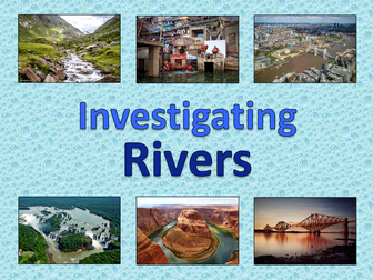
Investigating Rivers is a Geography unit suitable for KS2 (Y4-6). The planning overview and topic title page can be downloaded for free here. Lessons include: L1 - Understanding the water cycle L2 - Identifying features of a river system L3 - Identifying characteristics of the three stages of a river L4 - Investigating features of the River Thames L5 - Thinking about the different ways we use water L6 - Understanding the impacts of floods and droughts Each lesson includes a presentation and differentiated activities/worksheets. If you like this resource, we would appreciate a review! We will happily send you a free resource in return for a review or useful suggestions/feedback. Contact us at ed@teachitforward.co.uk.
Rivers: Meanders & Ox-bow LakesQuick View
markthegeographermarkthegeographer

Rivers: Meanders & Ox-bow Lakes

(1)
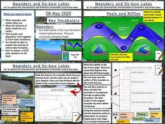
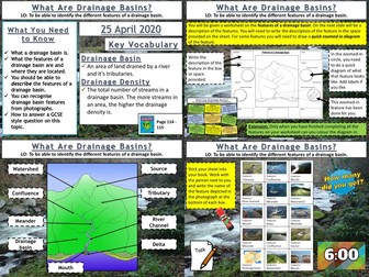
AQA GCSE Geography lesson for the new specification Unit 1C: In this lesson we look at how both meanders and ox-bow lakes are formed by both erosion and deposition. The starter is a retrieval practice grid filled in for the rivers work so far, but it’s editable. We then look at a diagram of the Mississippi flood plain and the pupils answer some questions about the archaic meanders that can be seen plotted on the diagram and how they might be formed. We then watch a short video clip on how river meanders get started. We then look at the cross section of a meander and its various features. The pupils get an outline drawing of a meander for them to colour in by numbers to start with, then label the various features on the cross section. The pupils seem to love this colourful neat diagram. The next thing we consider is riffles and pools, after discussing how they are formed the pupils create a diagram in their books for this one. We then watch a video clip on meander formation and there are some colourful diagrams to help teacher explanation. The pupils have a strip to stick in their books, there is a feint outline of the original meander to help them in their drawings. They then explain the process. We finish with a 6-mark question on the formation of ox-bow lakes with some guidance. In a nutshell lesson includes: Retrieval practice grid starter. Question answer session on old Mississippi meanders diagram. Colour by numbers cross sectional diagram activity. Diagram activity on the formation of riffles and pools. Sequential diagram task on ox-bow lake formation. 6-mark GCSE question with guidance. Hope this saves you some valuable planning time. https://www.tes.com/teaching-resources/shop/markthegeographer
AQA Geography GCSE - Paper 1 revision work bookletsQuick View
CharlotteBrimerCharlotteBrimer

AQA Geography GCSE - Paper 1 revision work booklets

(1)
Included in each booket: Knowledge tests after each section of specification content A wide range of different exam questions Structure strips for the 9 mark questions Detailed case study sheets Various activities all linked to the specification to aid students revision Space for DIRT/FIT work Can be set as homework or in class revision
Rivers: Waterfalls and GorgesQuick View
markthegeographermarkthegeographer

Rivers: Waterfalls and Gorges

(1)
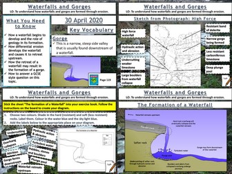
AQA GCSE Geography lesson for the new specification Unit 1C: In this lesson we look at waterfalls and gorges and how they are formed through the processes of erosion. The starter is a retrieval practice grid filled in for the rivers work so far, but it’s editable. We then look at how underlying geology plays and important part in the formation of waterfalls, the pupils have some questions to answer and I sometimes get a pupil to teach this bit. We then look at how waterfalls develop, after some teacher exposition the pupils will have an outline diagram of a waterfall with some tasks to complete on the diagram. We then look at the formation of gorges and how they relate to waterfalls. This time the pupils use the diagram on the board to create one themselves. We finish with a sketch from photograph of High Force. After we have introduced the waterfall and given some detail on its formation the pupils will create a field sketch either in a blank box, or using a feint outline, which they can draw over the top of. They then label features etc. We finish with a 6-mark question similar to the 2019 May exam on physical processes and waterfalls/gorges. There is advice and guidance should the pupils need it. In a nutshell lesson includes: Retrieval practice grid starter. Question answer session on how a waterfall starts to form. Blank outline actvity on the development of waterfalls over time. Diagram activity on the formation of a gorge. Worksheet activty on sketching High Force from a photograph. 6-mark GCSE question with guidance. Hope this saves you some valuable planning time. https://www.tes.com/teaching-resources/shop/markthegeographer
Geography Christmas QuizQuick View
Cre8tive_ResourcesCre8tive_Resources

Geography Christmas Quiz

(3)
Geography Christmas Quiz – Christmas 50+ Questions for that perfect end of term subject based lesson. This Christmas quiz has a mixture of questions and rounds and skills. Some of the rounds will be subject based with subject based knowledge whilst others will be Christmas themed giving that perfect mix for an end of term Christmas lesson. This resource will last a full 50 minutes to 1 hour. This Geography resource contains: 1x PowerPoint with questions and answers 1x Student Answer Sheet double sided out of /54+ Marks 3 sets of Editable Team Certificates (1st place, 2nd place and 3rd place) Skills reflection slide Personal reflection questions What does the Geography Christmas quiz comprise of? Round 1: Identify winter inspired images Round 2: True or False - good variety of themed questions **Round 3: ** Matching and strategy can you find the correct links and eliminate all others Round 4: Linking Round - be able to make the correct links between left and right lists Round 5: Numbers Round -all the answers will involve numbers. Round 6: Jumbled up Round - Unravel these to find the answer staring directly back at you Round 7: Multiple Choice theory - Put your team to the test Round 8: Observation Round - Look at the image , remember everything you see…. Round 9: Wordsearch Round - Locate the words before time runs out… **Round 10: ** Tie Breaker - Design it but use all your team’s creative abilities This will last a full hour for the full quiz by the time you get students into small teams and run through the quiz and the interactive way the answers appear. This informative, fun and engaging quiz will be a great way to celebrate the end of term and Christmas. Search ‘Cre8tive Resources’ for support with our library of resources or send us an email. Leave a review and email TheCre8tiveResources@gmail.com for a free resource as a thank you!! Explore all our resources on TES
New AQA A level Geography model answers for 20 mark essays.Quick View
pnmasonukpnmasonuk

New AQA A level Geography model answers for 20 mark essays.

18 Resources
A collection of essays to support revision & teaching of the new AQA Geography A level. This download contains a collection of eighteen model answers as well as some shorter answer questions and support activities. Marks schemes have been used to help ensure model answers access the higher band for each question. These create excellent support resources for your teaching of the new AQA Geography A level and will save you many hours in preparation time. These essays would also support the teaching of other A level Geography specifications. Essays included: 0 3 . 4 “Flooding and erosion is set to increase to unprecedented levels along coastlines across the world. In response, mitigation and adaptation by coastal managers will ensure that people and places are not affected.” 03.4 Assess the relative importance of weathering and erosion in the development of coastal landscapes. (20) Assess the extent to which predicted climate change will present challenges for sustainable management of a local scale environment that you have studied. (20 marks). “Human activity affects coasts globally. This interference with coastal processes is the key determining factor in shaping coastal landscapes.” To what extent do you agree with this opinion? (20 marks) 026 ‘Sustainable approaches to coastal management will become more important than traditional approaches in dealing with the impacts of climate change.’ 20 marks Explain the formation of a saltmarsh environment. (4 marks) Assess the role of vegetation in the development of a sand dune landscape. (6 marks) Camber Sands teaching resource. To what extent do the advantages of globalisation outweigh the disadvantages? [20] (or 25 marks under WJEC) Transnational corporations (TNCs) are the most significant factor in creating unequal flows of people and money within global systems.’ 20 marks. Analyse the roles of international government organisations and NGOs in the governance of Antarctica and assess their effectiveness. 20 marks 01.4 Assess the potential cause and impacts of changes in the water balance within a tropical rainforest that you have studied. 20 marks Assess the extent to which rising global temperatures may result in a positive feedback cycle of yet higher carbon content in the atmosphere. (20 marks) With reference to a river catchment that you have studied, assess the potential impact of human activity upon the drainage basin. (20 marks) Assess the extent to which there are interrelationships between processes in water cycle and factors driving change in the carbon cycle. (20 marks) With reference to a local scale of a specific place in a hazardous setting, assess the extent to which the physical nature of hazards can shape the character of a community and its ability to respond to risk. (20 marks) To what extent have global institutions helped to promote growth and stability within global systems? (20 marks) To what extent can wildfires be caused, intensified and mitigated by human activity? 20 marks. ‘The Disaster Response Curve (The Park Model) has contributed to improved understanding and therefore management of the impact of tectonic hazards.’ To what extent do you agree with this view? [20 marks] An additional AS short essay: Assess the extent that coastlines of submergence are created by sea level change. (9 Marks)
Layers of the soil KS2 science foldable activity for rocks and soilsQuick View
Gdwaters1Gdwaters1

Layers of the soil KS2 science foldable activity for rocks and soils

(0)
The activity Review the layers of the soil beneath our feet with this differentiated foldable activity. This fun alternative to a worksheet allows pupils to order the layers in the soil profile with either descriptions or name labels. There’s also an option for pupils to write descriptions in the boxes. The templates There are 3 template options to choose from in this PDF: Colour the layers of soil, cut out the names or descriptions of the layers, glue, cut, and fold. Colour the layers of soil, cut out the pictures of the layers with their descriptions, arrange them on the template, glue, cut, and fold. Colour the layers of soil, write descriptions for each layer, cut, and fold. No glue is required for this option. Curriculum links Lower KS2 Science (Year 3 Rocks and Soils) ‘Recognise that soils are made from rocks and organic matter’. US and UK paper sizes are included. Please note that this is not an editable resource. Layers of the soil are not presented to scale.
Rivers: Levees, Floodplains and EstuariesQuick View
markthegeographermarkthegeographer

Rivers: Levees, Floodplains and Estuaries

(1)
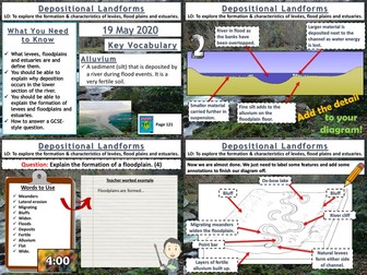
AQA GCSE Geography lesson for the new specification Unit 1C: In this lesson we look at depositional features found in the lower course of a river. The starter is a a countdown retrieval practice quiz with dramatic countdown music! We start by looking at natural levees and how they are formed. The pupils create a sequence of diagrams to show their formation based on information on the board. They are provided with outline drawings to start with to save time. We then look at the formation of floodplains. The pupils create a diagram based on the instructions on the board without actually seeing the diagram, but there is an example if they are struggling and they are given an outline floodplain to start with. We then look at the formation of estuaries. The pupils annotate a photograph to show the different features of the estuary formed by deposition. We finish on a 4 mark question on the formation of floodplains that was in an exam in 2017. I usually model the answer after the pupils have had a go. In a nutshell lesson includes: Retrieval practice grid starter. Formation of levees sequential diagram. Formation and features of a floodplain diagram activity with outline. Photo annotation for estuaries. 4-mark GCSE question with guidance. Hope this saves you some valuable planning time. https://www.tes.com/teaching-resources/shop/markthegeographer
Rivers: Erosion and TransportationQuick View
markthegeographermarkthegeographer

Rivers: Erosion and Transportation

(2)
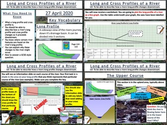
AQA GCSE Geography lesson for the new specification Unit 1C: In this lesson we look at erosion, transportation and deposition. The starter is “which row is the odd one out”. The pupils need to work out which row has an incorrect term in. Just gets them thinking. We then look at erosion and when rivers are eroding more effectively. The pupils learn about vertical and lateral erosion and will be making some diagrams in there exercise books. They then receive a worksheet where the processes of erosion and transportation are illustrated, the pupils use an information slide (or sheet if you prefer) and label the processes on and colour code the area of the diagram where that process is displayed. We then look at how these processes vary as you progress down the long profile of a river. The pupils get another worksheet where they read the labels and draw an appropriate diagram in each box to create an illustrated log profile. We finish with a summarising pyramid plenary. In a nutshell lesson includes: Odd one out starter. Vertical and lateral erosion diagram activity Worksheet on processes of erosion Worksheet activity on processes of erosion along the course of a river Summarising pyramid Hope this saves you some valuable planning time. https://www.tes.com/teaching-resources/shop/markthegeographer
KS3 Coasts TopicQuick View
teachgeogblogteachgeogblog

KS3 Coasts Topic

(1)
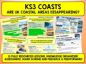
Topic 12 (Lessons are coded) Taught to Year 9 pupils 12A: Intro to Coasts 12B: Coastal Processes 12C: Coastal Erosion 12D: Old Harry’s Rocks 12E: Coastal Deposition 12F: Spit formation (Spurn Head) 12G: Why do coasts need protecting? 12H: Hard Engineering 12I: Soft Engineering 12J: Coasts OS Maps 12K: Coasts GIS [Digimaps] 12L: Assessment, Mark Scheme 12M: Close the Gap activity, Feed Forward Task A Knowledge Organiser and 10 tasks to use as revision.
Managing Floods - Soft EngineeringQuick View
markthegeographermarkthegeographer

Managing Floods - Soft Engineering

(0)
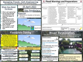
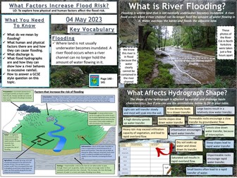
AQA GCSE Geography lesson for the 2016 specification Unit 1C: In this lesson we look at soft engineering methods of flood management. We start with a retrieval practice grid game based around the work we have undertaken in the rivers unit of work so far. The students then complete a cloze exercise to create a definition of what soft engineering is. The students then investigate flood warnings as issued by the Environment Agency and preparations by completing a guided reading exercise. We then look at three soft engineering strategies in turn: River restoration, flood plain zoning and afforestation. For each method, the students write a description, sort out the advantages and disadvantages and complete a task involving a diagram. There is a short video task on rover restoration. We finish with a 6-mark GCSE style question and there is some guidance for students who need it on how to answer it. Hope this saves you some valuable planning time. https://www.tes.com/teaching-resources/shop/markthegeographer
Barnaby visits egyptQuick View
lulimayalulimaya

Barnaby visits egypt

(12)
i have used this to use with my Year 1 class in the topic: Where in the workd is Barnaby Bear! I hope it is useful!
Soils worksheetQuick View
RachdfRachdf

Soils worksheet

(20)
Worksheet in 3 sections: 1. Three types of soil 2. What soil is made up of 3. Layers of soil
Rock types and rock CycleQuick View
R DallyR Dally

Rock types and rock Cycle

(10)
Information based on the rock types found in Pembrokeshire. Links to interactive rock cycles and contains class activities.
What is the water cycle?Quick View
88collinsl88collinsl

What is the water cycle?

(108)
A basic introduction lesson to the water cycle. This lesson was aimed at year 7 and includes a variety of activities for different abilities.