
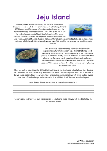
When looking at maps we can find it difficult to imagine what the landscape looks like if we were actually there. This worksheet explains how to draw a cross-section of Jeju Island, South Korea, by using the contours on a map and following a simple flow diagram.
Please like and follow us on Facebook @WillsonEducation or Pinterest @willsoned for more exciting resources, activities, and upcoming events to incorporate into your lessons.
Something went wrong, please try again later.
No map with this, so it can't be used. The activity would be great, IF there was a map. Waste of money.
Report this resourceto let us know if it violates our terms and conditions.
Our customer service team will review your report and will be in touch.
£2.00