


The first of a ten part series of lessons that focus on many of the elements of the locational knowledge aspects for the KS2 Geography curriculum. The series of lessons focuses predominantly on children being able to use maps to find countries and cities in different continents as well as a brief focus on time zones and globalisation. All of the resources needed to run the lesson are included with worksheets, any potential example maps required (in case atlases are unavailable) the presentation and unit of work plan.
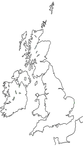
This lesson focuses on being able to locate cities from the United Kingdom on a map, identifying them on a blank copy.
This lesson focuses on being able to locate cities from the United Kingdom on a map, identifying them on a blank copy.
Something went wrong, please try again later.
This resource hasn't been reviewed yet
To ensure quality for our reviews, only customers who have downloaded this resource can review it
Report this resourceto let us know if it violates our terms and conditions.
Our customer service team will review your report and will be in touch.
£0.00