
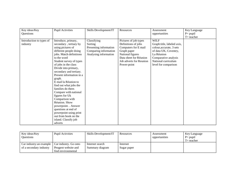
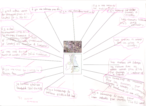
This lesson uses OS map and aerial photography to look at the locational factors for a car factory. Student use the map to find evidence of the reasons for the location of the Peugeot factory in Coventry. this factory has now closed but a similar exercise could be replicated for other UK car factories. It will show you how to use Geographical map work skills and French to achieve a good outcome .
Something went wrong, please try again later.
This resource hasn't been reviewed yet
To ensure quality for our reviews, only customers who have downloaded this resource can review it
Report this resourceto let us know if it violates our terms and conditions.
Our customer service team will review your report and will be in touch.
£0.00