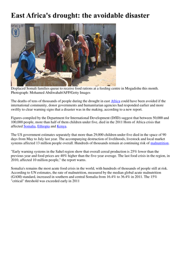
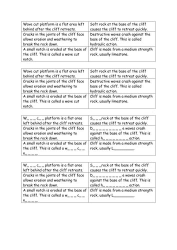
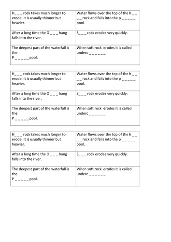
Hero image

G_4_ Geography

Average Rating2.33
(based on 9 reviews)

I provide resources in the format of whole lessons, which can easily be adapted to suit the needs of your school and to fit into your schemes of learning. Most resources are Geography based with some wider links to other subject areas such as Citizenship, Business and other Humanities disciplines.

43Uploads

25k+Views

6k+Downloads

I provide resources in the format of whole lessons, which can easily be adapted to suit the needs of your school and to fit into your schemes of learning. Most resources are Geography based with some wider links to other subject areas such as Citizenship, Business and other Humanities disciplines.
Climate change in Africa.
Pollard89Pollard89

Climate change in Africa.

(1)
Students explore the issues caused by climate change in Africa. Lesson provides an overview of the issues facing Africa due to climate change such as desertification, drought, locusts and tropical storms. Use of news articles to annotate an A3 map of Africa with particular issues.
Managing tourism in the Lake district
Pollard89Pollard89

Managing tourism in the Lake district

(0)
A case study lesson looking at carrying capacity and management within the Lake District I do not own the rights to the video and two of the info slides (Impacts and Conflict matrix) the remainder of the lesson has been planned by me.
HIV/AIDS in Africa
Pollard89Pollard89

HIV/AIDS in Africa

(0)
Lesson about the HIV and AIDS epidemic in Africa. Use of maps to identify the distribution of the disease. Acknowledgements: video links, starter true or false statements.
Causes of globalisation
Pollard89Pollard89

Causes of globalisation

(0)
PPT and market place resources (Differentiated) with teamwork opportunities for reflection. Resource focuses upon four causes of globalisation: Culture, Trade, Multinational companies, Internet and communications.
Megacities - Growing megacities (Numeracy task) and assessment
Pollard89Pollard89

Megacities - Growing megacities (Numeracy task) and assessment

(0)
Numeracy based lesson focussing upon the growth of the largest megacities. Students calculate the growth rate of megacities between 1975 and 2015. Students can then plot the megacities of 1975 in one colour and 2015 in another, to draw a comparison between both years. Differentiated numeracy sheets. Assessment A3 map for plotting, and a series of differentiated planning grids to support students with their interpretation and explanation.