
Students will be able to describe the location of the continent of South America using longitude and latitude, then describe the physical features of South America that are present. Finally students will log into laptops and use the worksheet provided to produce a GIS map of the different physical features of South America along with annotations of their maps and what they see.
Starter: Knowledge Retention of previous learning
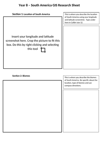
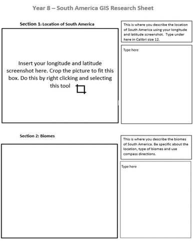
Task 1: Description of South America using longitude and latitude.
Task 2: Describing the physical features using compass points in South America
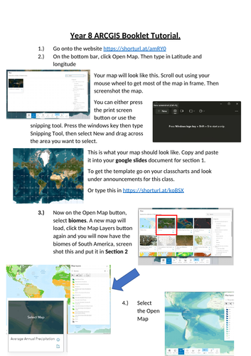
Task 3: Main Task: Using GIS online students will create a map with different physical features present in South America
Task 4: Plenary: Home Learning on the physical features of South America (On last slide of powerpoint)
Lesson contains one powerpoint and one worksheet.
Get this resource as part of a bundle and save up to 40%
A bundle is a package of resources grouped together to teach a particular topic, or a series of lessons, in one place.
Something went wrong, please try again later.
This resource hasn't been reviewed yet
To ensure quality for our reviews, only customers who have purchased this resource can review it
Report this resourceto let us know if it violates our terms and conditions.
Our customer service team will review your report and will be in touch.
£1.99