Providing quality tested Geography resources at an affordable price. Take the stress out of your teaching and enjoy what many teachers joined the profession for, working with young people. Please follow & review to help me grow my store!
Providing quality tested Geography resources at an affordable price. Take the stress out of your teaching and enjoy what many teachers joined the profession for, working with young people. Please follow & review to help me grow my store!
In this 2 hour KS3 resource pupils contrast the quality of life in Ghana with that of the UK. Pupils are first taught how to describe the location of Ghana at various scales. Source analysis is used to stimulate discussion regarding living conditions within Ghana. Pupils read an interview of a girl living in Ghana and consider how her quality of life will be affected by her living conditions. The text is annotated with prompt questions to stimulate discussion and allow pupils to complete the worksheet activity. The learning is later assessed through a extended independent writing task. A writing frame is provided to guide pupils and improve structure.
**Bundle and save! This lesson is part of a larger bundle:- **
Development topic bundle
Check out some of my other products relating to weather and climate:-
What is development?
How can we measure development?
What are the causes of global inequality?
What is Africa like?
What are Africa’s climate zones?
How do squatter settlements affect peoples quality of life?
How can fair trade help to reduce the development gap?
If you like my work, please follow me for more resources and leave a review!
This 1 hour KS3 lesson investigates how and why companies are able to become global brands. Pupils develop their awareness of the characteristics of transnational co-operations, using Apple as a case study. Pupils engage in a duel-coding activity, learning the benefits of producing and selling goods in lots of countries around the world.
Check out some of my other products relating to Globalisation:-
What are products and services?
What are producers and consumers?
How has employment structure changed in the UK?
What is globalisation?
What factors have caused globalisation?
How do conflict minerals affect people living in Africa?
Does slavery still exist? (Investigating Apple’s iPhone factories)
If you like my work, please follow me for more resources and leave a review!
This 2 hour KS3 lesson investigates the development of squatter settlements in Indian cities. Pupils develop their geographic skills by analysing graphs of urban population change. Students reflect on why rural to urban migration occurs and consider the impact this has on housing the urban poor. A video link illustrates the terrible living conditions found within these settlements. Students discover why squatter settlement contribute significant amounts of plastic waste to the worlds oceans and explore the range of strategies being used to combat this.
Bundle and save! This lesson is part of a larger bundle:-
India & The Plastic Problem
Check out some of my other products relating to India & The Plastic Problem:-
Why is plastic hazardous?
Where is India and what is it like?
How does India’s physical Geography influence the location of its major cities?
Why does India have a monsoon climate?
How do ocean gyres move plastic pollution?
How developed is India?
Why does India have so many squatter settlements?
What are the impacts of marine plastic waste?
How can plastic waste be reduced?
If you like my work, please follow me for more resources and leave a review!
This 2 hour KS3 resource looks at both 4 and 6 figure grid referencing. Clean instructional slides are provided on how to demonstrate such skills. Two respective worksheets are provided as well as some whole class tasks.
Bundle and save! This lesson is part of a larger bundle:-
Geographical skills topic bundle
Check out some of my other products relating to Geographical skills:-
Where are the major oceans, countries, continents, rivers and mountains?
How can we use a compass?
What are lines of latitude and longitude?
Why are map symbols useful?
How is height represented on a map?
How can we measure distance using maps?
If you like my work, please follow me for more resources and leave a review!
This 1 hour KS3 lesson helps pupils to better understand why globalisation occurs. Pupils use images to reflect on why globalisation occurs and engage in a card sort activity, designed to encourage learners to elaborate their ideas! The lesson includes a video link, allowing visual learners to better understand this complex process.
Check out some of my other products relating to Globalisation:-
What are products and services?
What are producers and consumers?
How has employment structure changed in the UK?
What is globalisation?
What factors have caused globalisation?
Why is Apple such a successful global brand?
How do conflict minerals affect people living in Africa?
Does slavery still exist? (Investigating Apple’s iPhone factories)
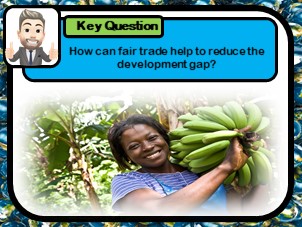
In this 2 hour KS3 lesson students learn how fair trade can help improve the lives of producers in developing countries. Pupils plot the sources of global foods on a world map and investigate, through role play, the reality of the trade chain. The lesson provides video case study links, highlighting the benefits of fair trade to banana farms in the Caribbean.
**Bundle and save! This lesson is part of a larger bundle:- **
Development topic bundle
Check out some of my other products relating to weather and climate:-
What is development?
How can we measure development?
What are the causes of global inequality?
What is Africa like?
What are Africa’s climate zones?
How do squatter settlements affect peoples quality of life?
How does quality of life differ between HIC & LIC countries?
This 1-2 hour KS3 resource investigates the factors influencing rural to urban migration in China. Pupils learn why individuals seek a better life in the city, and reflect on whether the grass is really greener. Students use a video case study to create a story board of one migrants experiences.
Check out some of my other products relating to China:-
Where is China?
What physical and human Geography exists across China?
How is the population distributed across China?
What are the problems of overpopulation?
How developed is China?
Was China’s one child policy an example of successful population control?
This 12 week scheme investigates China. China has a rich and unique heritage, spanning back thousands of years. Its huge size produces diverse landscapes and unique physical Geography, found nowhere else in the world. These contrasting landscapes are mirrored by huge inequalities across its human landscapes. Stark population differences and large discrepancies in standards of living across the country provide interest, given how China portrays itself at the world stage. The decisive but often controversial decisions made by the Chinese government have helped China’s economy grow to become one of the largest in the world. This unit investigates this growing superpower, evaluating the impacts of physical Geography and government policy on development across the nation.
Check out my other topic bundles!
Weather & Climate Topic Bundle
Africa & The Development Gap Topic Bundle
Globalisation Topic Bundle
World Tourism Topic Bundle
Tectonic Hazards Topic Bundle
India & The Plastic Problem Topic Bundle
Earth’s History Topic Bundle
Geographical Skills Topic Bundle
Energy & Climate Change Topic Bundle -(Coming soon)
If you like my work, please follow me for more resources and leave a review!
This 1-2 hour KS3 lesson teaches pupils to use map symbols. Students are initially required to try to identify potential map symbols on an OS image. Understanding is developed through a mix and match task, followed by a fun kinaesthetic ‘pairs’ style activity. Students finally design their own treasure map, being required to write a descriptive paragraph to guide their partner to the buried treasure!
Bundle and save! This lesson is part of a larger bundle:-
Geographical skills topic bundle
Check out some of my other products relating to Geographical skills:-
Where are the major oceans, countries, continents, rivers and mountains?
How can we use a compass?
What are lines of latitude and longitude?
How can we use 4 & 6 figure grid references?
How is height represented on a map?
How can we measure distance using maps?
If you like my work, please follow me for more resources and leave a review!
This 1 hour KS3 lesson teaches pupils about the various types of tourism. Students first discover what separates tourism from travel. Pupils are required to organise a holiday package for different customer types, before justifying why each aspect of the holiday has been selected for their chosen customer. A mix and match card sort is used to teach students about the vast range of tourism opportunities and environments.
Bundle and save! This lesson is part of a larger bundle:-
Tourism topic bundle
Check out some of my other products relating to Tourism:-
Why has the tourism industry grown?
Why do coasts, mountains and cities attract visitors?
How do glaciers shape the landscape?
What are the features of a glaciated landscape?
Why does conflict exist in national parks?
How can conflict in national parks be managed?
Where is the Amazon Rainforests & what is it like?
Why is the Amazon Rainforests under threat?
How can eco-tourism help to manage rainforests sustainably?
Why do tourists visit extreme environments?
How does tourism impact Antarctica?
If you like my work, please follow me for more resources and leave a review!
This 1-2 hour KS3 lesson teaches pupils to use latitude and longitude. The lesson includes learning strategies, which allow pupils to remember key differences with ease. Pupils are required to plot the location of key countries using latitude and longitude values. Students then play a ‘battle ships’ style game developing their newly learnt skills in a fun kinaesthetic activity. Pupils reflect on their learning and use a key term box to describe lines of latitude and longitude. Students are required to then move themselves around the room into specific areas using latitude an longitude values. This allows teachers to assess learning with ease.
Bundle and save! This lesson is part of a larger bundle:-
Geographical skills topic bundle
Check out some of my other products relating to Geographical skills:-
Where are the major oceans, countries, continents, rivers and mountains?
How can we use a compass?
How can we use 4 & 6 figure grid references?
Why are map symbols useful?
How is height represented on a map?
How can we measure distance using maps?
If you like my work, please follow me for more resources and leave a review!
In this** 2 hour KS3 lesson**, pupils investigate extreme tourism in Antarctica. Students watch a video clip to understand why tourists visit this extreme but beautiful continent. Source images are used to teach pupils about the conflicts caused by tourists. A card sort activity is included in which pupils categorise the positive and negative impacts of tourism. Students are taught about the strategies being use to make Antarctica tourism more sustainable.
Bundle and save! This lesson is part of a larger bundle:-
Tourism topic bundle
Check out some of my other products relating to Tourism:-
What types of tourism exist?
Why has the tourism industry grown?
Why do coasts, mountains and cities attract visitors?
How do glaciers shape the landscape?
What are the features of a glaciated landscape?
Why does conflict exist in national parks?
How can conflict in national parks be managed?
Where is the Amazon Rainforests & what is it like?
Why is the Amazon Rainforests under threat?
How can eco-tourism help to manage rainforests sustainably?
Why do tourists visit extreme environments?
How does tourism impact Antarctica?
If you like my work, please follow me for more resources and leave a review!
This 1 hour KS3 lesson focuses on extreme tourism in Antarctica. Students reflect on the rational for undertaking such a trip and consider the appeal of extreme destinations. The lesson includes a link to an Antarctica interactive quiz. Pupils listen to the sounds of Antarctica, helping to students to visualise visiting this isolated area. Pupils then complete a piece of creative writing using source images and supporting word bank. A mapping task is included to improving locational knowledge.
Bundle and save! This lesson is part of a larger bundle:-
Tourism topic bundle
Check out some of my other products relating to Tourism:-
What types of tourism exist?
Why has the tourism industry grown?
Why do coasts, mountains and cities attract visitors?
How do glaciers shape the land?
What are the features of a glaciated landscape?
Why does conflict exist in national parks?
How can conflict in national parks be managed?
Where is the Amazon Rainforests & what is it like?
Why is the Amazon Rainforests under threat?
How can eco-tourism help to manage rainforests sustainably?
How does tourism impact Antarctica?
If you like my work, please follow me for more resources and leave a review!
This 1-2 hour lesson teaches pupils about the sensitive nature of food webs. Students first engage in an interactive task in which they must create their own food web using cards and other members of the class. Once the food chain has been ‘found’ they answer questions about their said chain. Pupils then reflect on the difference between a food chain and a food web. Students are taught how energy flows through a food web, before adding arrows to a example, representing predator pray relationships. In the final tasks the idea of interdependence is introduced. Here pupils are required to explain the impact of various changes to a food web.
Workbook pintables are provided which follow the PowerPoint lesson. Multiple choice checking for understanding slides are included, as well as links and videos to allow pupils to secure their learning at home.
Bundle and save! This lesson is part of a larger bundle:-
Rainforest ecosystems
Check out some of my other products relating to Rainforests & Ecosystems:-
What is a food chain?
What are the major biomes?
What are rainforests like?
How do animal and plants adapt to the rainforest?
Why does deforestation occur in tropical rainforests?
Why has deforestation occurred in Malaysia?
How can deforestation be managed sustainably?
If you like my work, please follow me for more resources and leave a review!
This 2-3 hour lesson teaches pupils about the importance of the rainforest. Students learn why tropical forests are being removed, despite them being such a precious resource both locally and globally. In the first task pupils use dual coding to mind map and categorise the importance of the forest. Satellite images are used to highlight global forest loss hot spots. Students then improve their numerical skills by comparing forest loss of the Brazilian and Non-Brazilian Amazon. A writing frame is provided here to support weaker pupils. Source images are used to stimulate discussion, as to why forest is being removed. Pupils then undertake a guided reading exercise, before finally completing a card sort task.
Workbook pintables are provided which follow the PowerPoint lesson. Multiple choice checking for understanding slides are included, as well as links and videos to allow pupils to secure their learning at home.
Bundle and save! This lesson is part of a larger bundle:-
Rainforest ecosystems
Check out some of my other products relating to Rainforests & Ecosystems:-
What is a food chain?
What are food webs?
What are the major biomes?
What are rainforests like?
How do animal and plants adapt to the rainforest?
Why has deforestation occurred in Malaysia?
How can deforestation be managed sustainably?
In this 2 hour KS3 lesson, pupils learn how development indicators can be used to evaluate a countries level of development. The lesson teaches pupils how to identify global patterns in wealth. Model answers are included to improve pupils understanding of how to use and analyse sources. Pupils learn that not all development indicators are reliable, and evaluate the effectiveness of death rate, GNI and HDI.
**Bundle and save! This lesson is part of a larger bundle:- **
Development topic bundle
Check out some of my other products relating to weather and climate:-
What is development?
What are the causes of global inequality?
What is Africa like?
What are Africa’s climate zones?
How do squatter settlements affect peoples quality of life?
How does quality of life differ between HIC & LIC countries?
How can fair trade help to reduce the development gap?
This 1-2 hour lesson investigates the concept of development. Pupils describe the location of countries of contrasting development, and learn to identify global patterns. A game activity is used to reinforce key geographical terms and a writing frame is provided for the written task.
**Bundle and save! This lesson is part of a larger bundle:- **
Development topic bundle
Check out some of my other products relating to weather and climate:-
How can we measure development?
What are the causes of global inequality?
What is Africa like?
What are Africa’s climate zones?
How do squatter settlements affect peoples quality of life?
How does quality of life differ between HIC & LIC countries?
How can fair trade help to reduce the development gap?
If you like my work, please follow me for more resources and leave a review!
This three hour KS3 lesson investigates the impact of glaciers on the physical landscape. Pupils learn how ice changes the shape of mountain valleys over time, using key terms to describe the features of such landscapes. The lesson includes a worksheet that guides pupils through the transition of ‘V’ and ‘U’ shaped valleys. Students then identify glacial features on a source image, using written descriptions. Pupils finally undertake a ‘carousel’ style exercise, collecting information about: corries, aretes, pyramidal peaks, glacial troughs, hanging valleys an ribbon lakes. Supporting worksheets included.
Bundle and save! This lesson is part of a larger bundle:-
Tourism topic bundle
Check out some of my other products relating to Tourism:-
What types of tourism exist?
Why has the tourism industry grown?
Why do coasts, mountains and cities attract visitors?
How do glaciers shape the land?
Why does conflict exist in national parks?
How can conflict in national parks be managed?
Where is the Amazon Rainforests & what is it like?
Why is the Amazon Rainforests under threat?
How can eco-tourism help to manage rainforests sustainably?
Why do tourists visit extreme environments?
How does tourism impact Antarctica?
If you like my work, please follow me for more resources and leave a review!
This 1 hour KS3 lesson investigates the features that attract people to both human and physical landscapes. Students use source images to consider the unique characteristics of coastal, mountainous and urban destinations. Pupils then complete their worksheet, which overviews the features of each area. Students are taught the difference between labels and annotates, and are required to select one area to work on independently. Exemplars and answer sheet included.
Bundle and save! This lesson is part of a larger bundle:-
Tourism topic bundle
Check out some of my other products relating to Tourism:-
What types of tourism exist?
Why has the tourism industry grown?
How do glaciers shape the land?
What are the features of a glaciated landscape?
Why does conflict exist in national parks?
How can conflict in national parks be managed?
Where is the Amazon Rainforests & what is it like?
Why is the Amazon Rainforests under threat?
How can eco-tourism help to manage rainforests sustainably?
Why do tourists visit extreme environments?
How does tourism impact Antarctica?
If you like my work, please follow me for more resources and leave a review!
This 2 hour KS3 lesson explores the concept of extinction. The 65MA dinosaur extinction event is the focus for the activities in this lesson. Pupils use prompt cards and a short experiment style demonstration to explain the impact of the meteorite. Writing frames to this activity are provided, as well as an alternative differentiated activity for lower abilities. Pupils must then complete a group task to research the alternative theories.
Bundle and save! This lesson is part of a larger bundle:-
Earth’s Story topic bundle
Check out some of my other products relating to Earth’s history:-
What was the Big Bang?
What is evolution?
How did life on Earth evolve?