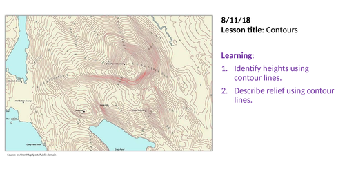
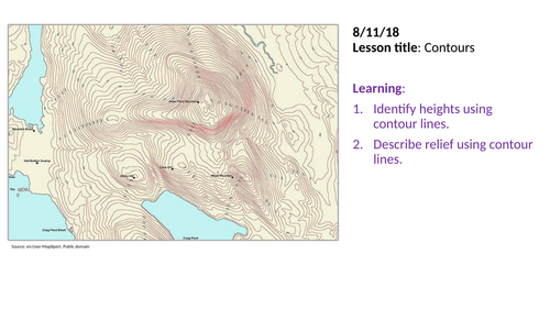
Contours
Subject: Geography
Age range: 7-11
Resource type: Lesson (complete)
This is a KS3 / KS2 lesson on reading contours. It is a very good practical lesson that will get students really involved in map work. Key facts about the lesson are:
The content covered by the lesson are; Definition of the term contours, how to use contour lines, practice giving height using contours, how do contours show steep and gentle slopes, creating your own map with contour lines.
Learning resources used in the lesson are; quiz, contour map work using grid references, matching contour lines with shape of land task, drawing contour lines on a map.
Other facts; The answers for the practice activities are included on the ppt which makes it even easier for non specialists to deliver.
What do you get in the package? The lesson is planned in detail all of the resources for teaching the lesson are included in the ppt; starter, learning activities with resources, clear outline of learning tasks and a plenary. Now just download and teach!
A bundle is a package of resources grouped together to teach a particular topic, or a series of lessons, in one place.
There are seven (7) lessons in this bundle. It's the complete set of map skill lessons that is usually taught to year 7s at the beginning of the school year. This bundle will cover your planning for entire first half-term. All the resources to deliver the lessons are included in the ppts. The ppts are very easy to follow and answers to practice tasks are included to make it easy for non-specialist who might be teaching this topic. The lessons are very practical so students will be doing most of the work while the teacher can provide one-one attention. The lessons included are: 1. Qualities of a good map 2. Map symbols 3. Map scales 4. Compass coordinates 5. Grid reference 6. Relief 7. Contours A description of each lesson can be found on my page for each individual lesson.
There are two lessons in this bundle on relief. The 1st lesson introduces the three techniques used to show height and shape of landscapes on maps (spot heights, colour shading and contours). The 1st lesson focuses on spot heights and colour shading in detail with good practical activities that will engage students. The 2nd leson focuses entirely on contours and how they can be used to describe the height and shape of the land. Here they are also goo pratical engaging activities. Both lessons are planned in detail and all the learning/teaching resources are included in the ppt. Just download and teach!
Something went wrong, please try again later.
This resource hasn't been reviewed yet
To ensure quality for our reviews, only customers who have purchased this resource can review it
Report this resourceto let us know if it violates our terms and conditions.
Our customer service team will review your report and will be in touch.