
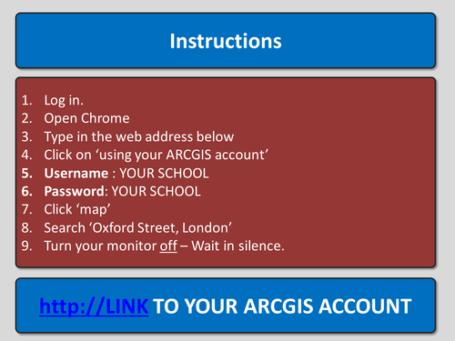
This is a full GCSE 1 hour lesson that covers land use and land use changes through ARCGIS - Though you could use another program easily. The lesson is part of a unit on urban change and challenges on the new Ed-Excel spec, though it could easily be adapted to other specifications. The lesson is geared up for ARCGIS and contains clear and detailed instructions on how to work through the activities, however you could take the concept and apply it to other software without much effort.
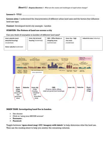
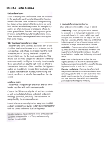
Learning Outcome 1 - 'I understand the characteristics of different urban land uses and the factors that influence land-use type.'
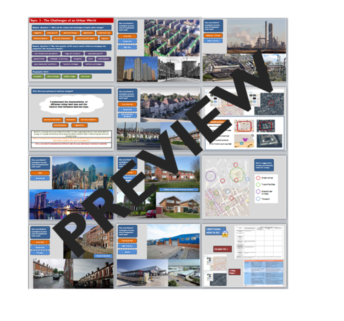
This lesson covers the following themes:
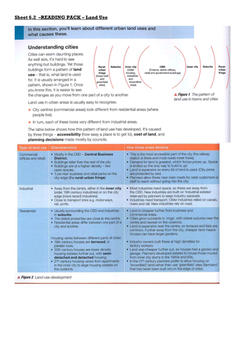
- Commercial, residential, industrial land uses.
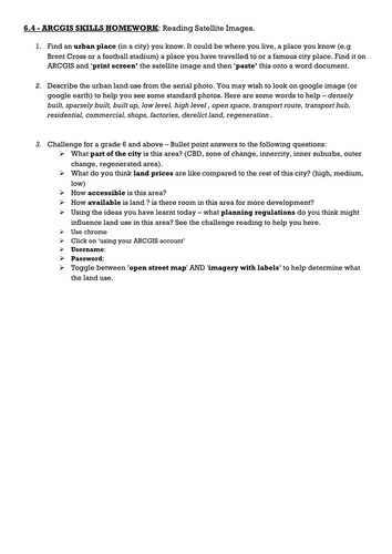
- How to identify land uses, using a map and satellite images.
- Common map characteristics of residential and commercial areas.
The lesson's core task is to use mapping software to identify 5 areas and describe the urban form, this will build students skills for later in the unit.
Ease of use is the aim, so the lesson includes a compact presentation with instructions and guidance in the notes section below each slide, it also includes referenced, differentiated handouts with printing instructions and is of course, proof read.
Please feel free to leave a review :)
Happy teaching!
Learning Outcome 1 - 'I understand the characteristics of different urban land uses and the factors that influence land-use type.'
This lesson covers the following themes:
- Commercial, residential, industrial land uses.
- How to identify land uses, using a map and satellite images.
- Common map characteristics of residential and commercial areas.
The lesson's core task is to use mapping software to identify 5 areas and describe the urban form, this will build students skills for later in the unit.
Ease of use is the aim, so the lesson includes a compact presentation with instructions and guidance in the notes section below each slide, it also includes referenced, differentiated handouts with printing instructions and is of course, proof read.
Please feel free to leave a review :)
Happy teaching!
Get this resource as part of a bundle and save up to 7%
A bundle is a package of resources grouped together to teach a particular topic, or a series of lessons, in one place.
Something went wrong, please try again later.
This resource hasn't been reviewed yet
To ensure quality for our reviews, only customers who have purchased this resource can review it
Report this resourceto let us know if it violates our terms and conditions.
Our customer service team will review your report and will be in touch.
£3.99