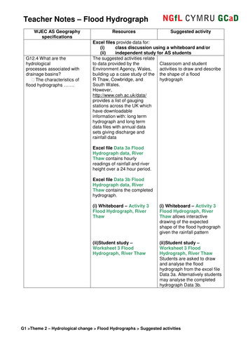


Excel data files of hourly rainfall and river height for three contrasting drainage basins in S Wales are used to construct and analyse flood hydrographs as both whiteboard and independent student activities. OS maps, sketch maps, photographs, videos and other Geographical Information Systems provide the background to an ‘Investigation into factors causing differing river flood levels’.
Something went wrong, please try again later.
Great resources, interesting data on hydrographs and usefull student worksheets and teacher resources
Report this resourceto let us know if it violates our terms and conditions.
Our customer service team will review your report and will be in touch.
£0.00