

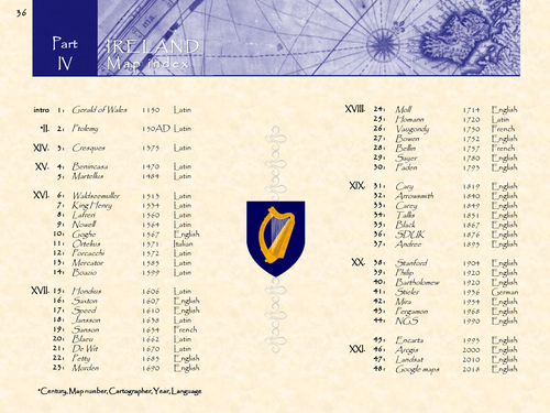
Ireland in 48 historical maps: 150AD-2018 (142 pages).
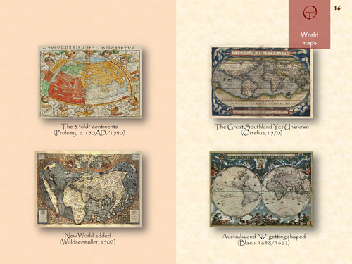
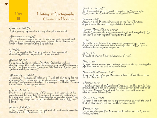
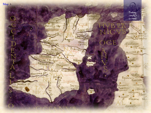
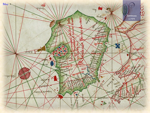
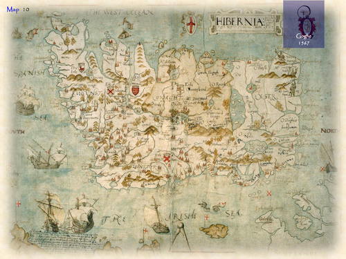
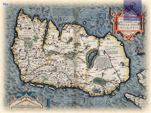
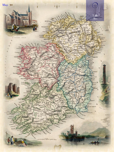
The name Ireland is derived from the Celtic word Eire, meaning “the fertile place”. On ancient (world) maps the Latin name Hibernia or Ibernia (later Irlandia) was used, which refers to the wintry or cold climate of this remote place. Ireland was already described by Ptolemy in his Geographia (150AD). The accompanying maps were worked out again by European cartographers at the end of the 15th century. Being part of the British Isles, Ireland is also depicted on the Mappa Mundi in medieval times. The coastline was drawn in more detail on 15th century Portolan charts (nautical maps). The first (printed) separate maps of Ireland appeared in the 16th century.
Something went wrong, please try again later.
This resource hasn't been reviewed yet
To ensure quality for our reviews, only customers who have purchased this resource can review it
Report this resourceto let us know if it violates our terms and conditions.
Our customer service team will review your report and will be in touch.
£4.80