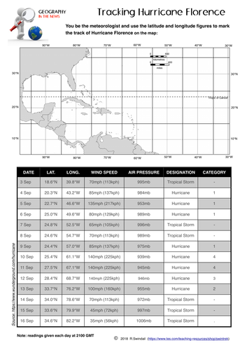

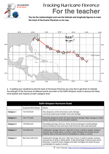
A simple worksheet that requires your students to plot the path using latitude and longitude of Hurricane Florence as it made its way from the mid-Atlantic to the US coast in the Carolinas. An answer key is provided. A good way to practice your students in plotting points using latitude and longitude, at the same time getting them to understand the relevance of this simple geographic skill to the real world.
Something went wrong, please try again later.
This resource hasn't been reviewed yet
To ensure quality for our reviews, only customers who have purchased this resource can review it
Report this resourceto let us know if it violates our terms and conditions.
Our customer service team will review your report and will be in touch.
£2.00