
A fully resourced, differentiated, and up-to-date lesson on how the UK is connected to the wider world through several different ways. In this lesson students will learn about how we are connected through trade, culture, transport and electronic communications.
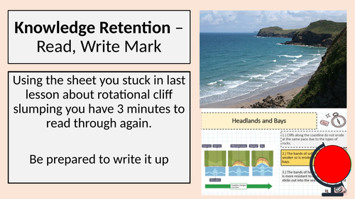
Task 1: Starter - Application of knowledge- Read, Write, Mark, all about the formation of headlands and bays.
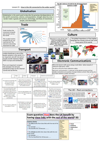
Task 2: Geographic Skills: Description of graphs - Describe what the diagrams show about UK’s changing trade links.
Task 3: Geographic Skills: Description of graphs - What is the graph showing, what is the type of graph, what is the difference, etc.
Task 4: Colour code the categories to the information.
Task 5: Main Task - Practice exam questions- “How does the UK benefit by having close links with the rest of the world (6 marks)"
High-ability students will complete this with limited scaffolding. LA students can use sentence starters and keywords for help.
Task 6: Plenary - Revise for headlands and bays exam question.
**Download contains PowerPoint and worksheet for the lesson. **
Get this resource as part of a bundle and save up to 40%
A bundle is a package of resources grouped together to teach a particular topic, or a series of lessons, in one place.
Something went wrong, please try again later.
This resource hasn't been reviewed yet
To ensure quality for our reviews, only customers who have purchased this resource can review it
Report this resourceto let us know if it violates our terms and conditions.
Our customer service team will review your report and will be in touch.
£1.99