

This GCSE Geography lessons looks in-depth at the land use patterns around the edge of Manchester’s city, or the urban-rural fringe. This area is where the city meets the countryside and is desirable for a range of development opportunities including golf courses, airports and out of town shopping centres.
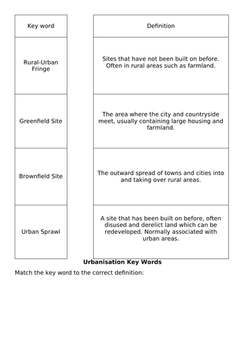
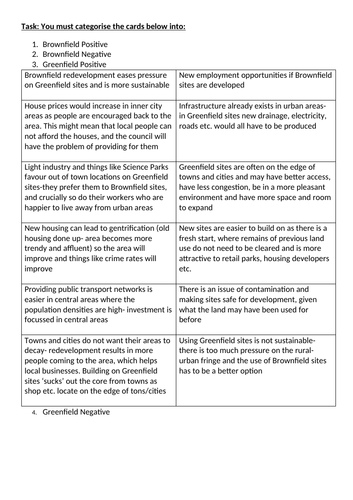
This lesson looks at an OS map of Manchester for the starter task, although using BING maps online will substitute if you do not have hard copies. The lesson develops map skills and annotation skills. There is a brownfield site card sort activity also to help students understand the advantages and disadvantages of building on brown field sites.
This lesson was written to compliment the AQA spec A GCSE curriculum, and briefly touches on the Burgess model, and how Manchester fits into this framework. It is part of other Manchester-based case study resources, also available from my shop. To go with the Urban Issues and Challenges topic SOW.
Something went wrong, please try again later.
This resource hasn't been reviewed yet
To ensure quality for our reviews, only customers who have purchased this resource can review it
Report this resourceto let us know if it violates our terms and conditions.
Our customer service team will review your report and will be in touch.
£3.50