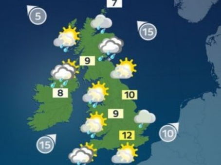
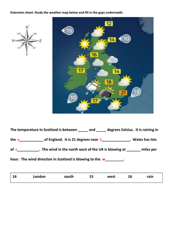

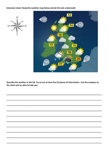
Full lesson on how weather is shown on a map, focusing on the UK. PowerPoint presentation and all resources. Suitable for either KS2 or low ability KS3 students.
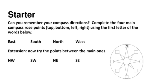
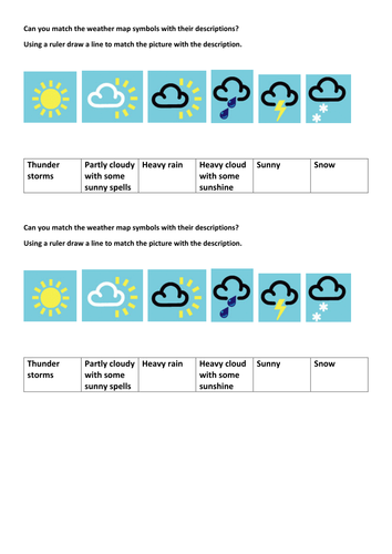
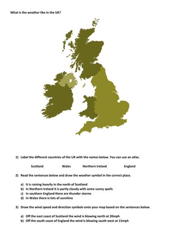
Covers UK countries, compass points and directions, how temperature, wind speed, and weather type are presented on weather maps.
Covers UK countries, compass points and directions, how temperature, wind speed, and weather type are presented on weather maps.
Something went wrong, please try again later.
This resource hasn't been reviewed yet
To ensure quality for our reviews, only customers who have purchased this resource can review it
Report this resourceto let us know if it violates our terms and conditions.
Our customer service team will review your report and will be in touch.
£2.00