International
Resources
Topical and themed
Pre-K and Kindergarten
Elementary
Middle school
High school
Special education
Education Jobs
Schools directory
News
Courses
Store
Resources
Education Jobs
Schools directory
News
Search
Tes for schools
Log in
Register
for free
Resources
Education Jobs
Schools directory
News
Magazine
Courses
Log out
Help
Home feed
My list
Courses
My Jobs
Job alerts
My CV
Career preferences
Resources
Author dashboard
Settings
Edit account
Log out
Home
Resources
Jobs
Schools directory
News
Magazine
Courses
Register for free
Log in
Help
MissPriceGeog's Shop
Add a resource
Edit shop
Average Rating
1.00
(based on 1 reviews)
MissPriceGeog's Shop
Average Rating
1.00
(based on 1 reviews)
Edit shop
Add a resource
19
Uploads
3k+
Views
473
Downloads
All resources
Relevance
Relevance
Newest
Highest rated
Lowest price
MissPriceGeog
Unit 1 Revision GCSE/WJEC Geography
(0)
MissPriceGeog
Volcanoes
(0)
MissPriceGeog
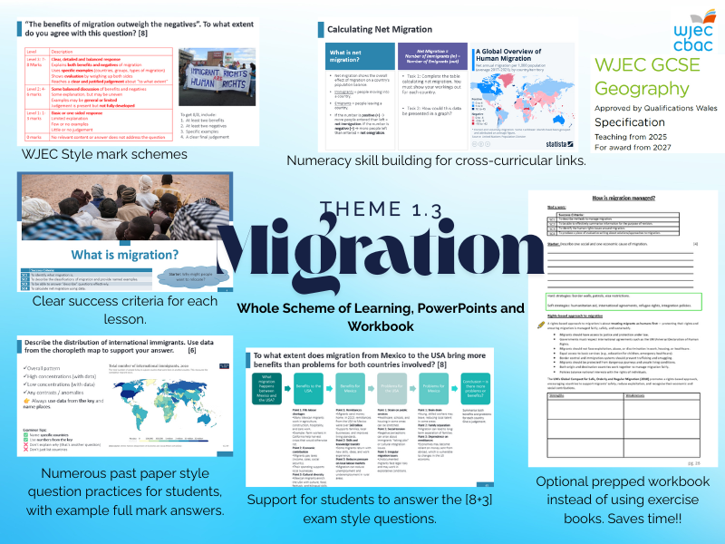
1.3 Migration. New WJEC GCSE Specification Full SOL
(0)
MissPriceGeog
California Heatwave and Drought (2015)
(0)
MissPriceGeog
WJEC GCSE Geog Theme 1 Revision Notes
(0)
MissPriceGeog
Causes of Migration
(0)
MissPriceGeog
WJEC Theme 7; Social Development Issues Workbook
(0)
MissPriceGeog
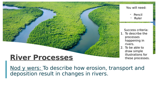
What are the processes that happen in rivers?
(0)
MissPriceGeog
Strengths and Weaknesses of Fairtrade
(0)
MissPriceGeog
Distinctive Lanscapes WJEC GCSE Geography
(0)
MissPriceGeog
Location of Population KS4
(0)
MissPriceGeog
WJEC Tectonic Landscapes Complete Resource Pack
(0)
MissPriceGeog
Tectonic Plates and their Movement
(0)
MissPriceGeog
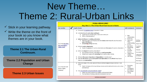
Theme 2: Rural Urban Links - Fully Resourced
(0)
MissPriceGeog
Introduction to the Tropical Rainforest
(0)
MissPriceGeog
Year 9 Literacy Task - Development Indicators
(0)
MissPriceGeog
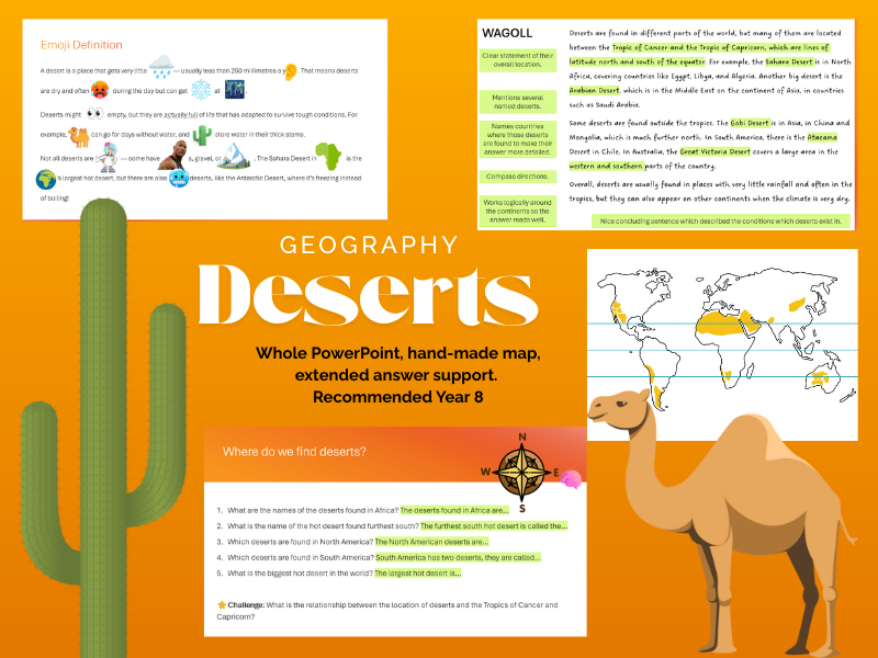
What is a desert? Year 8 Geography Lesson
(0)
MissPriceGeog
Why do rivers have bends?
(0)
MissPriceGeog
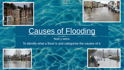
Categorising the Causes of Flooding
(1)