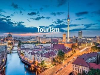
Tourism  Quick View
thisisgeographythisisgeography

Tourism

(5)
Full unit of work for tourism. All lesson are suitable for 50 minutes to 1 hour of teaching time. Includes supporting worksheets for lessons - no additional resources are required. Homework’s integrated into lessons where appropriate. Most suitable for KS3 geography. All lessons have a starter and lesson objectives. All PowerPoints in the same style. Lesson sequence: 1 - What is tourism? 2 - The growth of tourism 3 - What attracts tourists to different destination? 4 - British tourism 5 - What are the impacts of tourism in National Parks? 6 - Declining tourism in Britain 7 - History and tourism 8 - The impact of tourism 9 - Jobs in the tourist industry 10 - Ski resorts 11 - Tourism in Kenya 12 - Sustainable tourism 13 - Sustainable tourism in Peru 14 - Does tourism cause conflict? For more resources visit This is Geography. Full SoW for all new GCSE specifications - AQA, Edexcel, OCR, CIE IGCSE, Edexcel IGCSE and Eduqas. As well as over 200 lessons for KS3 and KS2. Want something bespoke designing? Email us for further details info@thisisgeography.co.uk
Map SkillsQuick View
thisisgeographythisisgeography

Map Skills

(3)
Full unit of work for map skills. All lesson are suitable for 50 minutes to 1 hour of teaching time. Includes supporting worksheets for lessons - no additional resources are required. Develops core skills for geography students in KS3 or high ability KS2. All lessons have a starter and lesson objectives. All PowerPoints in the same signature style. Lesson sequence: 1 - Introduction to maps 2 - Where is the UK? 3 - Compass points 4 - Map symbols 5 - 4 and 6 figure grid references 6 - Scale and distance 7 - Atlas skills 8 - Height and relief 9 - Longitude and latitude 10 - Design your own treasure map 11 - Mapzone GIS Also includes Types of Geography lesson (can be used as an introduction lesson for Y7), Geography Literacy mat and Geography Numeracy/Map Skills mat. Homeworks - 3 x countries and capitals test sheets to develop global place knowledge For more resources visit This is Geography. Full SoW for all new GCSE specifications - AQA, Edexcel, OCR, CIE IGCSE, Edexcel IGCSE and Eduqas. As well as over 200 lessons for KS3 and KS2. Want something bespoke designing? Email us for further details info@thisisgeography.co.uk
World Map with CoordinatesQuick View
holt_becciholt_becci

World Map with Coordinates

(0)
A simple coloured world map with coordinates. Children can use the map to become familiar with countries, continents, oceans and seas! Also using their coordinates skills. Can be printed A4/A3 depending on use.
SettlementQuick View
thisisgeographythisisgeography

Settlement

(1)
Full unit of work for Settlement. This unit explores the evolution of settlements in the UK and across the world. All lesson are suitable for 50 minutes to 1 hour of teaching time. Includes supporting worksheets for lessons - no additional resources are required. Most suitable for KS3 or high ability KS2. All lessons have a starter and lesson aim. All PowerPoints in the same signature style. Lesson sequence: 1 – What is a settlement? 2 – Settlement functions 3 – Site, situation and settlement patterns 4 – Why do settlements change? 5 – Burgess and Hoyt model 6 – Changes in retail 7 – Favelas 8 – Changing London and the effect of the Olympics 9 – GIS and settlement change – A comparison of the UK and Brazil 10 – Brownfield vs Greenfield sites Also includes Geography Literacy mat and Geography Numeracy/Map Skills mat. For more resources visit This is Geography. Full SoW for all new GCSE specifications - AQA, Edexcel, OCR, CIE IGCSE, Edexcel IGCSE and Eduqas. As well as over 200 lessons for KS3 and KS2. Want something bespoke designing? Email us for further details info@thisisgeography.co.uk
Geography topic: Coasts - powerpoint lessons and activitiesQuick View
highwaystarhighwaystar

Geography topic: Coasts - powerpoint lessons and activities

(0)
A set of lessons and worksheets looking at coasts, erosion, deposition and tourism. POWERPOINTS INTRODUCING COASTS: Introduction to what coasts are; erosion and deposition, and investigating different coastal localities around the UK. COASTAL EROSION: Looks at different physical features caused by wave erosion - arches, caves and coastal stacks, and demonstrates the process of erosion by animated diagrams of how each feature is formed. It also briefly explains how different rock types erode at different rates, and shows a map of the UK, with the main types of rock found in each area. It ends with a series of photographs for the children to look at and identify coastal features. COASTAL DEPOSITION: Investigates the process of longshore drift, with an animated example, and explains the difference between sand and shingle beaches. INVESTIGATING COASTAL ENVIRONMENTS: Gives the children the task of writing a piece about a different coastal location for a holiday brochure. MANAGING THE COASTLINE: Explores how coastal erosion affects humans, and the reasons why we need to protect the coast from erosion. It explains how we protect the coast by building groynes, sea walls, armour, artificial harbours, or how we can just do nothing - giving the advantages and disadvantages of each method of protection. COASTAL DEVELOPMENT: Gives the children the task of being a local resident, a sea angler, a travel company representative, a holidaymaker, or a local government official, and deciding whether a hotel should be built in an unspoilt area of coastline. WORKSHEETS (PDF) LABEL COASTAL AREAS ON UK MAP: A blank UK map for the children to identify coastal areas that they know. COASTAL EROSION: 2 pictures of coastal erosion for children to name features and describe the formation WORLD AND UK MAP: To locate coastal areas in the world that they have visited BROCHURE TEMPLATES: 10 different blank layouts for the children to fill in for the holiday brochure. COASTAL DEVELOPMENT GROUP WORKSHEETS: Recording sheets when the children split into different groups to decide on whether a hotel should be built.
Business Location GCSE Business Studies LessonQuick View
andrewjohn82andrewjohn82

Business Location GCSE Business Studies Lesson

(2)
A great resource for your students studying Business Location, as part of the GCSE Business Studies specification (e.g. AQA Unit 1 Setting up a Business, Topic 1). The Cool Sports Case Study will really help students to apply their knowledge and understanding effectively as well help prepare them for the real exam by developing their analysis and judgement skills of what is the most effective location for a business. This resource has certainly helped my class and is thoroughly recommended for all centres. It comes complete with Location Case Study, PowerPoint Presentation and Lesson Plan, making it a great resource for a Lesson Observation.
30 Images of WalesQuick View
peterfogartypeterfogarty

30 Images of Wales

(0)
You could look at it directly as a presentation and discuss the different places being shown in each of the photos. You could print off and laminate the photos to make an interesting, eye-catching display about Wales. The students could also take the laminated photos and sort them into different rich Victorian children. The students can then discuss what they can see in each of the pictures. The photos could also be used as prompts for creative writing, factual writing or descriptive writing.
UK map activityQuick View
idjidj

UK map activity

(12)
In this activity, the pupils learn the difference between the British Isles, Great Britain and the United Kingdom. They then go on to use an atlas to help them name the major countries, cities and seas in the UK. It makes for a good lesson when learning about the geography of the UK.
Weather - Scheme of work, whole unitQuick View
superdiscosuperdisco

Weather - Scheme of work, whole unit

(7)
Geography unit of work for KS3 Lessons include: L1 - Introduction to weather/How does weather impact the lives of people L2 - Measuring Weather L3 - Rainfall and Clouds (Includes Videos) L4 - Why is our weather so changeable L5 and 6 - Boscastle Floods L7 - Climate and Climate Graphs L8 - Factors that influence Climate L9 - Assessment - Attached. All lessons include PowerPoint. Worksheets are also available. Assessment also available.
The London Docklands RegenerationQuick View
lburton88lburton88

The London Docklands Regeneration

(6)
A worksheet to understand the regeneration of the London Docklands. I made this for the AS Edexcel unit (2) topic titled ‘Rebranding Places’ but it could be used for any secondary age group. It is best used when blown up to A3 otherwise the boxes are too small to write in.
Pointless - Geography 'Populations' EditionQuick View
TandLGuruTandLGuru

Pointless - Geography 'Populations' Edition

(1)
Based on the popular game show 'Pointless', this resource is perfect for use as a starter activity, plenary, or revision tool. Editable, so that you can change to any other topic or change the questions/answers. Containing sound clips, engaging visuals, and suitably challenging questions, this resource is effective at both promoting engagement and enhancing learning. There are several full rounds of questions to build students' understanding of populations, including: - Naming the most populous countries in the world;. - Defining key 'populations' terminology;; - Unscrambling puzzles to identify populous regions; - Thinking about the most densely populated places in a local area. The nature of the game ensures that this resource can challenge students of all levels. NOTE: You can buy this resource alone, or in a bundle of 8 Pointless games, for only £1 more!
Fragile EnvironmentsQuick View
thisisgeographythisisgeography

Fragile Environments

(1)
Full KS3 unit of work for Fragile Environments. This unit explores the world’s fragile environments including the Antarctic, coral reefs and endangered animals. All lesson are suitable for 50 minutes to 1 hour of teaching time. Includes supporting worksheets for lessons - no additional resources are required. Most suitable for KS3 or high ability KS2. All lessons have a starter and learning objectives. All PowerPoints in the same signature style. Lesson sequence: 1 - Introduction 2 - Climate change 3 - What are fragile environments? 4 - Antarctic fact file 5 - Coral reefs 6 - Human impact of coral reefs 7 - Protecting coral reefs 8 - Antarctic ICT 9 - Endangered species 10 - Endangered animals group work 11 - Endangered animals group presentations 12 - Saving our environment 13 - Revision 14 - End of unit test Also includes Geography Literacy mat and Geography Numeracy/Map Skills mat. For more resources visit This is Geography. Full SoW for all new GCSE specifications - AQA, Edexcel, OCR, CIE IGCSE, Edexcel IGCSE and Eduqas. As well as over 200 lessons for KS3 and KS2. Want something bespoke designing? Email us for further details info@thisisgeography.co.uk
ESL Super BundleQuick View
peterfogartypeterfogarty

ESL Super Bundle

19 Resources
Here are lots of different fun teaching resources for students who are learning to speak English as a second language, or for students who want to revise and improve their understanding of English. This is perfect for both an home or school setting.
St Andrew's Day Activity Pack KS1/KS2Quick View
PrimaryTopicTeacherPrimaryTopicTeacher

St Andrew's Day Activity Pack KS1/KS2

(1)
This is a set of Worksheets which can be used to teach about St Andrew's Day and the Story of Saint Andrew. They are Microsoft Word and Publisher Documents so can be adapted to meet different needs. Fun quick and easy to use; simply print off and hand out. It includes the following: 1. Information text sheet explaining who was St Andrew 2. Comprehension questions 3. Acrostic Poem ST ANDREW 4. Activity Sheet - looking at the Scottish Flag and designing your own 5. Scotland Fact File 6. Recount Frame - How St Andrew became Scotland's Patron Saint 7. Story Board Worksheet - Telling the Story of St Andrew 8. St Andrew's day word search and answers to the word search.
Fun End of Year Geography AssessmentsQuick View
beachman0274beachman0274

Fun End of Year Geography Assessments

(0)
These test papers have a wide range of tasks and topics, and are differentiated to give all KS3 students some degree of success. Created for the EBSD school I work at, they can be easily adapted to suit your classroom.
Comparing Features of India and the UKQuick View
jenniwren1234jenniwren1234

Comparing Features of India and the UK

(0)
A carroll diagram to compare human and physical features of India and the UK. Included are a selection of images for both the UK and India for children to cut out and stick into the correct part of the worksheet.
Managing Tourism In A Honeypot Site- Lake District Case Study Lesson GCSE AQA A Geography (2hr les)Quick View
MatthewJSMatthewJS

Managing Tourism In A Honeypot Site- Lake District Case Study Lesson GCSE AQA A Geography (2hr les)

(1)
This lesson teaches students about how tourism can be managed within a tourist destination. There is a heavy emphasis on the Lake District, students will leave with a detailed understanding of how key factors are managed such as footpath erosion, traffic, environmental damage and issues on Lake Windermere. I used this with a mixed ability year 10 GCSE class studying AQA A Geography (two lessons). The resources are very detailed with a heavy emphasis on independent learning in sections for in depth questioning. This took me two lessons to cover, however it can be cut down to one lesson.