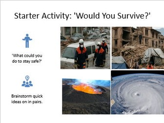
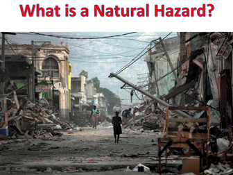
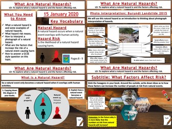
AQA GCSE Geography lesson for Unit 1a. in this lesson we start with a photo starter of a pyroclastic flow where the pupils can design their own GCSE style question then answer. We then move on to look at interpreting photographs of natural hazards which is something we do more of later in the unit. We practice on the landslides in Burundi in 2015. We then look at when a natural event becomes a natural hazard. We progress to categorising various hazards to introduce the categories of hazards. We watch a short video clip on human interaction with natural hazards before the students complete a mind map using hexagons of the factors that increase hazard risk. We finish with a practice question with guidance should the students need it.
In a nutshell, the lesson includes:
Create a question starter
Photo interpretation task
Hazard categorising shaded grid task
Video clip
Factors mind map task
GCSE practice question with writing frame.
Hope this saves you some valuable planning time.
https://www.tes.com/teaching-resources/shop/markthegeographer
Full KS3 unit of work for Natural Hazards. This unit explores Natural Hazards, from plate tectonics to volcanoes, earthquakes and hurricanes. All lesson are suitable for 50 minutes to 1 hour of teaching time. Includes supporting worksheets for lessons - no additional resources are required.
All lessons have a starter and learning objectives. All PowerPoints in the same signature style.
Lesson sequence:
1 – Structure of the earth
2 – Plate tectonics
3 – Destructive plate boundaries
4 – Constructive and conservative plate boundaries
5 – Volcanoes
6 – Volcano ICT fact file
7 – Mt St Helens
8 – Mt Vesuvius
9 – Why live near a volcano?
10 - Earthquakes
11 – Measuring earthquakes
12 – Kobe, Japan
13 - Tsunami
14 – Japanese 2001 Tsunami
15 – Japanese Tsunami documentary
16 – Formation of a tropical storm
17 – Hurricane Katrina ICT fact file
18 – Hurricane Katrina documentary
19 – Comparing MEDC and LEDC disasters
20 – Revision
Also includes Geography Literacy mat and Geography Numeracy/Map Skills mat.
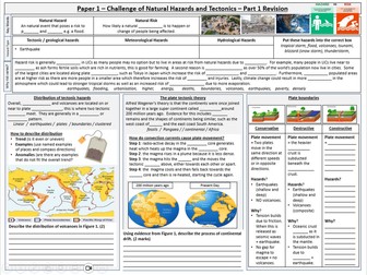
This is a revision summary sheet for Paper 1 of the AQA 8035 geography specification.
It includes an overview of what a natural hazard is and a summary of why hazard risk varies.
It also includes a section on tectonic hazards, which includes:
distribution
plate tectonic theory
plate margins
It does not include earthquakes or volcano formation in detail, or named examples of tectonic hazards or how to reduce the risk of tectonic hazards.
Perfect for quick revision and to summarise key information.
This bundle contains a complete unit of the Challenge of Natural Hazards. The lessons are planned to ensure learners of all abilities make maximum progress, with an opportunity for students to challenge themselves with a variety of different tasks. As well as this there are revision tasks provided, that allow students to consolidate their knowledge further through completing activities.
Bring your natural hazards lessons to life with this detailed and engaging carousel activity!
Perfect for Geography (Year 8–9), this lesson helps students explore how people and governments manage the impacts of natural disasters through prediction, planning, protection, and response. Featuring real-world case studies from Japan, Nepal, the USA, and the Philippines, students move between four interactive information stations packed with clear explanations and thoughtful questions. The activity encourages enquiry-based learning, literacy development, and comparison between rich and poor countries. Ideal for use as a standalone lesson, revision activity, or part of a Natural Hazards or Tectonic Hazards unit, this printable Word resource saves you hours of planning and delivers deep understanding in a fun, student-led format.
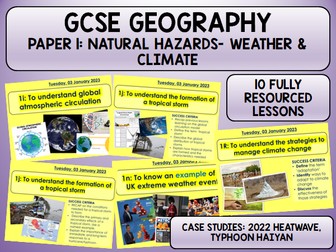
10 FULLY RESOURCED LESSONS
Lesson 1: Global Atmospheric Circulation Model
Lesson 2: Tropical Storms
Lesson 3: Case Study: Typhoon Haiyan
Lesson 4: Reducing the effects of a tropical storm
Lesson 5: UK Weather
Lesson 6: Case Study UK Extreme Weather- 2022 Heatwave
Lesson 7: Evidence for Climate Change
Lesson 8: Natural causes of climate change
Lesson 9: Human causes of climate change
Lesson 10 (2 lessons): Mitigation and Adaptation of Climate Change
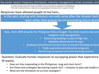
LOs: To name social and economic impacts of tropical storms and volcanic eruptions in the Philippines.
To be able to evaluate human responses to occupying places that experience a range of hazards.
Teaches the hazards that can occur in the Philippines and offers specific examples of significant events in history.
Applies knowledge to an exam question:
Question: Evaluate human responses to occupying places that experience a range of hazards. (9 marks)
How are they responding in the Philippines- long and short term?
Are these new strategies decreasing hazard risk? – compare to past and modern examples.
What are the limitations to current strategies?
All lessons are fully resourced. Lessons are designed to last for 50-60 minutes. Lessons are resourced with videos, extension questioning, deep thinking and uses graphs/images to aid learning.
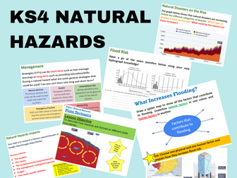
These lessons follow the Cambridge KS4 curriculum and look at;
Natural Hazards
Plate Tectonics
Causes & Distribution of Earthquakes
Causes & Distribution of Volcanoes
Causes & Distribution of Tropical Cyclones
Causes of Flooding
Causes of Drought
Impacts of Natural Hazards
Managing Natural Hazards
Opportunities of Natural Hazards
Each lesson includes a starter, lesson objective, plenary, exam question and various student led activities.
If you liked this resource please check out my other resources at https://www.tes.com/teaching-resources/shop/SimpleGeography
Natural Hazards Unit (Lessons 1–6) – AQA GCSE Geography
This fully resourced 5-lesson unit introduces and develops the topic of Natural Hazards, aligned to the AQA GCSE Geography specification. It covers the types of natural hazards, structure of the Earth, plate tectonic theory, plate boundaries, reasons why people live in hazardous areas (Iceland), and strategies for reducing risk (the 3Ps: Prediction, Protection, Planning). Each lesson includes a structured, easy-to-follow PowerPoint, student worksheets, case studies (Japan and Nepal), and engaging tasks like matching activities, video links, diagrams, and exam-style questions. Every PowerPoint can be changed to suit teachers’ needs, making this unit flexible, adaptable, and ready to use in a wide range of classroom settings. Perfect for introducing or revising tectonic hazards.
Lessons Covered:
What are natural Hazards
PLate tectonic Theory
Plate Boundaries
Living with the risk of tectonic hazards
Earthquake case studies
Ruducing the risk of tectonic hazards
This comprehensive unit covers every key concept from the AQA GCSE Geography specification, using the Oxford GCSE 9–1 Second Edition textbook as a guide. Each lesson is carefully structured with clear learning objectives, differentiated tasks, and a variety of activities, including recap quizzes, case study analysis, diagram labelling, and exam-style questions with model answers. Topics include global atmospheric circulation, the formation and impacts of tropical storms, climate change links, extreme weather in the UK, and hazard management strategies. All PPT slides are fully editable so you can adapt them to suit your class, and the pack includes printable worksheets, case study resources, and suggested video links. Perfect for saving time while delivering an engaging, curriculum-focused sequence of lessons.
Complete Climate Change unit designed for GCSE Geography, covering natural and human causes, evidence, impacts, mitigation, and adaptation strategies. Each lesson includes detailed case studies, engaging tasks, diagrams, videos, and editable worksheets to keep students actively involved. The unit is fully adaptable to suit different teaching styles and abilities, with recap activities, assessment opportunities, and extension challenges built in. Perfect for delivering the topic with confidence and depth while saving hours of planning.
Lessons:
Evidence of climate change
Natural causes of climate change
Human causes of climate change
Climate change mitigation and adaptation
These lessons are designed to be used in the run up to the GCSE exams or for intervention lessons.
Each lesson includes…
Knowledge retrieval quiz for the topic.
Overview of the relevant GCSE paper.
YouTube video links to recap knowledge
Exam questions linked to figures.
Exam question answers.
Model answers for 6 and 9 mark answers.
NB the examples used in this lesson are the Nepal & Chile earthquakes, Typhoon Haiyan, and the Beast from the East
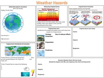
Complete Weather Hazards sequence of lessons for Unit 1, Section A of the AQA GCSE. Cyclone Idai is the case study tropical storm and Somerset Levels is the example of extreme weather in the UK.
The lessons included are detailed below.
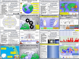
Global Atmospheric Circulation
The Global Distribution of Tropical Storms
The Formation of Tropical Storms
Climate Change and Tropical Storms
Cyclone Idai: A Tropical storm
Reducing the Effects of Tropical Storms
Extreme Weather In The UK
The Somerset Levels Floods: 2014
Hope this saves you some valuable planning time.
https://www.tes.com/teaching-resources/shop/markthegeographer
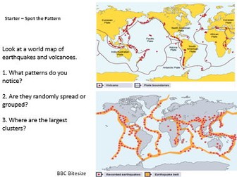
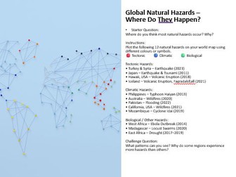
Designed for (ages 11–14), this engaging lesson introduces students to the fascinating world of natural hazards through real photographs, mapping tasks, and analytical thinking. Pupils begin by identifying eight striking hazard images, then investigate global patterns using a colour-coded world map activity. The lesson develops key geographical skills and understanding of tectonic, climatic, and biological hazards, with extension tasks exploring their impacts and human responses. Complete with PowerPoint, worksheet, and differentiated challenges, this ready-to-teach resource is perfect for building curiosity, discussion, and deep understanding of Earth’s dynamic systems.
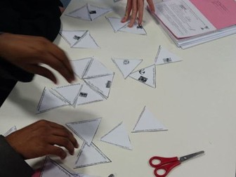
This Tarsia puzzle covers the theme of Natural Hazards (tectonics, extreme weather, UK weather). Great for 9-1 GCSE revision and intervention sessions. Made for AQA but I'm sure it fits other exam board specs.
A Tarsia puzzle requires students to match up sides of triangles to form a hexagonal shape. They are brilliant for revision and get students to think hard. I use these at the starts of ends of lessons and they can take 10-20 minutes depending on your class's confidence in the material. All materials are provided here including student instructions, student puzzle pieces and teacher answers. All images have been acquired through a search engine filtered to labelled for re-use. Enjoy!
AQA A-Level; Natural Hazards. Part 6; Tropical Storms; introduction, Forms of Hazard, Size & Distribution, Reducing the Impact, Hurricane Katrina, Typhoon Haiyan
6 lesson Ppts with accompanying student work booklet. Includes practice questions and a marking proforma, Wider reading links to support this section of the course.
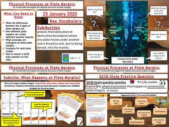
AQA GCSEGeography Lesson for Unit1A. In this lesson we look at the four different types of plate boundaries; destructive, constructive, collision and conservative (transform). We start by looking at the example of Iceland. We then use information cards to complete a foldables exercise for each plate type for the pupils to stick into their books. We then answer a GCSE-style question with some pointers on content for the pupils to use if you wish them to. ****Please note the foldables template may need adapting for certain printers as it depends on settings, it just needs a quick check to ensure it will print the right way around.
Hope this saves you valuable planning time.
https://www.tes.com/teaching-resources/shop/markthegeographer
Natural Disasters Overview – Differentiated Reading Comprehension Pack
This resource introduces pupils to the six major natural disasters: floods, earthquakes, cyclones/hurricanes, volcanic eruptions, droughts, and wildfires.
It includes two differentiated texts (Lower: 650L–750L, Upper KS2; Higher: 900L–1050L, Lower KS3) plus 16 comprehension activities (retrieval, inference, cloze, multiple-choice, crosswords, and more). The texts cover how disasters happen, factors that make them worse, and historical case studies of the deadliest events in history.
Also available in this series:
Deadliest Volcanic Eruptions
Wildfires Reading Comprehension
Hurricane Reading Comprehension
Tsunami Reading Passages & Worksheets
Earthquake Reading Pack
Floods Reading Comprehension
No prep. Easy to print. Ready to use.
An introductory lesson for the topic of Natural Hazards. Ideal for Years 7 to 9. Previously taught by myself in a 1hr lesson. The bulk of the lesson explores reasons behind why people are vulnerable to Natural Hazards across the world.
Lesson covers the different types of hazard, describing hazard distribution, and graphing different types of hazards.
Activities include describing a map, plotting bar charts, and brainstorming.
All worksheets and answers included within the ppt.
A free, complete one-hour lesson for AQA GCSE Geography’s The Challenge of Natural Hazards (Paper 1, Section A, 3.1.1.1): when does a hazard become a disaster? It is Lesson 1 of a 17-lesson sequence and works as a stand-alone lesson, so you can try it with a class before deciding whether to use the rest.
The big question: when does a hazard become a disaster? Students define a natural hazard, a disaster and hazard risk, sort twelve hazards into tectonic, weather and mixed-cause types, and explain how factors such as urbanisation, poverty, farming, climate change and the size and frequency of events change the risk. They finish by using data on Bangladesh’s cyclone deaths, which fell from about 138,000 in 1991 to about 4,000 in 2007, to show that risk depends on people as well as on the hazard.
What is in the lesson
A 37-slide editable PowerPoint: a five-question starter quiz with answers, an outcome and big question, key words, and three learning cycles. Each cycle has short explanation slides built around original diagrams, a check for understanding with a reveal slide, and a practice task with a feedback slide.
Three practice tasks, each with a Challenge question answered on its feedback slide: definitions and a tsunami scenario (Task A), sorting twelve hazards (Task B), and ranking three made-up places by risk using hazard, exposure, vulnerability and capacity (Task C).
A video slide linking to a short tutor2u clip on hazard risk, with a QR code and watch-for questions.
Two original exam-style questions (01.1 for 1 mark, 01.2 for 4 marks) with a writing frame, a student-friendly mark scheme for peer marking, a Level 2 example answer, and a five-question exit quiz.
4 pages of teacher notes: a 60-minute timeline with slide numbers, answers to every check, task and Challenge, the mark scheme, a specification map, common misconceptions, and sources.
No printing is needed. Students work in exercise books.
Specification: AQA GCSE Geography (8035), 3.1.1.1 Natural hazards: definition, types of hazard, and factors affecting hazard risk. The teacher notes include a specification map.
Want the rest? Lessons 2–17 cover plate tectonics, Nepal 2015, Chile 2010, tropical storms, Typhoon Haiyan, UK weather hazards, the Somerset Levels floods, climate change, exam technique and a printed Section A-style assessment: Natural Hazards: 17 AQA GCSE Lessons.


 Quick View