3 Lessons of Powerpoints and Worksheets covering the areas of Rectangles, Triangles, Parallelograms and Trapeziums. The pupils have to find areas of different colours on national flags which are all the above area, and also using other mathematical topics. You will need to write on the powerpoints quite a bit on the starters, plenaries and examples! If you like this resource then please check out my other stuff on here!
Thank you to @1hannahjones for making a number of corrections and clarifications!
See here an extra lesson for circles! https://www.tes.com/teaching-resource/areas-of-flags-with-circles-11164206
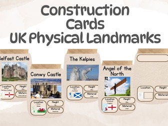
Prompts to use in the construction area that prompt children of different physical landmarks across the United Kingdom.
Each landmark includes:
title
photo
location (country located on UK map and relevant flag)
height in meters
material it is built from
Location links to geography objectives focusing on the UK, Height links to year 1 maths curriculum and materials link to the materials taught in the year 1 curriculum.
22 landmarks include:
London Eye, St. Paul’s Cathedral, Buckingham Palace, Big Ben, Cardiff Castle, Edinburgh Castle, Titanic Museum
There is a blank page to that children can complete or be used to create your own.
A while ago I uploaded a set of resources on calculating the areas of shapes on flags, see here:
https://www.tes.com/teaching-resource/areas-of-flags-6327719
A number of people messaged me asking if I had one for circles - and here is is now! I had to get creative with finding flags I could use, and I’d recommend that you have already had a lesson on Area and Circumference before this, as the questions get very challenging! Thank you to @1hannahjones for making a number of corrections and clarifications!
If you like this resource, then please check out the rest of my stuff! https://www.tes.com/teaching-resources/search/?f=authorId[2095097]
Hessian flags with precursive lettering for areas within the classroom could also be used outside. Includes:
Maths, Writing, Playdough, Construction, Small World, Investigation and Reading.
In this lesson for learners with SEN, they look at the many different types of flags around the world. Learners understand that flags do not just represent countries but also communities and organisations. Learners explore 3 individual flags (union jack, rainbow flag, and the Olympic flag) and present their findings according to ability back to the group.The notes provide language which would be appropriate for SLD SEN group.For more materials associated with this resource, please follow the links provided.
You will also need to make a booklet with the flags in. Students need to measure two sides and the included angle and use the formula for area of a triangle using sine to find the area covered by each colour on each flag.Also added older format as requested.
Waving the flag! Using the Olympic timeline the children identify the last four countries and cities to host the Summer Olympic Games. The flag for Great Britain is pulled apart to see which countries make up the Union Jack.
Brighten up your classroom with this stylish number banner display, designed to support early number recognition and counting skills. Each flag shows a bold numeral alongside a ten frame representation, helping children make clear visual connections between numbers and quantities.
Features:
Numbers with matching ten frames for visual learning.
Clean, rustic wood-effect design that complements any classroom .
Perfect for EYFS and KS1 maths displays.
Can be laminated for durability and used year after year.
Ideal for continuous provision, maths areas, and whole class displays, making numbers meaningful and visually engaging for young learners.
Help your students develop their number skills, and also provide a cross curricular link with Geography.
This National Flags Activity Pack includes
- 3 activity sheets with answers,
- National Flags 1 (Multiplication facts)
- National Flags 2 (Division facts)
- Find the flags crossword
- information sheets about 15 different countries.
The data provided in the information sheets can be used to promote discussion on concepts such as population size, population density and measurement of physical features of the landscape.
Students can also be introduced to the variety of currency used, pictures of which are readily available online.
The pack is aimed at pupils in upper KS2 and lower KS3.
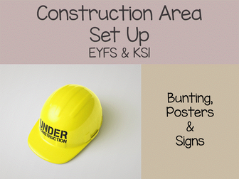
Transform your learning space into an engaging construction zone that sparks curiosity and creativity. This bunting set features vibrant ‘Construction Area’ flags flanked by two further flags adorned with playful truck designs. Also included six posters of common construction vehicles. Also, a further 7 large posters to zone the area and 8 small signs for pupils to use on and around their work. Elevate your teaching environment and inspire young minds to build, explore and construct with this eye-catching display.
Included:
Bunting with the words ‘Construction Area’
Two flags featuring truck designs
One flag with a cute hard hat design
6 construction vehicle posters
7 large construction area signs
8 small signs
If you find this resource useful, please leave a comment and let me know how you used it in your classroom.
Loved this free construction area set-up? Complete your construction zone with my matching resources below:
https://www.tes.com/teaching-resource/construction-and-continuous-provision-eyfs-and-ks1-bundle-13490453
https://www.tes.com/teaching-resource/construction-area-display-bundle-13310089
https://www.tes.com/teaching-resource/eyfs-classroom-set-up-mega-bundle-construction-maths-reading-and-outdoor-provision-displays-13489981
If you have used this resource, I would really appreciate it if you could leave a review on TES. Your feedback helps other teachers find my resources and supports me in creating more classroom materials. Thank you for your support.
This big savings bundle includes three more themed packs' (Easter, UK, Italy and France). Plus Y6 maths and more themed fun activities to do in class. Grab the opportunity by downloading them all for £5.
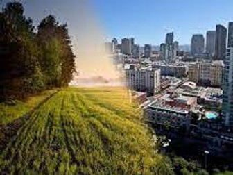
A lesson allowing students to work independently and to look at urban vs rural areas. A game of splat is included as well as re-cap opportunities for students. Guess the country flag powerpoint too!
Parts 1, 2 and 3 booklets originally from someone else - sorry was given by BA a few years back, I don't have the original, thanks to whoever created them first.
Listening assessment is using Métro 3 red audio files as well as some files free on the Internet.
All other work was done during carousel lessons on specific themes. 'cut up' docs and dominos obviously need to be cut up and mixed!
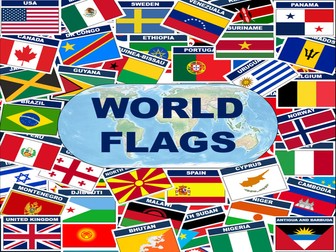
OVER 200 A4 FLAGS FROM ALL COUNTRIES AROUND THE WORLD.
The flags have been split into areas to make them easier to use:
North America
Central American
Caribbean Island Nations
South America
Europe
Africa
Asia
Oceana
UK nations
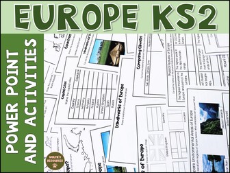
Let’s learn all about Europe. This product includes planning, teaching power point, print and go activities and work for early finishers. Everything you need to teach students all about Europe in KS2. Ideal for Year 3 and Year 4.
*Now includes a workbook for SEN/EAL students. This includes a workbook and resources for students who find it difficult to access the KS2 curriculum but follows the same subjects as the main product lessons *
The 76 slide power point includes 9 lessons, each with an end of lesson quiz. Each lesson has printable activities to accompany the power point, answer sheets included.
Lesson 10 is an end of unit quiz for assessment.
Each activity is differentiated 2 ways.
Also included are some extra activities and task cards for early finishers.
This Product Includes:
Teaching Power Point and activities for the following lessons -
Lesson 1
Where Is Europe - Label continents, colour Europe on a map, label areas of water
Lesson 2
Countries of Europe - Label the countries of Europe, Countries of Europe quiz
Lesson 3
Capital Cities of Europe - Match capital city to correct country
Lesson 4
Landmarks of Europe - Match pictures with descriptions, match pictures with labels - both cut and stick, draw a well known landmark
Lesson 5
Flags of Europe - Color the flags, design your own European flag
Lesson 6
Weather and Climate of Europe - Compare climates x 2 cut and stick
Lesson 7
Physical Features of Europe - Draw features on a map, match places and descriptions cut and stick
Lesson 8
Environmental Regions Of Europe - compare environmental areas of Europe - writing activity
Lesson 9 Human Characteristics of Europe - Trade in Europe research activities
Lesson 10 - End of unit quiz for assessment
Extra Activities
European Union Comprehension x 2 differentiated
Compare a European and non European Country research worksheet
European Country Study
European Capital Cities Word Search
8 task cards for early finishers
planning sheets
You might also like
KS2 The UK
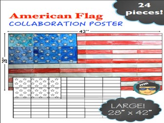
American Flag Collaboration Poster: This American Flag collaboration poster is a great group activity. Together students will color the poster, assemble it and display it in their classroom to let visitors know their classroom is a creative, collaborative, and patriotic place!
This is a great activity for American patriotic holidays! Ideal for Flag Day, 4th of July, Patriot Day (September 11), Veterans Day, Memorial Day, and other American Patriotic events.
My collaboration posters are fun for kids and easy for teachers!
Students simply color in the shapes based on a key at the top of each page. There are only three colors in the American flag, so you will only need to provide red and blue crayons, colored pencils, or markers to your students. All white spaces will be left white. It will look nice if you have thick copy paper since there are so many white areas–however, it’s not essential!
There are 24 pieces in total.
If you plan to laminate this poster, do not use crayons to color it. Crayons melt when the poster is laminated. If you are going to laminate it, I suggest you use colored pencils and/or markers.
I have included all the instructions you need, plus an American Flag coloring page for when students finish.
This poster is very large, approx. 28” x 42”. The exact size depends on your printer settings, but be sure to select “fit to page” on your printer settings when you print out the original pages, so the entire image fits on the page.
Ghana is a country located on the west coast of Africa. It is bordered by Ivory Coast to the west, Burkina Faso to the north, Togo to the east, and the Gulf of Guinea to the south. The country has a population of approximately 30 million people, and its capital and largest city is Accra.
Ghana has a rich history and culture. It was the first sub-Saharan African country to gain independence from European colonizers, and it has played a significant role in the history of the continent. The country is known for its vibrant music and dance scenes, and it is home to a number of UNESCO World Heritage Sites, including the historic forts and castles of the slave trade.
The economy of Ghana is primarily based on agriculture, and the country is a leading producer of cocoa beans. It is also rich in natural resources, including gold, oil, and natural gas. The country has made significant progress in recent years, with strong economic growth and improvements in education and healthcare.
Despite these successes, Ghana still faces challenges. Poverty and inequality remain prevalent, and the country is vulnerable to the effects of climate change. It is also affected by regional conflicts and insecurity, particularly in the northern and western parts of the country.
Despite these challenges, Ghana remains a vibrant and dynamic country with a rich culture and a bright future. Its strong economy and progress in key development areas provide a solid foundation for continued growth and prosperity.
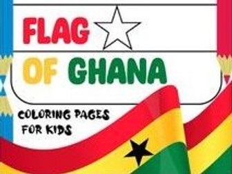
The Ghanaian flag consists of three horizontal stripes. The two stripes on the outside are red, while the stripe in the center is yellow.
In Ghana, red stands for blood shed during the country’s struggle for independence. Yellow stands for gold, which is one of Ghana’s natural resources.
Enjoyed these coloring pages? Don’t miss our top-tier coloring pages, the epitome of artistic delight! Check out below:
Cars Coloring Pages
Fifa World Cup Quiz For Kids
Inside Out Coloring Pages
Alphabet coloring pages
Find more fun filled coloring pages, educational workbooks and amazing quizzes, our store or official Website TheLearningapps.
Keep your kids engaged for hours with our fun and engaging app. For Games, Videos, Activities and outstanding learning experiences, visit TheLearningApps.com Homeschool - which is designed to empower parents to deliver quality education to their children at home.
To stay updated with the latest offerings, follow us on :
YouTube
Instagram
Facebook
Pinterest
Twitter
Linkedin
For any queries or assistance, please reach out to us at support@thelearningapps.com
Download our other resources today and provide your child with an exceptional educational journey:
English Reading Comprehension
English Reading Comprehension Lite
Math Workbook
Math Workbook Lite
Empower your child’s education with The Learning Apps, where learning is made interactive, engaging, and enjoyable.