
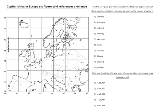
This worksheet combines 6 figure grid references with geographical knowledge of Europe. Students will be both following 6 figure grid references and finding them out.
This worksheet has been used with years 7-10. Students will need a map of Europe displayed on the board (or most students have a map of Europe in their school planners). Or alternatively an Atlas.
To make it easier students should first colour in all the sea/water blue. This will help them differentiate between land and ocean. They could also label all the countries to begin with.
Something went wrong, please try again later.
This resource hasn't been reviewed yet
To ensure quality for our reviews, only customers who have purchased this resource can review it
Report this resourceto let us know if it violates our terms and conditions.
Our customer service team will review your report and will be in touch.
£1.00