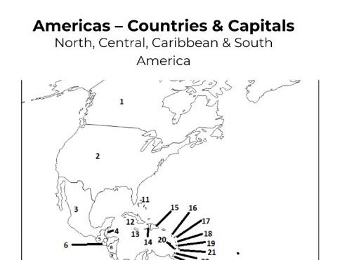

This Americas Countries and Capitals Map Worksheet helps students learn the political geography of North America, Central America, the Caribbean, and South America.
Students use the numbered map to identify each country and write the correct capital in the table. This resource is ideal for geography lessons, revision, and assessment.
Includes:
Numbered political map of the Americas
Countries and capitals table
Answer key
Printable PDF
Perfect for middle school, high school, and homeschool.
Something went wrong, please try again later.
This resource hasn't been reviewed yet
To ensure quality for our reviews, only customers who have purchased this resource can review it
Report this resourceto let us know if it violates our terms and conditions.
Our customer service team will review your report and will be in touch.
£3.00