

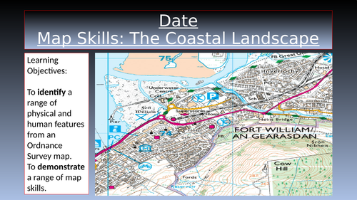

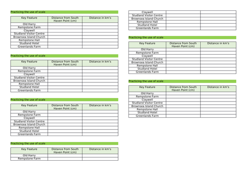
This contains a fully resourced, differentiated lesson on map skills aimed at a GCSE class, namely four-figure grid references and scale. The main part of the lesson involves students annotating an O.S. map with its physical and human features, and then carrying out a range of exercises to practice the use of four-figure grid references and scale.
Although this lesson is aimed to be included within the unit ‘Distinctive Landscapes’, it can be easily adapted to suit the needs of any Geography GCSE specification.
Learning Objectives:
To identify a range of physical and human features from an Ordnance Survey map.
To demonstrate a range of map skills.
Something went wrong, please try again later.
Brilliant
Really useful, helped a lot
Report this resourceto let us know if it violates our terms and conditions.
Our customer service team will review your report and will be in touch.
£0.00