
A clear and engaging map labeling activity for learning the major rivers and seas of Europe. Includes answer key. Perfect for KS3/Lower Secondary.
Full description:
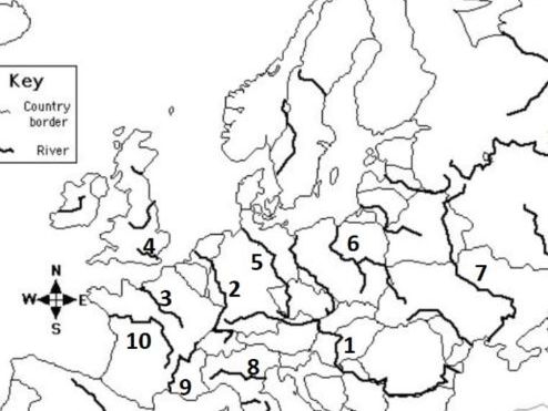
This worksheet helps students identify and label the major rivers and seas of Europe.
It’s designed as a clear, easy-to-use activity suitable for KS3 and lower secondary geography lessons.
What’s included:
- Printable map worksheet
- Rivers and seas labeling task
- Full answer key
- Suitable for classwork, homework, revision, or cover lessons
- Clean, easy-to-read layout
Skills covered:
- Locational knowledge
- European physical geography
- Map reading and labeling
This resource works well for Years 7–9 / Ages 11–14 and supports both teachers and students with a simple, effective geography task.
Something went wrong, please try again later.
This resource hasn't been reviewed yet
To ensure quality for our reviews, only customers who have purchased this resource can review it
Report this resourceto let us know if it violates our terms and conditions.
Our customer service team will review your report and will be in touch.
£3.00