


Geography OS Map Lesson / Resources
This resource helps students develop essential geographical skills using real Ordnance Survey maps, interactive tasks, and visually clear worksheets. Ideal for both classroom and fieldwork preparation, it supports students in understanding how to interpret landscapes and use maps confidently.
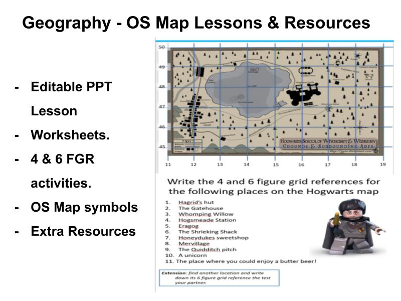
Included in this resource pack:
Fully editable PowerPoint lesson with clear explanations and activities
Student worksheets covering 4- and 6-figure grid references, contour lines, symbols, and scale
OS map extracts for practical application and interpretation tasks
Engaging challenges and extension questions for higher-ability learners
Extra OS map resources seperate from the lesson.
Something went wrong, please try again later.
This resource hasn't been reviewed yet
To ensure quality for our reviews, only customers who have purchased this resource can review it
Report this resourceto let us know if it violates our terms and conditions.
Our customer service team will review your report and will be in touch.
£3.00