


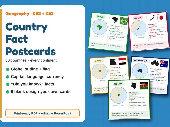
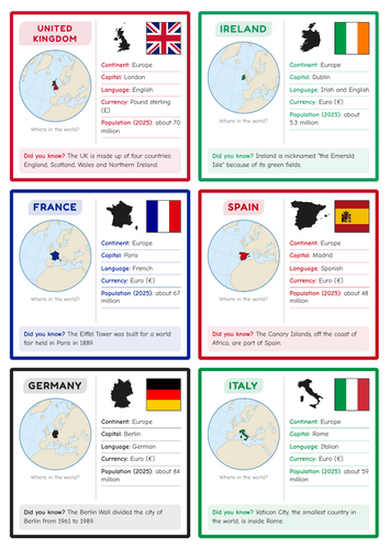
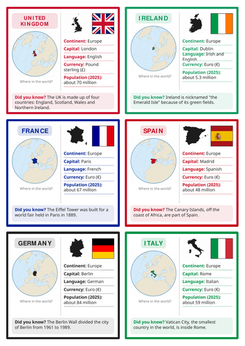
30 colourful country fact cards to bring geography to life! Each card shows exactly where the country is in the world, plus its flag, outline and five key facts.
Every card includes:
- a mini globe with the country highlighted
- the country’s outline and flag
- continent, capital, language, currency and population (2025)
- a fun “Did you know?” fact
The 30 countries, spread across every inhabited continent:
- Europe: UK, Ireland, France, Spain, Germany, Italy, Greece, Norway, Turkey
- Africa: Egypt, Morocco, Nigeria, Kenya, Tanzania, South Africa
- Americas: USA, Canada, Mexico, Jamaica, Brazil, Argentina
- Asia: China, India, Pakistan, Thailand, Japan, South Korea, UAE
- Oceania: Australia, New Zealand
Bonus: 6 blank “design your own” cards, so students can research and create their own country.
Great for:
- geography lessons and display walls
- international days and world cultures weeks
- research and fact-finding tasks
- EAL learners sharing their home country
- tutor time quizzes
Files: a print-ready PDF (6 A4 pages, 6 cards per page) and an editable PowerPoint.
Get this resource as part of a bundle and save up to 20%
A bundle is a package of resources grouped together to teach a particular topic, or a series of lessons, in one place.
Something went wrong, please try again later.
This resource hasn't been reviewed yet
To ensure quality for our reviews, only customers who have purchased this resource can review it
Report this resourceto let us know if it violates our terms and conditions.
Our customer service team will review your report and will be in touch.
£2.50