
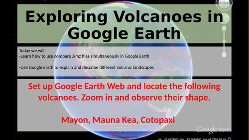
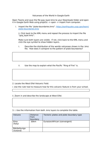
Self-guided GIS lesson using Google Earth Web to import two KMZ/KML files and explore the patterns of tectonic boundaries and volcanicc activity. The data files are very extensive and students learn a lot about real world examples. Good for practising tectonic theory and introducing the idea of hotspots.
Something went wrong, please try again later.
This resource hasn't been reviewed yet
To ensure quality for our reviews, only customers who have purchased this resource can review it
Report this resourceto let us know if it violates our terms and conditions.
Our customer service team will review your report and will be in touch.
£1.00