


Help pupils explore how location influences climate in this ready-to-teach geography lesson.
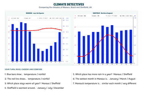
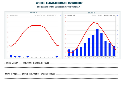
Pupils begin by retrieving their learning about maps and biomes, then distinguish weather from climate through a sorting activity. They investigate how latitude affects temperature before learning how to read a climate graph. Finally, they use graph evidence to compare Manaus and Sheffield, and identify the Sahara and Canadian Arctic tundra.
Pupils will learn to:
- Explain the difference between weather and climate.
- Describe how sunlight and latitude affect temperature.
- Identify temperature and precipitation on a climate graph.
- Use evidence from climate graphs to compare places.
This resource includes:
A PowerPoint slide deck for the lesson.
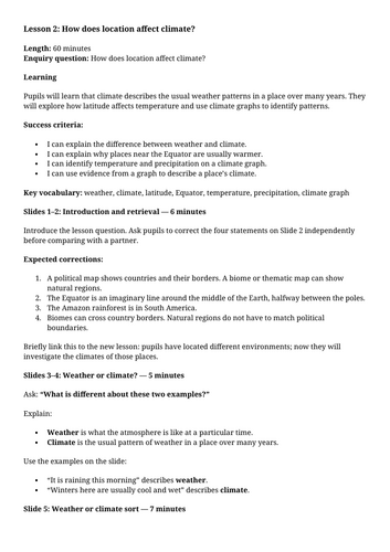
- A teacher plan with timings, teaching prompts and suggested answers.
- Weather and climate sorting statements.
- Geography retrieval task linked to the previous lesson.
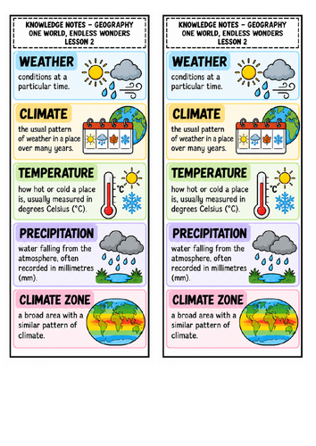
- Knowledge notes covering key vocabulary.
- Climate graph tasks comparing Manaus, Sheffield, the Sahara and the Canadian Arctic tundra.
The lesson combines geographical vocabulary, map knowledge, graph-reading skills and discussion. Tasks include supported choices and sentence starters to help pupils explain their thinking.
Something went wrong, please try again later.
This resource hasn't been reviewed yet
To ensure quality for our reviews, only customers who have purchased this resource can review it
Report this resourceto let us know if it violates our terms and conditions.
Our customer service team will review your report and will be in touch.
£1.50