

Tour Stonehenge with Google Earth (03:15)
Make a virtual field trip to one of Europe’s most famous landmarks; Stonehenge. You will be using Google Earth to watch a pre-recorded tour of this ancient site. The trip lasts for 3 minutes and 15 seconds.
The product also includes…
1. A PowerPoint that illustrates the names, locations, and information about the different stones that comprise Stonehenge.
2. A document of about 15 talking points and interesting facts about the mysterious landmark is also included.
3. A pdf that describes what you are seeing based on the corresponding minutes in the video. This is so you can pause the tour at the given time stamp and let the class know what they are looking at.
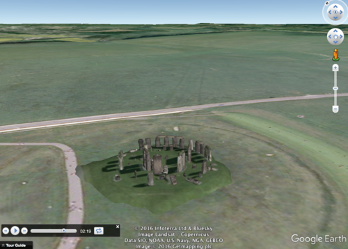
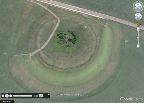
For example, the document says at, “:52 – :1:05 – The camera gets even closer to Stonehenge pausing above the site. The stones are in the center. The dark circle that a manmade path crosses over is the original henge. The faded and light colored path that comes in from the northeast and enters the henge is the original Avenue. The Heel Stone is located along the avenue. It is the white dot that can be seen right near the highway.”
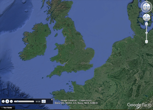
The tour begins with a view of Europe from outer space. You are then zoomed in to the site’s location to see it from a few different viewpoints. The angles are chosen so the students can get a good idea of Stonehenge’s location and its physical relationship to the surroundings. Finally, you are taken back out to a long shot of Europe.
To watch, all you have to do is click on the file, Google Earth will open and you will be taken on a short trip to the World Heritage site. * Your computer must have Google Earth to watch these tours.
Feel free to visit some other famous landmarks in North America.
1. The Golden Gate Bridge (3:29)
2. Chichen Itza (5:38)
3. Niagara Falls (2:10)
4. Panama Canal (3:02)
5. Statue of Liberty (2:07)
6. Gateway Arch in St. Louis, Missouri (1:06)
Here are some European landmarks
1. Stonehenge (3:29)
2. The Acropolis
3. The Colosseum
4. The Leaning Tower of Pisa
5. The Eiffel Tower
These tours work great with social studies lessons about famous landmarks, maps, cardinal directions, etc.
Please feel free to email me directly at r_nyg@yahoo.com if you need any assistance.
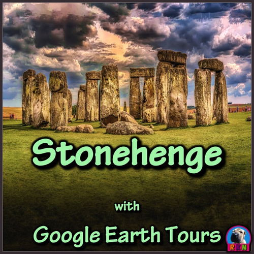
The cover photo was taken by Walkerssk @ https://pixabay.com/en/stonehenge-architecture-history-1590047/
Google Earth Tour Map Attribution
Map Data: Google, Image Landsat / Copernicus
Data SIO, NOAA, U.S. Navy, NGA, GEBCO
Image IBCAO
Image U.S. Geological Survey
US DEPT of State Geographer
© 2016 Infoterra Ltd & Bluesky
Image © 2016 Getmapping pic
Make a virtual field trip to one of Europe’s most famous landmarks; Stonehenge. You will be using Google Earth to watch a pre-recorded tour of this ancient site. The trip lasts for 3 minutes and 15 seconds.
The product also includes…
1. A PowerPoint that illustrates the names, locations, and information about the different stones that comprise Stonehenge.
2. A document of about 15 talking points and interesting facts about the mysterious landmark is also included.
3. A pdf that describes what you are seeing based on the corresponding minutes in the video. This is so you can pause the tour at the given time stamp and let the class know what they are looking at.
For example, the document says at, “:52 – :1:05 – The camera gets even closer to Stonehenge pausing above the site. The stones are in the center. The dark circle that a manmade path crosses over is the original henge. The faded and light colored path that comes in from the northeast and enters the henge is the original Avenue. The Heel Stone is located along the avenue. It is the white dot that can be seen right near the highway.”
The tour begins with a view of Europe from outer space. You are then zoomed in to the site’s location to see it from a few different viewpoints. The angles are chosen so the students can get a good idea of Stonehenge’s location and its physical relationship to the surroundings. Finally, you are taken back out to a long shot of Europe.
To watch, all you have to do is click on the file, Google Earth will open and you will be taken on a short trip to the World Heritage site. * Your computer must have Google Earth to watch these tours.
Feel free to visit some other famous landmarks in North America.
1. The Golden Gate Bridge (3:29)
2. Chichen Itza (5:38)
3. Niagara Falls (2:10)
4. Panama Canal (3:02)
5. Statue of Liberty (2:07)
6. Gateway Arch in St. Louis, Missouri (1:06)
Here are some European landmarks
1. Stonehenge (3:29)
2. The Acropolis
3. The Colosseum
4. The Leaning Tower of Pisa
5. The Eiffel Tower
These tours work great with social studies lessons about famous landmarks, maps, cardinal directions, etc.
Please feel free to email me directly at r_nyg@yahoo.com if you need any assistance.
The cover photo was taken by Walkerssk @ https://pixabay.com/en/stonehenge-architecture-history-1590047/
Google Earth Tour Map Attribution
Map Data: Google, Image Landsat / Copernicus
Data SIO, NOAA, U.S. Navy, NGA, GEBCO
Image IBCAO
Image U.S. Geological Survey
US DEPT of State Geographer
© 2016 Infoterra Ltd & Bluesky
Image © 2016 Getmapping pic
Something went wrong, please try again later.
This resource hasn't been reviewed yet
To ensure quality for our reviews, only customers who have purchased this resource can review it
Report this resourceto let us know if it violates our terms and conditions.
Our customer service team will review your report and will be in touch.
$3.99