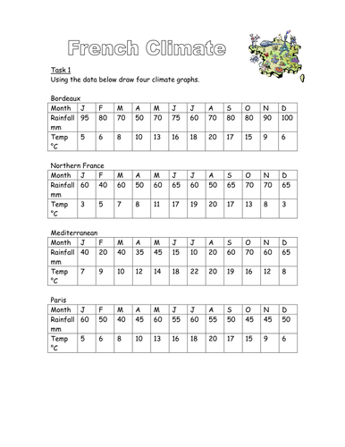

Activity involving drawing climate graphs of four regions of France and then matching them to a map and photos.
Something went wrong, please try again later.
Decent activities using climate data for regions of France with reasonable follow up activities
Report this resourceto let us know if it violates our terms and conditions.
Our customer service team will review your report and will be in touch.
£0.00