


Teacher Description – The Mackenzie River Colouring Poster
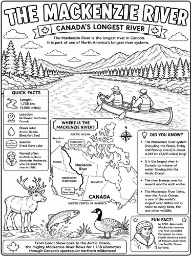
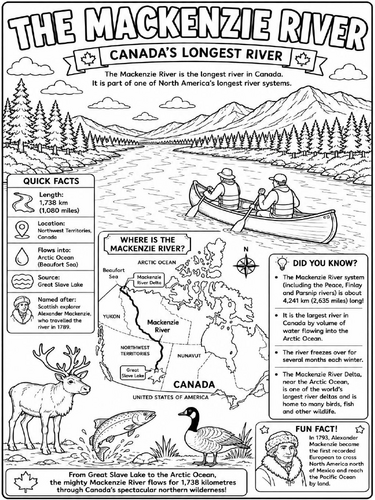
Bring Canadian geography to life with this engaging Mackenzie River Colouring Poster. Pupils can colour a detailed illustration of Canada’s longest river while learning key geographical facts through clear, child-friendly information panels.
The poster introduces the Mackenzie River, which flows 1,738 km (1,080 miles) from Great Slave Lake to the Arctic Ocean (Beaufort Sea) through the Northwest Territories. It explains why the river is important, highlights its wildlife-rich delta, and includes a simple map showing its location in Canada. Pupils also learn about Scottish explorer Alexander Mackenzie, who travelled the river in 1789 and later became the first recorded European to cross North America north of Mexico to reach the Pacific Ocean by land in 1793.
Ideal for:
Geography lessons
Canada topic work
Rivers and waterways units
North America studies
Independent learning activities
Early finisher tasks
Classroom displays
Homeschool learning
Learning Objectives
Identify Canada’s longest river and locate it on a map.
Describe where the Mackenzie River begins and ends.
Understand the importance of the Mackenzie River to Canada’s geography and wildlife.
Learn about the achievements of explorer Alexander Mackenzie.
Develop map-reading, colouring and observational skills.
Suitable for: Ages 7–12 (Key Stage 2 / Grades 2–6)
This printer-friendly, black-and-white poster combines colouring with curriculum-linked learning, making it an engaging resource for geography lessons and classroom displays.
Something went wrong, please try again later.
This resource hasn't been reviewed yet
To ensure quality for our reviews, only customers who have purchased this resource can review it
Report this resourceto let us know if it violates our terms and conditions.
Our customer service team will review your report and will be in touch.
£2.00