
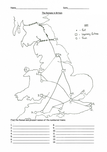
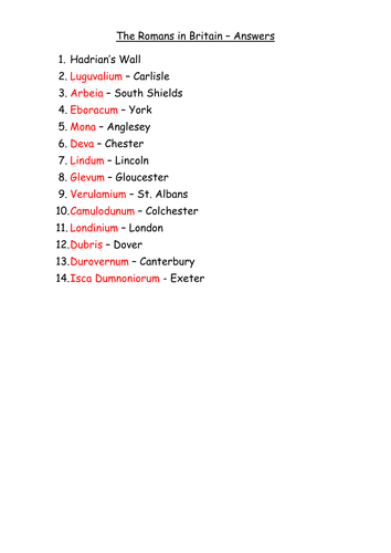
This is a simple sketch map of Roman Britain, showing the main roads, towns and forts. The children need to identify the numbered towns by their Roman names and their names in the present. I have used this with Key Stage 2 children as part of a history unit of study on The Romans. The second sheet provides the answers.
Something went wrong, please try again later.
This resource hasn't been reviewed yet
To ensure quality for our reviews, only customers who have purchased this resource can review it
Report this resourceto let us know if it violates our terms and conditions.
Our customer service team will review your report and will be in touch.
£2.00