
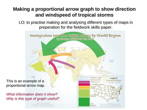
Understanding the speed, direction and likely paths of tropical storms is fundamental in managing risk and saving lives during these atmospheric natural hazard events. Students will combine their understanding of hurricane formation and the prevailing winds across the globe, in order to plot arrows onto a map of the Pacific Ocean. These proportional arrows will represent the wind speeds of the most powerful tropical storms in recent times. Student will be given a table to fill out, using their numeracy skills, to convert wind speed into an arrow width, before locating and drawing these onto the map. Perfect skills based revision lesson, which has detailed instructions, and also shows some of the answers. Can be done in class or independently.
Something went wrong, please try again later.
This resource hasn't been reviewed yet
To ensure quality for our reviews, only customers who have purchased this resource can review it
Report this resourceto let us know if it violates our terms and conditions.
Our customer service team will review your report and will be in touch.
£3.50