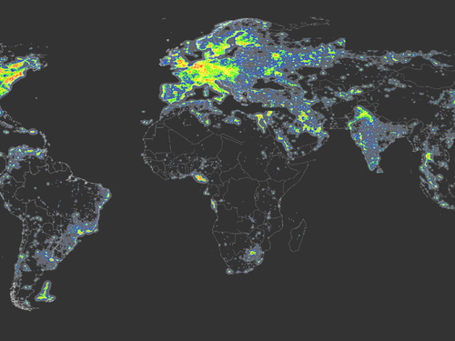


Pupils define and calculate population density complete world distribution maps, plot data using proportional map symbols, and explain why there is a link between environmental factors and population density. Extention task using an Atlas to research additional information.
Something went wrong, please try again later.
Report this resourceto let us know if it violates our terms and conditions.
Our customer service team will review your report and will be in touch.
£0.00