Printable | Child-Friendly | Perfect for Early Geography Skills
What’s Included:
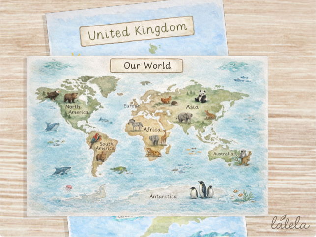
- World Map – clearly shows the 7 continents in a simple, child-friendly layout
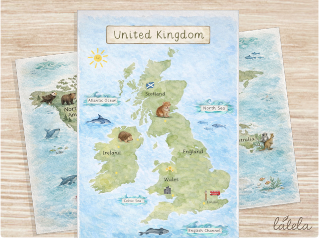
- United Kingdom Map – highlights England, Scotland, and Ireland with surrounding seas
- Soft, calming design ideal for classroom display or learning activities
Why This Resource is Perfect for Young Learners:
Simplified maps designed specifically for ages 4–7,
Clear visuals to support early geographical understanding,
Encourages curiosity about the world and where we live,
Ideal for both teaching input and continuous provision.
How Teachers Can Use This Resource:
Discussion Starters:
“Where do we live?”
“Can you find our country on the map?”
“Which animals live in different parts of the world?”
Geography Skills:
Identify continents and countries
Begin to understand location and place
Compare different environments
Lesson Ideas:
Pair with Earth Day topics
Link to animals around the world
Use alongside storybooks set in different countries
Introduce weather and climate differences
Explore oceans and seas around the UK
Something went wrong, please try again later.
This resource hasn't been reviewed yet
To ensure quality for our reviews, only customers who have purchased this resource can review it
Report this resourceto let us know if it violates our terms and conditions.
Our customer service team will review your report and will be in touch.
£1.80