
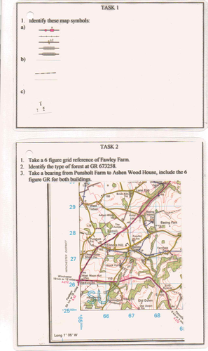
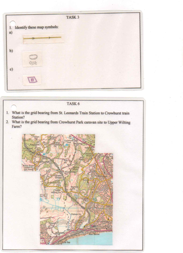
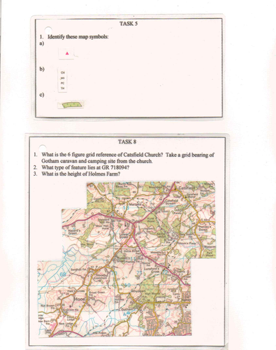
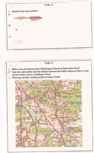
A series of 12 activities to use as a teaching tool, aid and resource when leading outdoor adventurous activities, orienteering, map reading, geography or Duke of Edinburgh Award training.
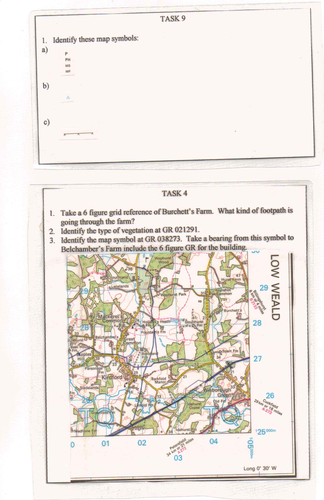
All resources are included (maps with all markings required to identify grid references, legend symbols, distance etc), making use of 1:25,000 mapping.
Perfect to use as a teaching tool or a consolidation resource.
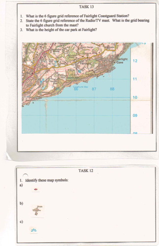
All resources are included (maps with all markings required to identify grid references, legend symbols, distance etc), making use of 1:25,000 mapping.
Perfect to use as a teaching tool or a consolidation resource.
Something went wrong, please try again later.
Report this resourceto let us know if it violates our terms and conditions.
Our customer service team will review your report and will be in touch.
£1.00