Mountain Environments is a Geography unit suitable for KS2 (Y4-6) and has everything you need for covering a mountains topic.
The planning overview, topic title page and vocabulary page can be downloaded for free here. Lessons include:
L1 – Identifying the key features of mountains
L2 – Identifying the world’s major mountain ranges
L3 – Locating the world’s famous mountains using latitude and longitude
L4 – Understanding how fold mountains are formed
L5 – Investigating the structure of a volcano (FREE)
L6 – Researching famous world mountains (FREE)
L7 – Investigating mountain climates
Each lesson includes a presentation and differentiated activities/worksheets.
If you like this resource, we would appreciate a review! We will happily send you a free resource in return for a review or useful suggestions/feedback. Contact us at ed@teachitforward.co.uk.
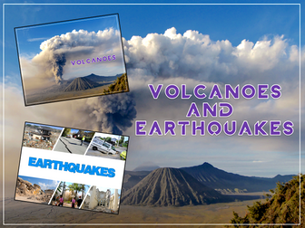
Volcanoes & Earthquakes is an exciting extended Geography unit designed for students in KS2.
The planning overview, topic title page and vocabulary page can be downloaded for free here. Lessons include:
L1 – Understanding the structure of the Earth
L2 – Investigating the structure of a volcano (FREE)
L3 – Locating the world’s famous volcanoes
L4 – Investigating the five deadly features of a volcanic eruption
L5 – Understanding tectonic plates
L6 – Exploring the effects of volcanic eruptions on Montserrat
L7 – Why do people live near volcanoes?
L8 – Understanding the causes of earthquakes
L9 – Investigating the five deadly features of an earthquake
L10 – Researching earthquakes using Wikipedia
L11 – Locating the world’s biggest earthquakes using latitude & longitude
L12 – Writing a fact file about a famous earthquake
Each lesson includes a presentation and differentiated activities/worksheets.
A FREE newspaper report template is also included in this unit.
If you like this resource, we would appreciate a review! We will happily send you a free resource in return for a review or useful suggestions/feedback. Contact us at ed@teachitforward.co.uk.
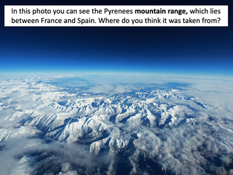
This is the first lesson in Mountain Environments, a Geography unit designed for students in upper KS2 (Y4-6).
First the presentation introduces students to the topic and looks at some of the activities people do in mountains. It then introduces the key features of a mountain range.
The activity challenges students to identify the key features of a mountain environment. It is differentiated three ways:
Easier – Students identify 8 key features of mountains.
Medium – Students identify 10 key features of mountains.
Harder – Students label the key features of mountains in their exercise book.
Extension – Students match mountain vocabulary to their definitions.
If you like this resource, we would appreciate a review! We will happily send you a free resource in return for a review or useful suggestions/feedback. Contact us at ed@teachitforward.co.uk.
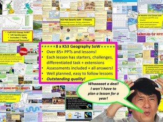
GET ALL OF MY PAID KS3 RESOURCES FOR JUST £13.99!!!
85+ lessons for under £14 or less than 15p a lesson… Bargain!
**Eight Key Stage 3 Schemes of work, enough teaching content for almost two years! **
All of my lessons are well planned, engaging, differentiated and fun! Download one of my free ones if you aren´t sure and try before you buy!
The following 8 Schemes of work are included WITH assessments:
World biomes (11 lessons)
• Lesson 1: Ecosystems
• Lesson 2: Food webs
• Lesson 3: Global biomes introduction
• Lesson 4: Mediterranean biome
• Lesson 5: Coral Reefs
• Lesson 6: Bamboo forests
• Lesson 7: Tropical Rainforests
• Lesson 8: Hot deserts
• Lesson 9: Polar biomes
• Lesson 10: Assessment lesson
• Lesson 11: Peer feedback/marking lesson
River landscapes of the UK (7 lessons)
• Lesson 1: Where are the UK’s rivers?
• Lesson 2: What are the UK’s rivers like?
• Lesson 3: What processes happen inside a river?
• Lesson 4: How do waterfalls form?
• Lesson 5: Meanders… they’re forever changing
• Lesson 6: The Landforms of the Lower Course
• Lesson 7: The Somerset levels floods 2014
• Lesson 8: How can we our manage rivers?
• Lesson 9: Rivers Assessment lesson
Weather and climate of the UK (9 lessons)
• Lesson 1: What is weather and climate?
• Lesson 2: Recording the Weather
• Lesson 3: Who cares about the weather?
• Lesson 4: Where does the UK’s weather come from?
• Lesson 5: The Beast from the East
• Lesson 6: How can the UK use it’s wind?
• Lesson 7: Does the UK need so much rain?
• Lesson 8: What are Urban Micro climates and how do they affect London?
• Lesson 9: Assessment and feedback
Tropical Rainforests (12 lessons)
• Lesson 1: What and where are our rainforests?
• Lesson 2: What is the structure of the Rainforests?
• Lesson 3: What is the climate like in the Rainforest?
• Lesson 4: How are plants and animals adapted to the rainforest?
• Lesson 5: How do we benefit from the Rainforest?
• Lesson 6: What is Deforestation?
• Lesson 7: What are the effects of Deforestation?
• Lesson 8: How can we use the rainforest sustainably?
• Lesson 9: Saving the Rainforest!
• Lesson 10: Assessment lesson
• Lesson 11: Assessment feedback and peer marking lesson.
• Lesson 12: Extended project: Researching a rainforest.
UK landscapes and processes (7 lessons)
• Lesson 1: introduction to UK landscapes
• Lesson 2: How does geology shape the UK?
• Lesson 3: Chemical weathering and limestone plateaus
• Lesson 4: Mountains in the UK: Their birth and erosion
• Lesson 5: Forests in the UK
• Lesson 6: Map reading and tourist developments in the lake district.
• Lesson 7: Assessment lesson with feedback PPT.
Polar biomes & environments (11 lessons)
Lesson 1 - Polar Environments, what are they and where they
Lesson 2 - Polar biomes climate graph
Lesson 3 - How have some plants and animals adapted to live in The Arctic
Lesson 4 - The threats to Polar biomes
Lesson 5 - How fast are polar biomes warming
Lesson 6 - Tourism in polar biomes
Lesson 7 - The Antarctic treaty
Lesson 8 - Should we mine Antartica
Lesson 9 - Map reading in Polar biomes
Lesson 10 - Assessment lesson
Lesson 11 - Assessment feedback & peer marking
Hot deserts (9 lessons)
Lesson 1: What is a hot desert and where are they found?
Lesson 2: Drawing a climate graph for hot deserts
Lesson 3: How can animals and plants survive in hot deserts?
Lesson 4: What is desertification and why is it happening?
Lesson 5: Can desertification be stopped?
Lesson 6: Tourism in a hot desert far far away…
Lesson 7: Can you navigate through a hot desert?
Lesson 8: Assessment lesson
Lesson 9: Peer marking and assessment feedback
Globalisation 12 lessons
Lesson 1: An introduction to globalisation
Lesson 2: How has globalisation happned?
Lesson 3: Why do companies go global? Mcdonalds
Lesson 4: What is a TNC and why do they work in so many countries?
Lesson 5: The pros and cons of globalisation
Lesson 6: The dark side of globalisation
Lesson 7: A TNC in Nigeria: Shell
Lesson 8: How is globalisation helpful? NGOs
Lesson 9: IGOs: WHO will stop Malaria?
Lesson 10: Assessment lesson
Lesson 11: Peer marking and assessment feedback
Lesson 12: Optional project on a TNC
Interplanetary population project
extras (wordsearches, extensions, games mapping, Halloween mapping…)
This includes ALL of my lessons, quizzes, and six full schemes of work with over 75 lessons in total!!!
(some stand alone lessons are omitted as they are repeated/included in SoW)
Please check out all of my FREE school resources and Geography lessons on my shop where you´ll also find full schemes of work for just £3 and lots of other useful resources��� Or purchase all of my KS3 resources for just £13.99!
I would really appreciate it if you could leave me a review, thanks!
https://www.tes.com/teaching-resources/shop/ukjoshkelly94
Questions or issues: ukjoshkelly@yahoo.co.uk
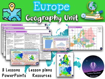
This Europe Geography Unit is a comprehensive and engaging teaching resource designed for Key Stage 2 children to explore various aspects of Europe, including famous landmarks, cultural similarities and differences, and the impact of human activity on the environment. The unit consists of eight lessons, each targeting specific learning objectives and accompanied by a range of interactive activities and discussions.
Lesson 1: Introduction to Europe
In this lesson, students are introduced to the continent of Europe and its diverse countries. They learn about the significance of Europe, its geographical features, and the countries that make up the continent.
Lesson 2: Exploring European Landmarks
Students delve into the fascinating world of famous landmarks in Europe, such as the Eiffel Tower, Colosseum, Big Ben, and more. They learn about the historical and cultural importance of these landmarks, their locations on a map of Europe, and engage in activities like landmark descriptions and map marking.
Lesson 3: Cultural Similarities and Differences
This lesson focuses on the cultural aspects of different European countries and compares them to the students’ local area. Students learn about traditions, customs, and languages, and engage in activities like creating travel brochure collages and group discussions about dream European holidays.
Lesson 4: Trade and Travel Connections
Students explore the trade and travel connections between Europe and their local area. They analyze import and export of goods, tourism, and transportation networks, and evaluate the impact of geographical factors on these connections.
Lesson 5: Planning a European Travel Adventure
In this lesson, students plan an imaginary travel adventure to visit multiple European landmarks. They research the landmarks, their locations, and plan an itinerary, considering factors like transportation, accommodations, local cuisine, and cultural experiences.
Lesson 6: Expressing Personal Views about European Locations
Students learn to express their opinions and preferences about specific European locations, providing clear reasons for their views. They engage in discussions and debates, considering factors like climate, landmarks, culture, or personal interests.
Lesson 7: Geographical Similarities and Differences
This lesson focuses on understanding geographical similarities and differences between Spain and the students’ local area. Students explore traditions, customs, languages, and analyze trade and travel connections, considering the impact of geographical factors.
Lesson 8: Graphing and Comparing Geographical Data
Students gather and analyze data related to temperature and rainfall in specific European locations. They create graphs to represent the data accurately and compare and interpret the data to draw conclusions about environmental conditions.
This resource provides a comprehensive and well-structured unit for teaching outstanding geography lessons about Europe to Key Stage 2 children. It incorporates a variety of interactive activities, discussions, and opportunities for reflection, promoting critical thinking and global awareness among students. The lessons are designed to engage and inspire students while fostering their understanding of landmarks and cultures. Also suitable for Key Stage 3.
KS2 LKS2 UKS2 KS3
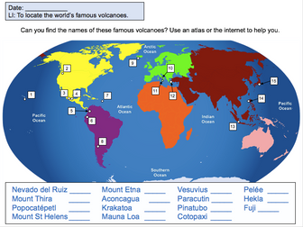
This lesson is designed for KS2 students. It can be taught as a stand alone lesson but is also available as part of two wider units, both of which are available on TES:
-Volcanoes
-Volcanoes & Earthquakes
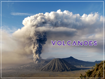
First the presentation introduces some of the world’s most famous volcanoes and classes them as active, dormant or extinct.
The activity then challenges students to locate volcanoes using an atlas or the internet (e.g. Google maps). Alternatively, a map of famous world volcanoes is also provided.
Easier – Students locate volcanoes using the map of famous volcanoes (writing numbers).
Medium – Students locate volcanoes using the map of famous volcanoes (writing volcano names).
Harder – Students locate volcanoes using an atlas.
(N.B. It is recommended you check the atlas has the relevant maps prior doing the activity.)
If you like this resource, we would appreciate a review! We will happily send you a free resource in return for a review or useful suggestions/feedback. Contact us at ed@teachitforward.co.uk.
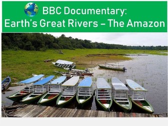
Easy to use question and answer worksheet to accompany the BBC documentary Earth’s Greatest Rivers, Episode 1, The Amazon River. Questions span the full 50 minute length of the documentary. An answer sheet for teachers is provided. There is an optional challenge sheet (exam questions and mapping task) to round up ideas from this documentary. Used with a year 8 group studying rivers, but equally could be used for students as part of a place based study in Brazil for example.
Topics include:
Factfile on the Amazon River
Upper, middle and lower course characteristics
Indigenous views of the river
Manaus
Human activity along the river
Flooding in the lower course
Download will include all worksheets both in Word and PDF formats.
Find other documentary worksheets and the rest of this series at my shop
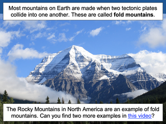
This lesson is part of Mountain Environments, a Geography unit designed for students in upper KS2 (Y4-6).
First the presentation recaps the structure of the Earth and how its crust is split into tectonic plates. It then investigates the different ways tectonic plates can move and how two tectonic plates colliding can form fold mountains (e.g. the Himalayas).
The differentiated activity challenges students to work out which tectonic plates formed different fold mountain ranges around the world.
Easier – Students have to find one tectonic plate.
Medium – Students have to find two tectonic plates.
Harder – Students find the name of each mountain range and two tectonic plates.
Extension – Students complete a cloze procedure paragraph about fold mountains.
If you like this resource, we would appreciate a review! We will happily send you a free resource in return for a review or useful suggestions/feedback. Contact us at ed@teachitforward.co.uk.
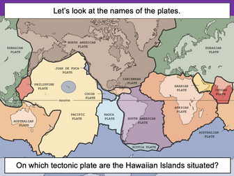
This lesson is designed for KS2 students. It can be taught as a stand alone lesson but is also available as part of three wider units, all of which are available on TES:
-Volcanoes
-Earthquakes
-Volcanoes & Earthquakes
The presentation introduces the idea that the world’s crust is split into tectonic plates and looks at how these are related to volcanoes and earthquakes.
The activity challenges students to identify tectonic plates using a map. It is differentiated two ways:
Easier – Students identify the world’s tectonic plates using a colour-coordinated map.
Harder – Students identify the world’s tectonic plates using a plain map.
Extension – Students use an atlas to find out which tectonic plate countries of the world are located on.
If you like this resource, we would appreciate a review! We will happily send you a free resource in return for a review or useful suggestions/feedback. Contact us at ed@teachitforward.co.uk.
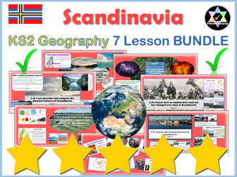
7 Quality lessons covering all aspects of life in Scandinavia and National Curriculum Geography learning objectives.
Powerful images, video links, resources, detailed plans and no preparation needed.
Enjoy my other Scandinavian Units:
Scandinavian Art Unit
Writing Scandinavian Christmas Stories
Check out my other popular Geography units:
Yosemite
Europe
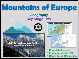
A complete geography lesson on the mountains of Europe. Includes a thorough teaching PowerPoint, interactive activities, worksheets, video, extensions and games.
Follow the ready-to-go PowerPoint to teach about the mountain ranges of Europe.
Cover:
Formation
Map work
Climate
Vegetation
Facts
Famous peaks
Planned for years 3 or 4, easily adaptable for years 5 and 6.
Differentiated recording tasks provided with two extensions.
Highlights:
Photo analysis starter activity
Activities for all styles of learners
Scaffolded learning
Check out my other popular Geography lessons on Europe:
Where is Europe? lesson pack
Countries of Europe lesson pack
Compare Cities of Europe lesson pack
Climate of Europe lesson pack
Rivers of Europe lesson pack
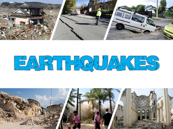
Earthquakes is an exciting Geography unit designed for students in KS2.
The planning overview, topic title page and vocabulary page can be downloaded for free here. Lessons include:
L1 – Understanding the structure of the Earth
L2 – Understanding tectonic plates
L3 – Understanding the causes of earthquakes
L4 – Investigating the five deadly features of an earthquake
L5 – Researching earthquakes using Wikipedia
L6 – Locating the world’s biggest earthquakes using latitude & longitude
L7 – Writing a fact file about a famous earthquake
Each lesson includes a presentation and differentiated activities/worksheets.
If you like this resource, we would appreciate a review! We will happily send you a free resource in return for a review or useful suggestions/feedback. Contact us at ed@teachitforward.co.uk.
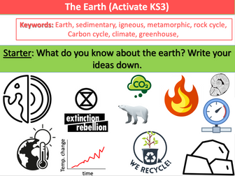
KS3 new for the Activate 2 unit ‘The Earth’
Full lessons ready to use straight ‘out of the box’. You’ll struggle to find a set of as many planned lessons this cheap and of similar quality
Similar structure to my other power points following the input - activity - review phasing
Plenary sections for progress checking
Clear learning objectives and outcomes
Modern and engaging layout
Little adaptation needed
LESSONS:
L1 The Earth and its Atmosphere
L2 Sedimentary Rock
L3 Igneous and Metamorphic Rock
L4 The Rock Cycle
L5 The Carbon Cycle
L6 Climate Change
L7 Recycling
Please leave constructive feedback :D
This lesson is part of Mountain Environments, a Geography unit designed for students in upper KS2 (Y4-6).
First the presentation introduces some of the most famous mountain ranges from around the world.
The differentiated activity then challenges students to locate the world’s mountain ranges and encourages them to use and explore atlases. It is recommended that students do the activity in pairs.
Easier – Students identify the world’s famous mountain ranges (less writing).
Medium – Students identify the world’s famous mountain ranges (first letter clues)
Harder – Students identify the world’s famous mountain ranges (no clues)
If you like this resource, we would appreciate a review! We will happily send you a free resource in return for a review or useful suggestions/feedback. Contact us at ed@teachitforward.co.uk.
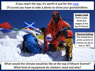
This lesson is part of Mountain Environments, a Geography unit designed for students in upper KS2 (Y4-6).
First the presentation looks at features of a mountain climate including lower temperatures and increased rainfall. It then focuses in more detail on the climate of Mount Everest.
There are two activities:
Interpreting climate graphs
In this activity students look at and answer questions about temperature graphs for both the summit and base camp of Mount Everest. It is differentiated two ways:
Easier – Students answer questions about temperature graphs for Mount Everest (suitable for Year 4 and 5).
Harder – Students answer questions about temperature graphs for Mount Everest (suitable for Year 6).
Creating a climate graph in Excel
In this ICT activity, students create their own climate graph, including temperature and rainfall, for the summit of Mount Everest using Microsoft Excel.
If you like this resource, we would appreciate a review! We will happily send you a free resource in return for a review or useful suggestions/feedback. Contact us at ed@teachitforward.co.uk.
Volcanoes is an exciting Geography unit designed for students in KS2.
The planning overview, topic title page and vocabulary page can be downloaded for free here. Lessons include:
L1 – Understanding the structure of the Earth
L2 – Investigating the structure of a volcano (FREE)
L3 – Locating the world’s famous volcanoes
L4 – Investigating the five deadly features of a volcanic eruption
L5 – Understanding tectonic plates
L6 – Exploring the effects of volcanic eruptions on Montserrat
L7 – Why do people live near volcanoes?
Each lesson includes a presentation and differentiated activities/worksheets.
A FREE newspaper report template is also included in this unit.
If you like this resource, we would appreciate a review! We will happily send you a free resource in return for a review or useful suggestions/feedback. Contact us at ed@teachitforward.co.uk.
Following the work in Session 11, chn consider how Italy fits into the categories of countries in the modern world. After a discussion of the difference between developed and developing countries, children identify the differences between Italy and the UK.
Suitable for years 3 and 4.
How do children around the world care for the environment? What do your class do to look after their community? And can your class put some of their ideas into action at school? These teaching activities use the Global Gang website to explore how we can all play a role in looking after our planet and invite your class to take up the challenge!
 Quick View