Investigating Rivers is a Geography unit suitable for KS2 (Y4-6).
The planning overview and topic title page can be downloaded for free here. Lessons include:
L1 - Understanding the water cycle
L2 - Identifying features of a river system
L3 - Identifying characteristics of the three stages of a river
L4 - Investigating features of the River Thames
L5 - Thinking about the different ways we use water
L6 - Understanding the impacts of floods and droughts
Each lesson includes a presentation and differentiated activities/worksheets.
If you like this resource, we would appreciate a review! We will happily send you a free resource in return for a review or useful suggestions/feedback. Contact us at ed@teachitforward.co.uk.
This lesson is part of Investigating Rivers, a unit designed for upper KS2 (Y4-6).
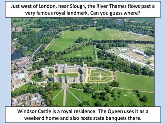
The presentation takes students on a journey from the source to the mouth of the River Thames. Starting at Thames Head, the source of the River Thames, students investigate maps and satellite photos and try to identify river features along the way. Other locations include Windsor Castle, the Isle of Dogs in London and the mouth of the river at Southend-on-Sea.
The writing-based activity challenges students to first label each map/satellite photo and then write a paragraph describing the location and river features they can see. It is differentiated two ways:
Easier – Students have maps/satellite photos and cloze procedure paragraphs to complete.
Harder – Students have maps/satellite photos, a wordbank and write their own paragraphs.
If you like this resource, we would appreciate a review! We will happily send you a free resource in return for a review or useful suggestions/feedback. Contact us at ed@teachitforward.co.uk.
Rivers double sided revision sheet can be printed on either A4 or A3. This sheet is aimed at pupils who prefer more structured revision or lower ability students who need more support. The sheets cover 12 different sections within the ‘River Landscapes’ section of UK Physical Landscapes. Sections covered include:
Long Profile
Lateral and Vertical Erosion
Types of Erosion
Transportation
Deposition
Meanders
Ox-Bow Lakes
Levees
Waterfalls
Causes of River Flooding
Hydrographs
Key Terms
AQA A Level Geography- Contemporary Urban Environments
Lessons include the following content: Urban form, world cities, Urban waste, Urban Climate, precipitation and drainage, megacities, Air quality and river restoration.
Discussion and research tasks which engage students about current issues in our cities- UK and global.
Key case studies include: Birmingham and Mumbai (social and environmental sustainability and regeneration) and the Cheonggyecheon River Restoration Project in Seoul. Emphasis on current global challenges and solutions to them.
Exam questions embedded and structured in most lesson to ensure progress is made towards the exams.
Any questions, please ask.
Year 7 Settlement Scheme of work - lesson slides and worksheets to print:
Dual coded lessons with a focus on Keywords and encouraging Year 7s to speak and write like Geographers
**Lesson: **
What is a settlement?
Settlement functions
Population distribution
Global population growth
What is Urbanisation?
Why do people migrate?
Population Pyramids
Bristol CS introduction
Bristol Harborside Regeneration
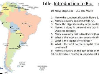
Rio CS introduction – challenges
Additional/cover lesson – Future Cities
Revision and Assessment
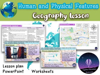
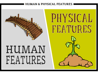
Elevate your geography lessons with this Key Stage 2 lesson focusing on Human and Physical Features. This resource provides a comprehensive package, featuring a lesson plan, a PowerPoint presentation, and engaging activity sheets. Designed to cultivate a deep understanding, students will learn to identify and differentiate between human and physical geographical features on a map. The lesson uses practical application, as children employ their newfound skills to create their own map. For added challenge, an extension activity prompts the identification of features on a map of London using compass points.
Resource Highlights:
★ Lesson Plan: A detailed guide for a seamless teaching experience.
★ PowerPoint: An engaging visual aid to reinforce concepts and spark curiosity.
★ Activity Sheets: Thoughtfully designed sheets for interactive and hands-on learning.
★ Practical Application: Move beyond theory as students create their own maps with identified features.
★ Extension Activity: Challenge students with an additional task that explores features on a map of London using compass points.
You may also be interested in…
☆ KS2 RAINFOREST Geography Unit - 6 Outstanding Lessons
☆ KS2 France Geography Unit - 5 outstanding lessons fully resourced
☆ KS1 Piet Mondrian Painting - Outstanding Art Lesson
Customer Support:
Encountering any challenges or have specific requests? Contact our support team directly at explore_education@outlook.com for a swift response.
Special Offer:
Enjoying this resource? Leave a review and receive a complimentary resource of your choice! Email us your purchase receipt and a screenshot of your review to avail this offer.
Tags: KS2, Key Stage 2, Geography, Human Features, Physical Features, Lesson Plan, PowerPoint, Activity Sheets, Map Identification, London Map, Compass Points, Education.
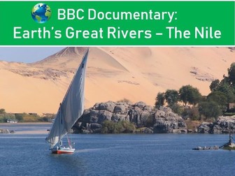
The Nile River
Easy to follow student worksheet to accompany the BBC documentary Earth’s Greatest Rivers, The Nile River. Questions cover the full 50 minutes of the documentary. There is a helpful teacher sheet with answers. The second page includes some exam style summarising questions and a mapping exercise.
Designed for use with a year 8 group studying rivers, but equally could be used for students as part of a place based study in Egypt or Africa for example.
Documentary length: 50 minutes (+10 mins how the programme was shot)
Downloaded bundle includes Word and PDF formats of all sheets.
Currently this documentary is on BBC iPlayer and Daily Motion.
These three worksheets would be perfect for children's independent work when learning about / understanding the difference between human and physical geographical features of locations. In this example, I chose a task involving the whole of the UK, a task focusing on London and another focusing on Edinburgh (these cities due to their visual differences and geographical distance, which could then lead to good plenary discussion when evaluating outcomes.)
Children cut out pictures from each location, try to stick them by the matching place name in the table, then decide whether it is a physical or human feature. The London/Edinburgh sheets can both be used either in one or two lessons. The UK sheet will require atlases or Google Maps for children to look up key locations.
This bundle contains all the case studies needed for the physical part of Edexcel A Level Geography (according to the specification). I’ve summarised all information needed for the exams and made it easy to understand.
This pack contains all the detailed case studies required for the topic of The Carbon Cycle and Energy Security in Edexcel A Level Geography. Notes are concise and written in bullet points (so easy to read!). They are written to match with topic questions that may come up in the exam!
A series of streamlined knowledge organisers for all topics in component 2 Edexcel B Geography. These are a really successful way of helping students organise their knowledge and prevent ‘over learning’ for the exam.
Paper 1 and Paper 2 revision game.
Rules, game board and answers attached.
Answers relate to key terms, case studies and individual units.
Each colour of the board relates to the individual unit on the specification.
Paper 1
Unit 1: Hazardous Earth (red)
Unit 2: Development Dynamics (blue)
Unit 3: Challenges of an urbanising world (light green)
Paper 2:
Unit 1: The UK’s evolving physical landscape (purple)
Unit 2: The UK’s evolving human landscape (dark green)
Unit 3: Investigations/fieldwork (yellow)
White= random answers from units above
Please note: Unit 3 is more specific to rivers and urban fieldwork.
Answers easily adaptable in Microsoft publisher
This is a full unit including unit planning, lesson PowerPoints and differentiated lesson resources. In addition to this, for certain lessons, there are ‘write ups’ which we use in class where the children have completed a practical task and we need evidence in books.
Edexcel Pearson spec knowledge organisers with revision notes & model answers: trends in urbanisation, factors affecting urban land use and strategies aimed at sustainable urban living.
Included is the specification for Paper 1 and Paper 2 of Edexcel Pearson IGSCE Geography. This revision guide contains definitions, key content in chapter sections (as below) and crucial exam technique with full mark model answers.
Through creating and using these revision notes I achieved a Grade 9.
6.1 – Trends in urbanisation (suburbanisation and counter-urbanisation), factors affected the rate of urbanisation and the emergence of mega-cities, problems associated with rapid urbanisation (congestion, transport, employment, crime and environmental issues).
6.2 – Factors affecting urban land use, urban challenges in a named developed country (Honk Kong) and developing country or emerging country (Nairobi).
6.3 – Development of the rural-urban fringe, strategies aimed at sustainable urban living in chosen urban area, role of differing groups of people in managing challenges in chosen urban area.
This resource is for KS1 Geography comparing human and physical features of the UK and China. Allows children to cut and stick appropriate features under the correct headings.
Grab some free Easter wordsearches here: https://www.tes.com/teaching-resource/resource-12987575
Or get this lesson as part of a full Easter bundle for just £3 here: https://www.tes.com/teaching-resource/easter-activities-bundle-perfect-for-ks3-ks4-geography-maths-english-and-more-12987573
GET ALL OF MY PAID KS3 RESOURCES FOR JUST £12.99!!!
60+ lessons, just 11p a lesson… Bargain!
https://www.tes.com/teaching-resource/all-of-my-ks3-resources-12842783
The lesson
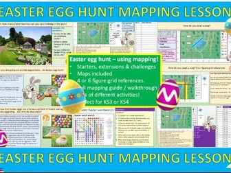
Have some fun before Easter with this engaging and educational Easter Egg hunt lesson! An eggciting lesson in which students learn to read a map and use Co-ordinates & map reading to track down the Easter Eggs in a park using co-ordinates! All answers in PPT.
Perfect for KS3 Geography, maths or any fun Easter lesson. The lesson has a short slide about Easter which can be removed if you teach in a non-demoninational school.
The lesson is easy to teach, fun, engaging and the perfect way to spend an Easter lesson!
Activities:
Fun starter, finding Easter bunnies
Short reading exercise about Easter
Mapping walkthrough
Mapping activity + extensions & challenges
Wordsearch
Extension activities
Please check out all of my FREE school resources and Geography lessons on my shop where you´ll also find full schemes of work for just £3 and lots of other useful resources… Or purchase all of my KS3 resources for just £12.99!
I would really appreciate it if you could leave me a review, thanks!
https://www.tes.com/teaching-resources/shop/ukjoshkelly94
Questions or issues: ukjoshkelly@yahoo.co.uk
Please leave a review!
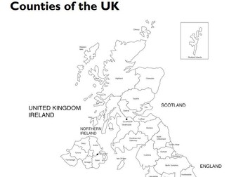
2 lessons covering UK Counties and Major Cities
Lesson 1: Counties in the UK
Learning objectives
Children should learn:
• the UK is divided into countries and counties.
Success criteria
Children can:
• understand that the countries in the UK are
divided into counties and can name some of the
counties.
Lesson 2: Major Cities in the UK
Learning objectives
Children should learn:
• about the major cities in the UK.
Success criteria
Children can:
• understand that there are a number of major
cities in the UK and can name and locate them.
Taken from LCP’s LKS2 Geography Resource File
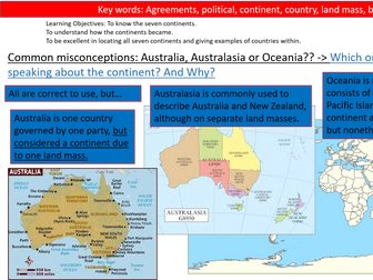
Updated unit of work- Where in the World?
Clear Sequencing of learning suited to the new Ofsted Framework.
SOL attached within. Clear homework opportunities and opportunities for public speaking and oracy.
Theses lessons are aiming to welcome and introduce year 7 students into geography. They look at key skills such as location, maps, grid referencing, current events analysis and more…
Tasks are all differentiated, lessons are engaging and many have videos and animations embedded into them.
Challenges misconceptions about location and countries within the British Isles and UK.
Includes two current event lessons from the Summer of 2019- Brexit and Whaley Bridge Dam.
Any Questions, please ask.
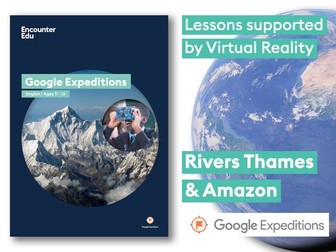
This #GoogleExpeditions lesson develops students’ skills in geographical descriptions, identifying similarities and differences between LEDCs and MEDCs, as well as the physical geography of rivers.
Students go on virtual field trips using Google Expeditions to both the Amazon and the River Thames, identifying, comparing and describing.
Google Expeditions are immersive 360 degree photo stories designed for use in the classroom. For more see: https://www.google.com/edu/expeditions/
To download Google Docs versions of the lesson plan go to: https://goo.gl/Y3OTY8
 Quick View