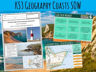
Coasts EdexcelQuick View
TheGeographyShopOriginal

Coasts Edexcel

9 Resources
Edexcel A-level Topic 2: Coasts Lesson 1 - Free - L1 - 2.1 -What are the Coast Distinctive Landscapes? https://www.tes.com/teaching-resource/resource-12638753 This SoW has been created to meet the teaching requirements of Topic 2: Coasts, which is a component of the Geography Edexcel A-level course. This SoW is designed in detail and is both differentiated and engaging, and allows you to move pupils through content efficiently. As a result, lessons take around two hours to deliver and hit the required components of the syllabus (see syllabus code). Made to a high standard and constructed using current research, both dual coding and retrieval practices are at the heart of this unit. A colour scheme also runs throughout to ease both your delivery and students comprehension. A KS3 SoW has also been include free… This resource is a part of a scheme that covers the entire A-level topic (Water Security), which can be viewed using the link below: L1 - 2.1 -What are the Coast Distinctive Landscapes? L2 - 2.2 + 2.3 - What role does Geology Play in Affecting Coastal Landscapes? L3 - 2.4 - How does Coastal Erosion Create Distinctive Landscapes? L4 - 2.5 - What landforms are created by coastal transportation and deposition? L5 - 2.6 - How do subaerial processes influence coastal landforms? L6 - 2.7 (2.10)- How are Changes to Sea Level Influencing Coast Over Various Time Scales? L7 - 2.8 (2.10) - How Does Rapid Coastal Retreat Cause Threaten Coastal Communities? L8 - 2.9 - Why is there a Growing Risk of Coastal Flooding? L9 - 2.11 - How are Coastal Recession and Flooding Affecting Communities? L10 - 2.12 - Why are Coasts Increasingly Managed by ICMZ? I’m happy to answer any questions you may have prior to purchase and any feedback is of course welcome… thegeographyshoporiginal@gmail.com Best FREE Resources (The Geography Shop) https://www.tes.com/teaching-resource/-12899088 (Climate Change SoW) https://www.tes.com/teaching-resource/-12899440 (Development SoW) https://www.tes.com/teaching-resource/-12638984 (Waste SoW) https://www.tes.com/teaching-resource/-12451443 (Britain Globalisation SoW) https://www.tes.com/teaching-resource/-12741793 (Local Area Investigation SoW) https://www.tes.com/teaching-resources/bundler/12949461 (Cambridge International) https://www.tes.com/teaching-resource/-12922653 (Israel & Palestine) https://www.tes.com/teaching-resource/resource-12485457 (What is Geography?) I hope you find this SoW useful. If you have, I have created a series of resources. You can check them out here. https://www.tes.com/teaching-resources/shop/TheGeographyShopOriginal
Coasts: Hard EngineeringQuick View
markthegeographer

Coasts: Hard Engineering

(4)
AQA GCSE Geography lesson for the new specification Unit 1C: In this lesson we look at types of hard engineering and where they are best applied. The starter is a quiz where the pupils need to select the squares that have a depositional landform. There are sound effects too so it’s all very exciting. We begin by looking at why certain areas of the coast need protecting and what factors go into consideration when planners are deciding whether or not to protect the coastline. The pupils are then given some information cards and a worksheet to fill in on the different types of hard engineering, they also have a visual scale to shade in for each one according to it’s effectiveness and durability, cost and sustainability. This can be done in a number of ways (group work, round the room, carousel etc). We then seek to apply this knowledge though the pupils completing a decision making exercise. This is based on a fictional town (Sandytown). The town has been divided into zones, the pupils read the information on each zone and decide what type fo hard engineering that zone needs and justify this. We finish with a 6 mark question on hard engineering with some guidance on how they can answer this. In a nutshell lesson includes: Interactive starter quiz on depositional landforms. Video clip. Hard engineering worksheet with visual scale. Decision making exercise activity. 6-mark GCSE-style question with guidance should the pupils need it. Hope this saves you some valuable planning time. https://www.tes.com/teaching-resources/shop/markthegeographer
Coasts: Soft EngineeringQuick View
markthegeographer

Coasts: Soft Engineering

(1)
AQA GCSE Geography lesson for the new specification Unit 1C: In this lesson we look at types of soft engineering and look at an example where they have been applied. We also use the lesson as an opportunity to practice some map skills. The starter is a simple retrieval practice grid based on the coasts unit of work. We begin by locating Crow Point which is an area in North Devon at risk from coastal erosion where soft engineering strategies have been used to prevent further erosion to the fragile dune system. The pupils will be given a large A3 sheet of paper with an outline map of the area including the dune system. The pupils then use grid references to add labels and features onto their map. Once they have completed this we look at the different types of soft engineering strategies and the advantages and disadvantages. The pupils are given grid references to the location these strategies have been applied. They locate them on their map and write the details in the appropriate box. We do this four all four strategies. This could be done as an info gather, round the room, carousel etc. We finish with a 4 mark question comparing hard and soft engineering with some guidance on how they can answer this. In a nutshell lesson includes: Retrieval practice starter Map skills practice Soft engineering information gather task 4-mark GCSE-style question with guidance should the pupils need it. Hope this saves you some valuable planning time. https://www.tes.com/teaching-resources/shop/markthegeographer
Coasts: Longshore Drift and DepositionQuick View
markthegeographer

Coasts: Longshore Drift and Deposition

(1)
AQA GCSE Geography lesson for the new specification Unit 1C: In this lesson we look at the processes of longshore drift, deposition and wave refraction. We start with a retrieval practice grid which can be filled in with your own questions. We then introduce the concept of longshore drift. We watch a video clip, look at some sequential diagrams, and also consider why some parts of the coastline do not experience longshore drift, yet other parts do. The pupils use this knowledge to complete a worksheet which has several tasks such as explaining, drawing sequential diagrams and annotating. We then move onto deposition and wave refraction. We consider how wave refraction can create areas of erosion and deposition. The pupils create a diagram, which we label and annotate as we go along. There are several extension questions for the pupils to consider too. We finish with a simple post-it plenary on groynes and longshore drift. In a nutshell lesson includes: Retrieval practice starter Worksheet on the process of longshore drift with several activities. Annotated diagram of wave refraction. Video clips where appropriate Post-it plenary. Hope this saves you some valuable planning time. https://www.tes.com/teaching-resources/shop/markthegeographer
Coasts: Weathering and Mass MovementQuick View
markthegeographer

Coasts: Weathering and Mass Movement

(2)
AQA GCSE Geography lesson for the new specification Unit 1C: In this lesson we look at the different types of weathering and mass movement. We start with a true or false retrieval practice quiz on wave types from the previous lesson. We then introduce the concept of weathering and proceed to look at mechanical, biological and chemical weathering. The pupils have a variety of annotation, drawing and question tasks to complete on the worksheet. Moving on to mass movement, the pupils get a second worksheet with 4 different slopes on. The pupils then are given information on each type of mass movement. They sketch the type of mass movement onto their slope and add labels. We finish with a simple GCSE-style question which I get the pupils to answer on a post-it note. In a nutshell lesson includes: True or False starter on wave types Weathering activity sheet with diagrams and questions. Mass movement ‘change the slope’ activity sheet. Video clips where appropriate GCSE-style question plenary Hope this saves you some valuable planning time. https://www.tes.com/teaching-resources/shop/markthegeographer
Holderness Coast - Case Study AQA A Level Geography CoastsQuick View
TomLilly

Holderness Coast - Case Study AQA A Level Geography Coasts

(0)
AQA A Level Geography Coasts Case Study - The Holderness Coastline. 2 A3 case study sheets containing information on the Holderness’ location, different types of coastline and landforms, factors affecting rates of erosion, impacts of erosion and sea level, hard engineering strategies along the Holderness coast and future management plans. DOCs and PDF Formats.
AQA GCSE Geography Coasts: All LessonsQuick View
markthegeographer

AQA GCSE Geography Coasts: All Lessons

14 Resources
A bundle of all my coasts lessons prepared for the AQA specification, but still useful for other specifications. Lesson titles in order are: Types of Waves Weathering and Mass Movement Processes of Erosion and Transportation Headlands and Bays Wave Cut-Notches & Platforms, Stacks, Stumps and Arches Longshore Drift and Deposition Beaches and Sand Dunes Spits and Bars Coastal Landforms at Swanage Hard Engineering Soft Engineering Managed Retreat Coastal Management at Lyme Regis https://www.tes.com/teaching-resources/shop/markthegeographer
Coasts: Managed RetreatQuick View
markthegeographer

Coasts: Managed Retreat

(1)
AQA GCSE Geography lesson for the new specification Unit 1C: In this lesson we look at what managed retreat is and we also consider an example at Medmerry in West Sussex. The starter is a a simple true or false quiz that is used for retrieval practice, but is easily edited. We introduce the concept of coastal management schemes first and then we explore the definition of managed retreat with a simple fill in the gap task and the pupils consider when it might be appropriate as a strategy and when not. We introduce Medmerry, the pupils write a description of it’s location before we look at the scheme and why it was needed. The pupils have a worksheet, the questions are answered whilst the pupils watch a video clip on the scheme. They then complete a visual plan map of the scheme to show how the area is flooded. We then consider the benefits and costs of the scheme in a categorising task. We finish with a 6 mark question on the effectiveness of coastal management schemes. The pupils have some guidance on this if you feel they need it. In a nutshell lesson includes: Retrieval practice starter Short tasks on definition of managed retreat and location of Medmerry. Worksheet tasks with questions and a plan view map of the scheme. Information categorising task on costs and benefits of the scheme. 6-mark GCSE-style question with guidance should the pupils need it. Hope this saves you some valuable planning time. https://www.tes.com/teaching-resources/shop/markthegeographer
Coasts: Coastal Landforms at SwanageQuick View
markthegeographer

Coasts: Coastal Landforms at Swanage

(1)
AQA GCSE Geography lesson for the new specification Unit 1C: In this lesson we look at coastal landforms along the Swanage coastline. The starter is called “perfect paragraph?” The pupils will see a response to a GCSE-style question and need to spot the errors in the paragraph, we then discuss if anything needs adding to the answer. We introduce Swanage to the pupils and its location. The pupils will be working on an A3 sheet of paper that will become a revision resource for them in the future. We start by locating Swanage and the pupils describe its location using geographical language. We the look at the discordant and concordant sections of the coastline and the pupils create an annotated map showing the locations of the landforms we will study as well as an explanation of how the geology affects the coastline. We then look at Old Harry Rocks. The pupils will do a field sketch from photograph which they then label to show all the features on the landform. We then look at Lulworth Cove and how it has formed on a concordant coast. The pupils create a 3 stage diagram to show how this formed., they annotate this too/ We finish with a post-it plenary based on a short question regarding the content of the lesson. In a nutshell lesson includes: Perfect paragraph? Starter. A3 poster worksheet with a variety of activities on the landforms around Swanage. Video clip. Post-it plenary. Hope this saves you some valuable planning time. https://www.tes.com/teaching-resources/shop/markthegeographer
Human Impact on Coasts KS2 GeographyQuick View
Teachallenjoy

Human Impact on Coasts KS2 Geography

(1)
A detailed lesson covering coasts and how they can change. Includes a 38 slide PowerPoint, a detailed plan, 2 writing templates and a challenge activity including another writing template. Covers the impact of tourism, shipping, urbanisation, overfishing and communities on the coast. Written for UKS2 but can easily be used by all year 3, 4, 5 and 6. An engaging starter, mixture of independent, paired and group work. Plenty of opportunities for discussion and for children to share ideas. Full of lots of interesting images to prompt discussion about geographical features. An extension activity to challenge the higher ability. Plenary for children to move on in their learning. Covers national curriculum learning objectives: Learn about diverse places, people and resources Learn about natural and human environments Learn about the interaction between physical and human processes Learn about the formation, use of and change of landscapes and environments All resources included. All reviews welcome.
KS3 Coasts TopicQuick View
teachgeogblog

KS3 Coasts Topic

(2)
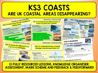
Topic 12 (Lessons are coded) Taught to Year 9 pupils 12A: Intro to Coasts 
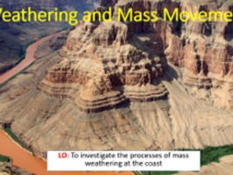
12B: Coastal Processes 
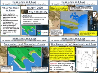
12C: Coastal Erosion 12D: Old Harry’s Rocks 
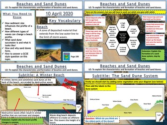
12E: Coastal Deposition 12F: Spit formation (Spurn Head) 12G: Why do coasts need protecting? 
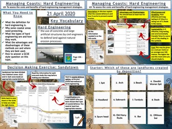
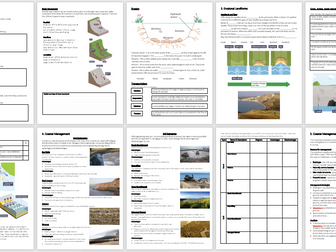
12H: Hard Engineering 
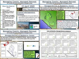
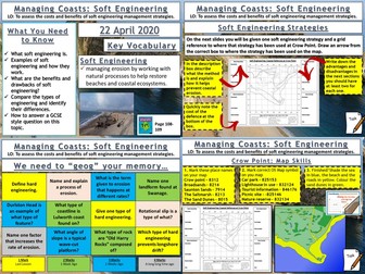
12I: Soft Engineering 12J: Coasts OS Maps 12K: Coasts GIS [Digimaps] 12L: Assessment, Mark Scheme 12M: Close the Gap activity, Feed Forward Task A Knowledge Organiser and 10 tasks to use as revision.
Coasts: Processes of Erosion and TransportationQuick View
markthegeographer

Coasts: Processes of Erosion and Transportation

(1)
AQA GCSE Geography lesson for the new specification Unit 1C: In this lesson we look at the processes of erosion and transportation (Note we don’t do longshore drift until the next lesson, too much for one lesson!) We start with a retrieval practice grid from the previous lesson (good for spaced practice). We then introduce the concept of erosion, we watch a short video clip of he problems at Dawlish several years ago to get the pupils thinking about why erosion is important. We then look at erosion first, the pupils have a worksheet which shows the processes. They need to describe the process, locate the process on the map with an arrow and as a bonus they get to colour the diagram in (They still love doing this in year 11). We briefly look at the four processes of transportation and they do the same thing on the diagram. Next we explore what factors might affect the rate of these processes occurring. I get the pupils to do a spray diagram or spider diagram. The pupils then use this to answer the question on the worksheet. In a nutshell lesson includes: Retrieval practice starter Worksheet on the processes of erosion and transportation. Activity on factors influencing these processes Video clips where appropriate GCSE-style question with guidance on answering Hope this saves you some valuable planning time. https://www.tes.com/teaching-resources/shop/markthegeographer
Coasts: Beaches and Sand DunesQuick View
markthegeographer

Coasts: Beaches and Sand Dunes

(3)
AQA GCSE Geography lesson for the new specification Unit 1C: In this lesson we look at beaches and how their profiles can be altered and sand dune succession and formation… We start with a simple retrieval practice grid which is good for spaced practice. We then discuss why some beaches have different profiles to other beaches and what difference the size of sediment makes. We then look at the different types of waves and how they affect beach profiles. The pupils will make annotated diagrams of winter and summer beaches. We move onto sand dune systems. The pupils have an outline profile of sand dune succession. We use info slides which can either be teacher led, or use as a round the room activity, group activity etc, the pupils add the appropriate info onto the diagram from the slides. We then look at what conditions are needed for the dune system to form. The pupils have a hexagon task. I usually get the pupils to think about each factor first, the next slide has the answers but they still need to match them up We finish with a GCSE-style question on the formation of sand dunes with some guidance on how to answer. In a nutshell lesson includes: Retrieval practice starter Beach profile diagram activity Sand dune succession annotated round the room/group diagram task. Formation of sand dunes hexagon task. 4 mark GCSE-style question with guidance should the pupils need it. Hope this saves you some valuable planning time. https://www.tes.com/teaching-resources/shop/markthegeographer
AQA GCSE Geography- Coasts BundleQuick View
teachgeogblog

AQA GCSE Geography- Coasts Bundle

(0)
Lesson 1: Intro to Physical Landscapes Lesson 2: Waves Lesson 3: Coastal Processes Lesson 4: Weathering and Deposition Lesson 5: Headland erosion Lesson 6: Depositional Landforms Lesson 7: Swanage- example of UK Coastline Lesson 8: Hard Engineering Lesson 9: Beaches and Sand Dunes Lesson 10: Soft Engineering Lesson 11: Coasts Revision Knowledge Organiser- Coasts and Rivers
Coasts Worksheets (AQA GCSE Geography)Quick View
alicemayhopwood

Coasts Worksheets (AQA GCSE Geography)

(0)
Worksheets covering Coasts (AQA GCSE Geography). Made on PPT in A3 format. These worksheets make excellent recap or booster activities and work perfectly alongside the GCSE AQA Geography 9-1 Oxford Text Book. These worksheets cover the following: How do waves form? Types of waves Weathering Mass movement Erosion Transportation Deposition Longshore drift Landforms Caves, arches, stacks, and stumps Sand dunes Spits and bars Hard and soft engineering, and managed retreat Coastal management case study: Lyme Regis You will receive a PDF and PowerPoint version, giving you both an editable and ready-to-go copy. I have worksheets on every topic for AQA GCSE Geography available on my shop. Including bundles for Paper 1, Paper 2 and the whole collection.
KS3 Coasts BookletQuick View
kamey1

KS3 Coasts Booklet

(0)
A work booklet for the Coasts topic. This pack includes an editable PowerPoint version, and a PDF version for a more printer friendly option. I have also included a seperate word and PDF copy of the reading task found in the booklet too. This pack focusses on Happisburgh as a case study, and concludes with an example of a written task which we use as an end of unit assessment. Perfect for use in lessons or for home learning. You will find lessons to accompany this uploaded to my resource bank too. Font: Modern Love, Calibri Images: Google images Icons: Noun Project
CoastsQuick View
twoody291

Coasts

(1)
Geography - Y9/GCSE Supplied is a list of resources and the slides that I have used in the past to teach the topic to my students. Assessment also supplied
KS3 Coasts - Holderness CoastQuick View
markalanwilliams10

KS3 Coasts - Holderness Coast

(5)
The final lesson in the series for the topic of Coasts, and its yours for FREE. Ideal for Years 7 to 9. Previously taught by myself in a 1hr lesson, but can be adapted to fill 2 hours. This lesson looks at the coastal erosion case study of the Holderness Coast in the North East of England, the fastest eroding coastline in Europe. One of my favourite lessons to teach and very much pupil led during the main activity. Hope you enjoy!